MyTopo
Goshute Utah US Topo Map
Couldn't load pickup availability
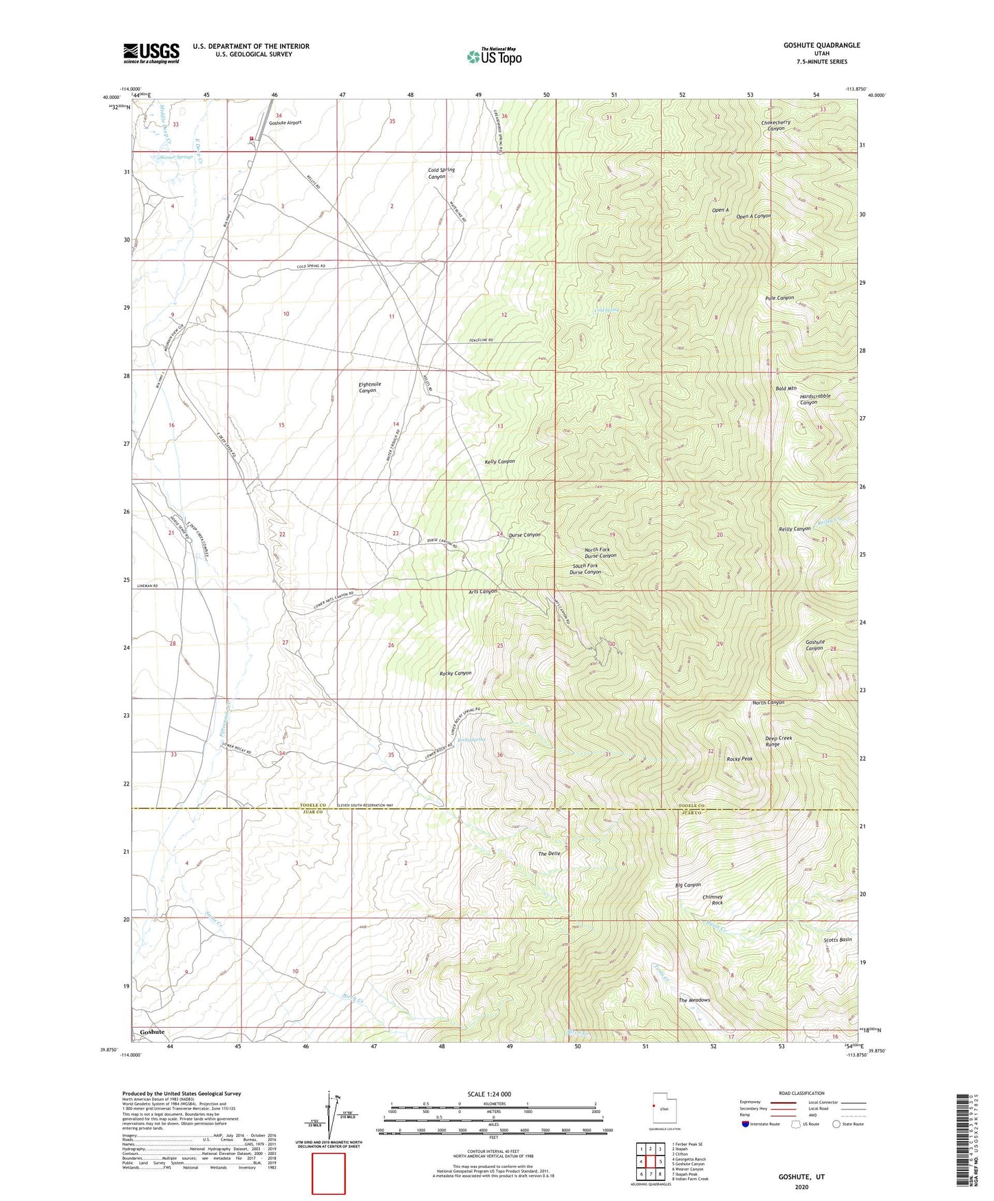
2023 topographic map quadrangle Goshute in the state of Utah. Scale: 1:24000. Based on the newly updated USGS 7.5' US Topo map series, this map is in the following counties: Tooele, Juab. The map contains contour data, water features, and other items you are used to seeing on USGS maps, but also has updated roads and other features. This is the next generation of topographic maps. Printed on high-quality waterproof paper with UV fade-resistant inks.
Quads adjacent to this one:
West: Georgetta Ranch
Northwest: Ferber Peak SE
North: Ibapah
Northeast: Clifton
East: Goshute Canyon
Southeast: Indian Farm Creek
South: Ibapah Peak
Southwest: Weaver Canyon
This map covers the same area as the classic USGS quad with code o39113h8.
Contains the following named places: Arts Canyon, Bald Mountain, Chimney Rock, Cold Spring, Cold Spring Canyon, Durse Canyon, Eightmile Canyon, Goshute - Ibapah Fire Department, Goshute Airport, Goshute Tribal Law Enforcement, Kelly Canyon, North Fork Durse Canyon, Open A, Rocky Canyon, Rocky Peak, Rocky Spring, Sams Creek, Scotts Basin, Skinner Springs, South Fork Durse Canyon, The Delle, The Meadows