MyTopo
Clifton Utah US Topo Map
Couldn't load pickup availability
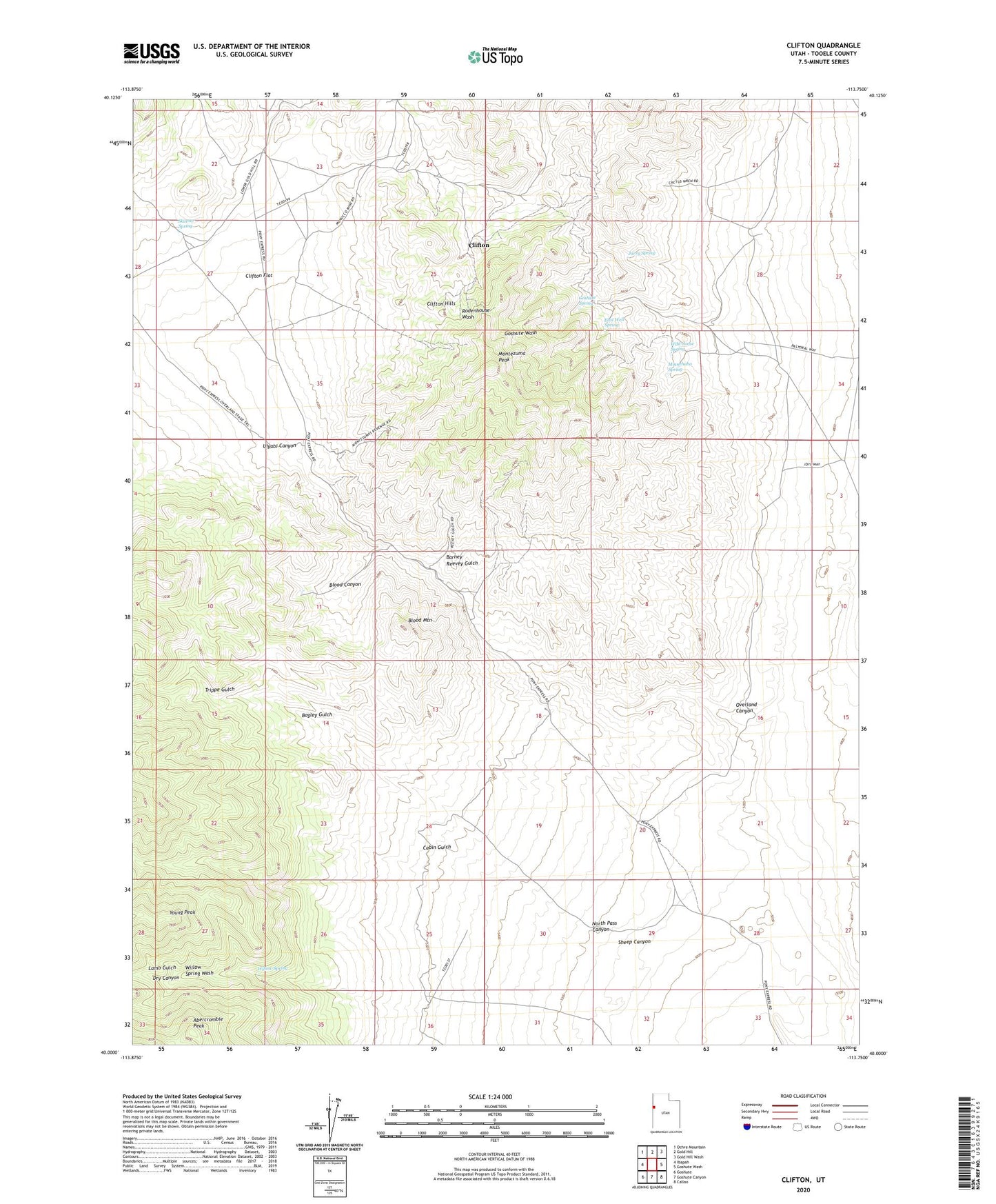
2023 topographic map quadrangle Clifton in the state of Utah. Scale: 1:24000. Based on the newly updated USGS 7.5' US Topo map series, this map is in the following counties: Tooele. The map contains contour data, water features, and other items you are used to seeing on USGS maps, but also has updated roads and other features. This is the next generation of topographic maps. Printed on high-quality waterproof paper with UV fade-resistant inks.
Quads adjacent to this one:
West: Ibapah
Northwest: Ochre Mountain
North: Gold Hill
Northeast: Gold Hill Wash
East: Goshute Wash
Southeast: Callao
South: Goshute Canyon
Southwest: Goshute
This map covers the same area as the classic USGS quad with code o40113a7.
Contains the following named places: Abercrombie Peak, Bagley Gulch, Barney Reevey Gulch, Blood Canyon, Blood Mountain, Cabin Gulch, Canon Pony Express Station Monument, Canyon Station, Clifton, Clifton Flat, Clifton Hills, Dry Canyon, East Well Spring, Goshute Spring, Jurry Spring, Lamb Gulch, Midas Mine, Minnehaha Spring, Monocco Mine, Montezuma Peak, North Pass Canyon, Overland Canyon, Sheep Canyon, Skinner Spring, Trippe Gulch, Uiyabi Canyon, Wild Goose Spring, Willow Spring, Young Peak