MyTopo
Hadden Holes Utah US Topo Map
Couldn't load pickup availability
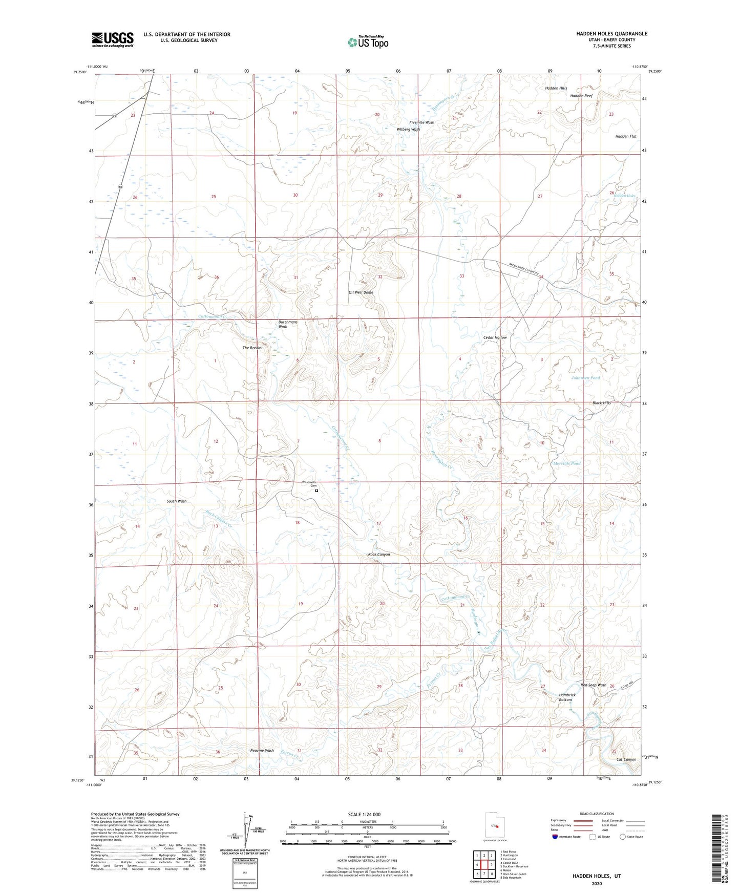
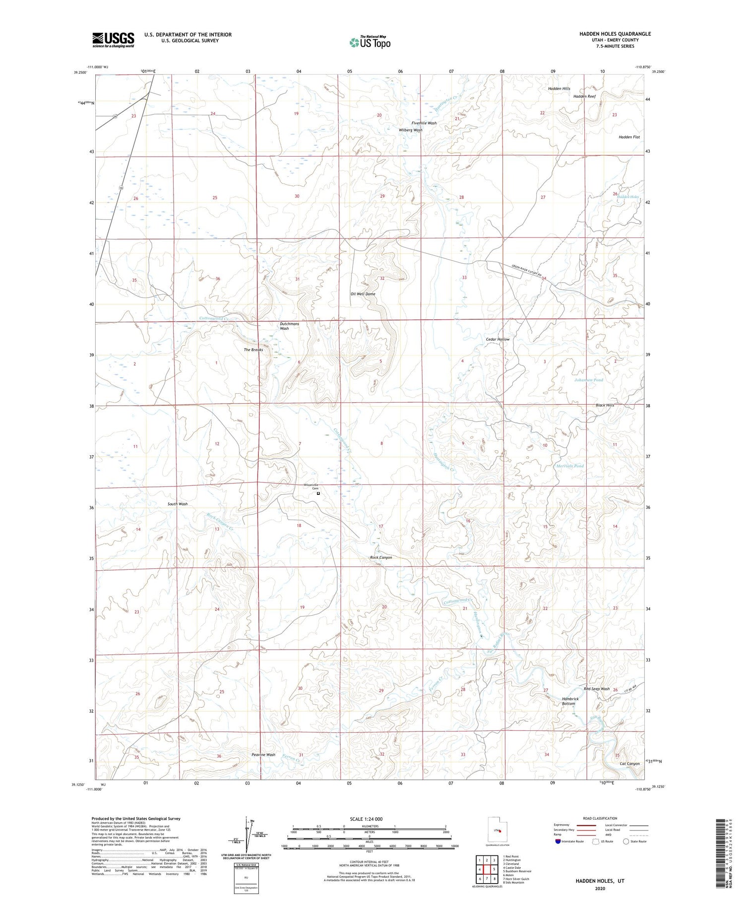
2020 topographic map quadrangle Hadden Holes in the state of Utah. Scale: 1:24000. Based on the newly updated USGS 7.5' US Topo map series, this map is in the following counties: Emery. The map contains contour data, water features, and other items you are used to seeing on USGS maps, but also has updated roads and other features. This is the next generation of topographic maps. Printed on high-quality waterproof paper with UV fade-resistant inks.
Quads adjacent to this one:
West: Castle Dale
Northwest: Red Point
North: Huntington
Northeast: Cleveland
East: Buckhorn Reservoir
Southeast: Sids Mountain
South: Horn Silver Gulch
Southwest: Molen
Contains the following named places: Black Hills, Cat Canyon, Cedar Hollow, Cottonwood Creek, Dutchmans Wash, Ferron Creek, Fivemile Wash, Gunnison Trail, Hadden Flat, Hadden Holes, Hambrick Bottom, Huntington Creek, Johansen Pond, Merrials Pond, Oil Well Dome, Peavine Wash, Red Seep Wash, Rock Canyon, Rock Canyon Creek, South Wash, The Breaks, Wilberg Wash, Wilsonville Cemetery