MyTopo
Horn Silver Gulch Utah US Topo Map
Couldn't load pickup availability
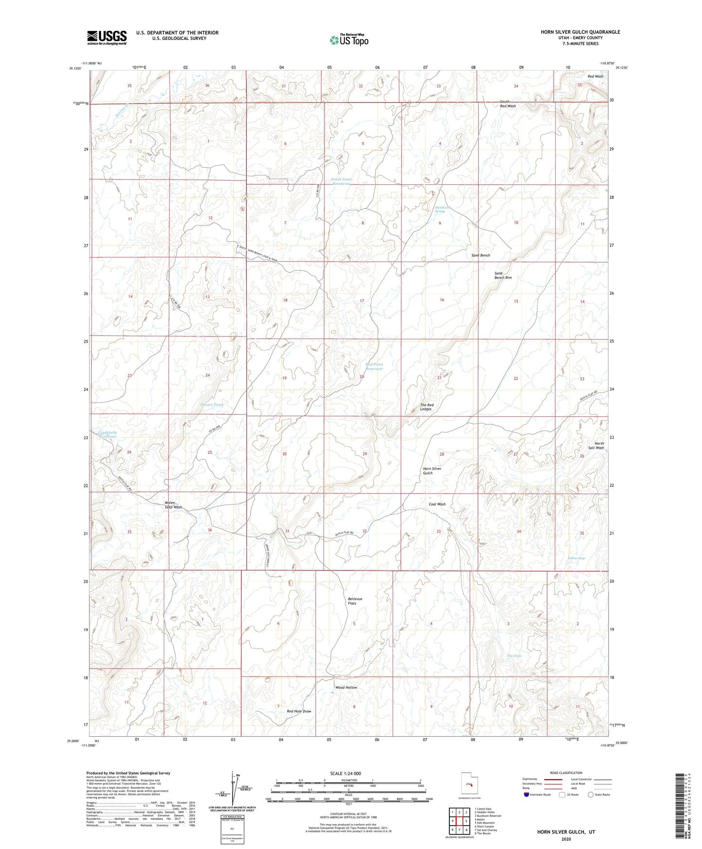
2023 topographic map quadrangle Horn Silver Gulch in the state of Utah. Scale: 1:24000. Based on the newly updated USGS 7.5' US Topo map series, this map is in the following counties: Emery. The map contains contour data, water features, and other items you are used to seeing on USGS maps, but also has updated roads and other features. This is the next generation of topographic maps. Printed on high-quality waterproof paper with UV fade-resistant inks.
Quads adjacent to this one:
West: Molen
Northwest: Castle Dale
North: Hadden Holes
Northeast: Buckhorn Reservoir
East: Sids Mountain
Southeast: The Blocks
South: Sid And Charley
Southwest: Short Canyon
This map covers the same area as the classic USGS quad with code o39110a8.
Contains the following named places: Bellevue Flats, Cinderella Reservoir, Coal Wash, Hendrick Spring, Horn Silver Gulch, Molen Seep Wash, Oscars Pond, Red Hole Draw, Red Point Reservoir, Red Wash, Sand Bench, Sand Bench Rim, South Red Wash, South Sand Reservoir, The Drips, The Red Ledges, Wood Hollow, Yellow Seep