MyTopo
Molen Utah US Topo Map
Couldn't load pickup availability
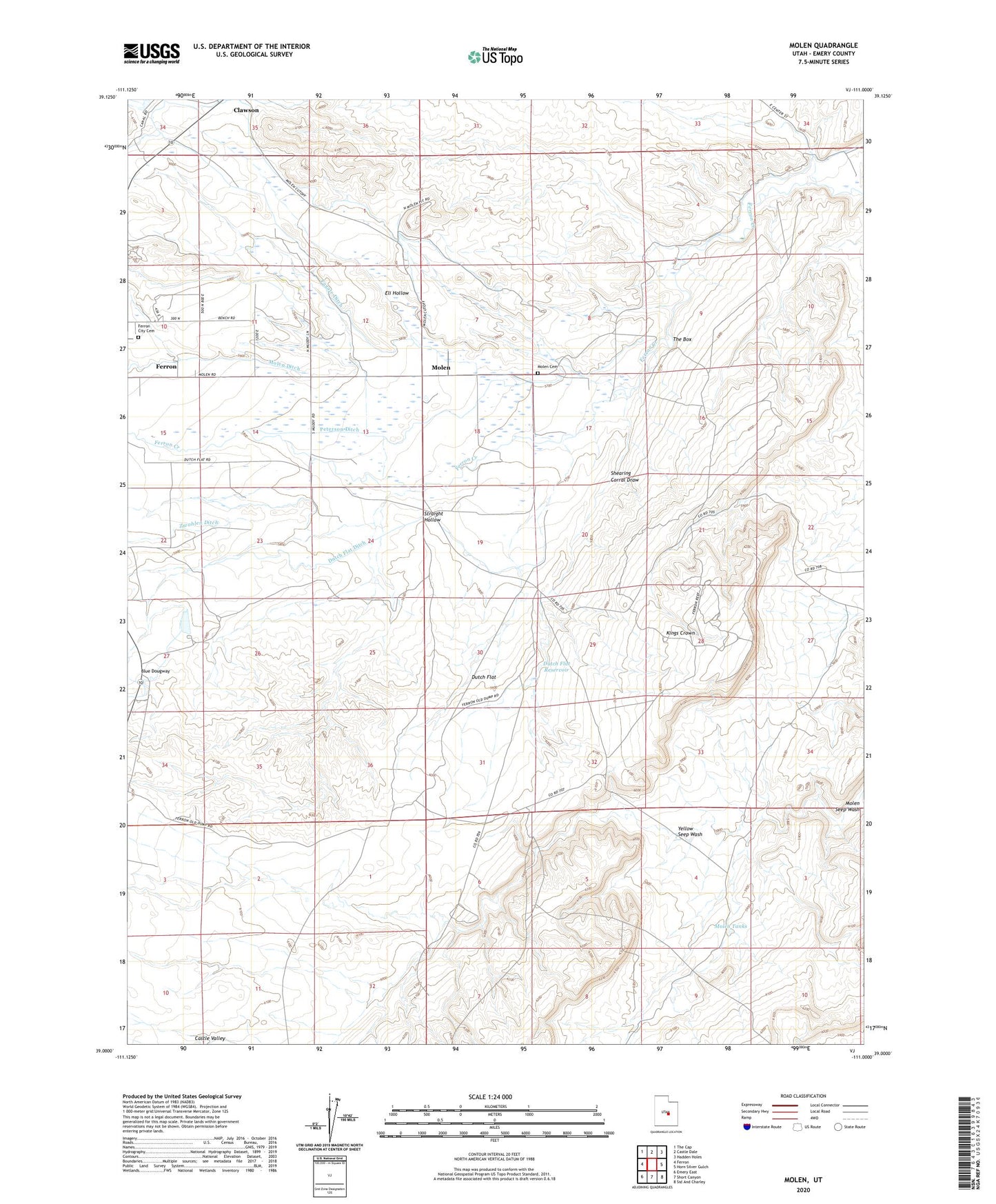
2023 topographic map quadrangle Molen in the state of Utah. Scale: 1:24000. Based on the newly updated USGS 7.5' US Topo map series, this map is in the following counties: Emery. The map contains contour data, water features, and other items you are used to seeing on USGS maps, but also has updated roads and other features. This is the next generation of topographic maps. Printed on high-quality waterproof paper with UV fade-resistant inks.
Quads adjacent to this one:
West: Ferron
Northwest: The Cap
North: Castle Dale
Northeast: Hadden Holes
East: Horn Silver Gulch
Southeast: Sid And Charley
South: Short Canyon
Southwest: Emery East
This map covers the same area as the classic USGS quad with code o39111a1.
Contains the following named places: Bench Ditch, Blue Dougway, Dutch Flat, Dutch Flat Ditch, Dutch Flat Reservoir, Eli Hollow, Ferron City Cemetery, Fugate Ditch, Kings Crown, Larson Ranch, Molen, Molen Cemetery, Molen Ditch, Molen Tanks, Nelson Ranch, Paradise Ranch, Peterson Ditch, Shearing Corral Draw, Straight Hollow, The Box, Yellow Seep Wash, Zwahlen Ditch