MyTopo
Hanna Utah US Topo Map
Couldn't load pickup availability
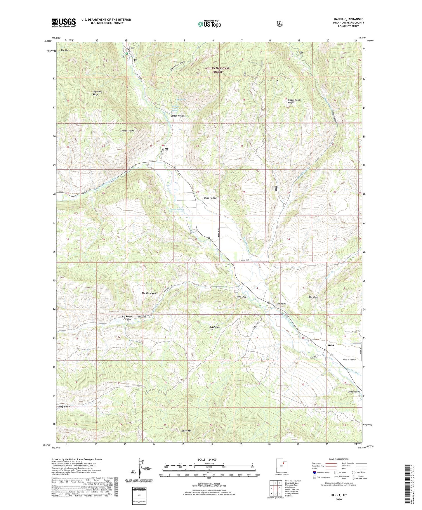
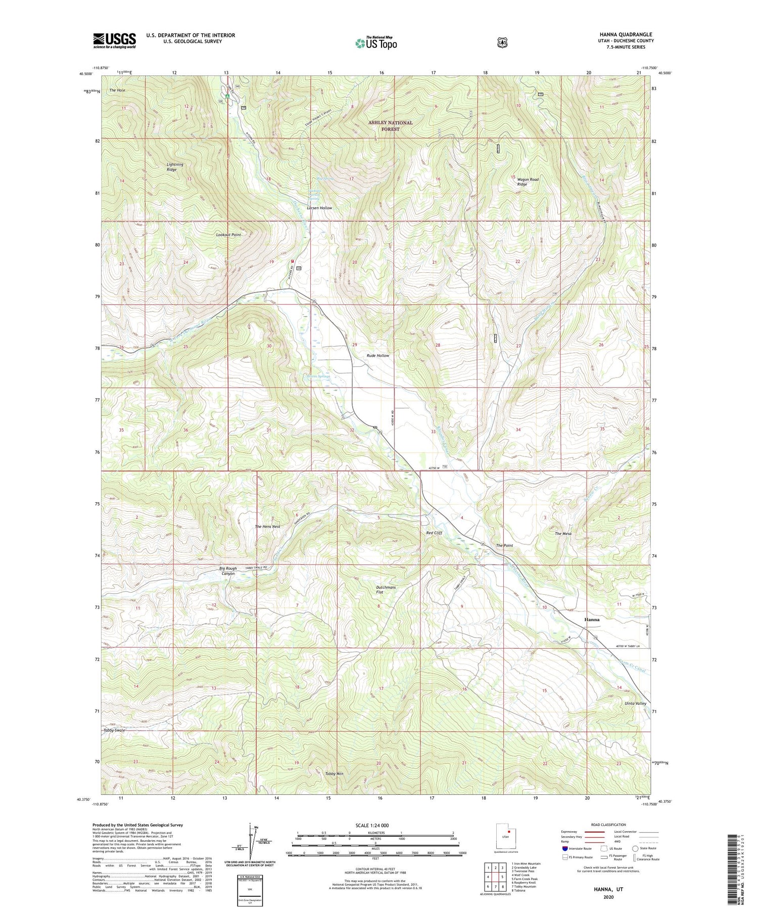
2020 topographic map quadrangle Hanna in the state of Utah. Scale: 1:24000. Based on the newly updated USGS 7.5' US Topo map series, this map is in the following counties: Duchesne. The map contains contour data, water features, and other items you are used to seeing on USGS maps, but also has updated roads and other features. This is the next generation of topographic maps. Printed on high-quality waterproof paper with UV fade-resistant inks.
Quads adjacent to this one:
West: Wolf Creek
Northwest: Iron Mine Mountain
North: Grandaddy Lake
Northeast: Tworoose Pass
East: Farm Creek Peak
Southeast: Tabiona
South: Tabby Mountain
Southwest: Raspberry Knoll
Contains the following named places: Aspen Campground, Big Rough Canyon, Big Spring, Blind Stream, Dutchmans Flat, Hanna, Hanna Heliport, Hanna Post Office, Jackass Larson Spring, Larsen Hollow, Lookout Point, Red Cliff, Rhoades Canal, Rude Hollow, Sand Creek, Squaw Creek, Stockmore Ranger Station, Tabby Swale, The Hens Nest, The Hole, The Mesa, The Point, United States Forest Service Fire Station - Stockmore Ranger District, Wagon Road Ridge, Warm Springs, West Fork Duchesne River