MyTopo
Wolf Creek Utah US Topo Map
Couldn't load pickup availability
Also explore the Wolf Creek Forest Service Topo of this same quad for updated USFS data
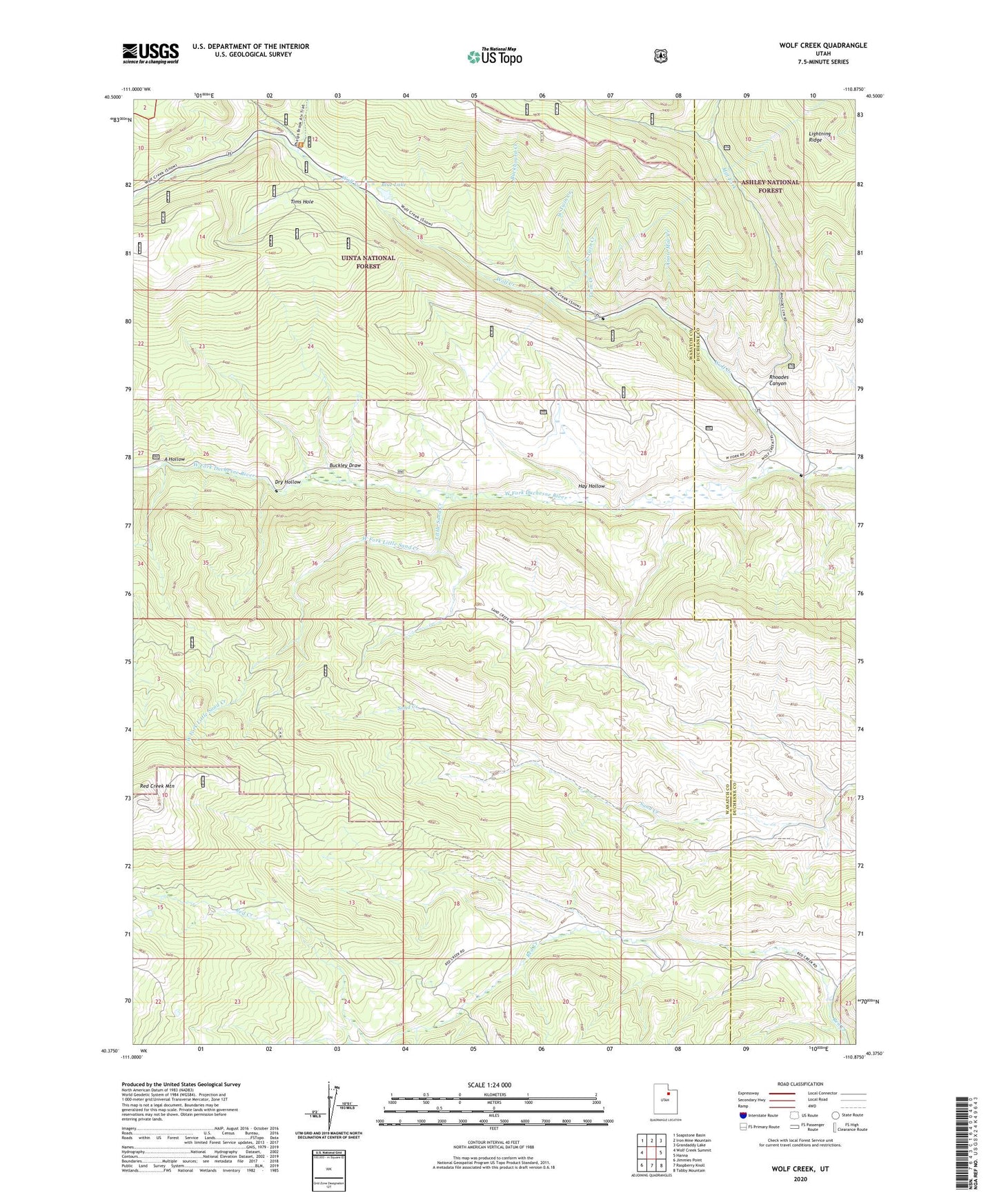
2023 topographic map quadrangle Wolf Creek in the state of Utah. Scale: 1:24000. Based on the newly updated USGS 7.5' US Topo map series, this map is in the following counties: Wasatch, Duchesne. The map contains contour data, water features, and other items you are used to seeing on USGS maps, but also has updated roads and other features. This is the next generation of topographic maps. Printed on high-quality waterproof paper with UV fade-resistant inks.
Quads adjacent to this one:
West: Wolf Creek Summit
Northwest: Soapstone Basin
North: Iron Mine Mountain
Northeast: Grandaddy Lake
East: Hanna
Southeast: Tabby Mountain
South: Raspberry Knoll
Southwest: Jimmies Point
This map covers the same area as the classic USGS quad with code o40110d8.
Contains the following named places: A Hollow, Annie Mae Creek, Bear Camp, Blue Lake, Buckboard Creek, Buckley Draw, Dry Hollow, East Fork Little Sand Creek, East Twin Creek, Hay Hollow, Lightning Ridge, Little Sand Creek, Mill Fork, North Fork Phelps Brook, Rhoades Canyon, South Fork Phelps Brook, Tims Hole, Twin Creek, West Fork Little Sand Creek, West Twin Creek, Wolf Creek