MyTopo
Turner Hollow Utah US Topo Map
Couldn't load pickup availability
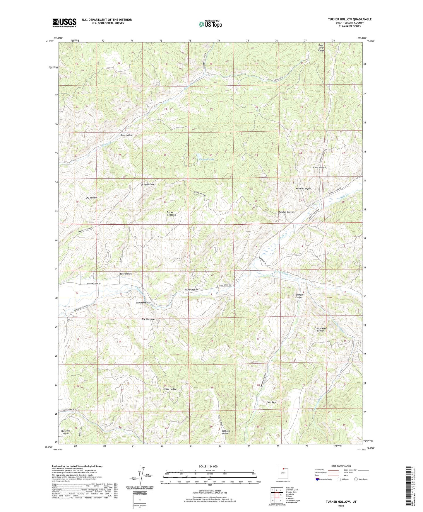
2023 topographic map quadrangle Turner Hollow in the state of Utah. Scale: 1:24000. Based on the newly updated USGS 7.5' US Topo map series, this map is in the following counties: Summit. The map contains contour data, water features, and other items you are used to seeing on USGS maps, but also has updated roads and other features. This is the next generation of topographic maps. Printed on high-quality waterproof paper with UV fade-resistant inks.
Quads adjacent to this one:
West: Coalville
Northwest: Henefer
North: Heiners Creek
Northeast: Castle Rock
East: Upton
Southeast: Hidden Lake
South: Crandall Canyon
Southwest: Wanship
This map covers the same area as the classic USGS quad with code o40111h3.
Contains the following named places: Bear Hollow, Big Robinson Ditch, Chappell Lake, Chappell Mine, Clark Canyon, Cottonwood Canyon, Deer Pen, Elkhorn Canyon, Fewkes Canyon, Grass Creek, Lodgepole Creek, Middle Canyon, North Narrows Ditch, Sage Hollow, South Fork Chalk Creek, The Meadows, The Narrows, Turner Hollow, Turner Meadows, Weber Mine