MyTopo
Jack Henry Knoll Utah US Topo Map
Couldn't load pickup availability
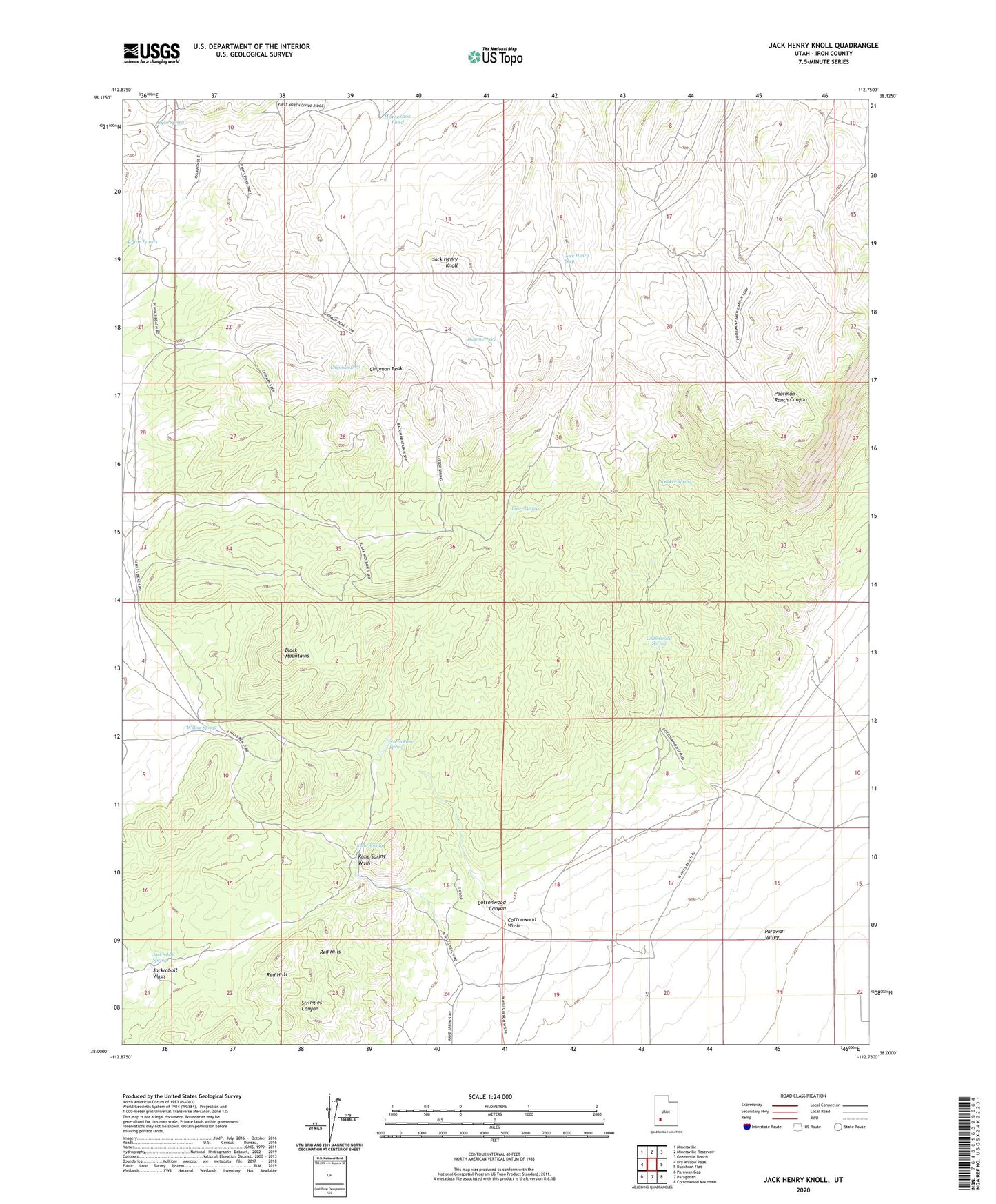
2023 topographic map quadrangle Jack Henry Knoll in the state of Utah. Scale: 1:24000. Based on the newly updated USGS 7.5' US Topo map series, this map is in the following counties: Iron. The map contains contour data, water features, and other items you are used to seeing on USGS maps, but also has updated roads and other features. This is the next generation of topographic maps. Printed on high-quality waterproof paper with UV fade-resistant inks.
Quads adjacent to this one:
West: Dry Willow Peak
Northwest: Minersville
North: Minersville Reservoir
Northeast: Greenville Bench
East: Buckhorn Flat
Southeast: Cottonwood Mountain
South: Paragonah
Southwest: Parowan Gap
This map covers the same area as the classic USGS quad with code o38112a7.
Contains the following named places: Chipman Peak, Chipman Seep, Cottonwood Canyon, Cottonwood Spring, Decker Spring, Guyman Seep, Horseshoe Pond, Jack Henry Knoll, Jack Henry Seep, Jackrabbit Spring, Kane Spring, Lister Spring, North Kane Spring, Red Hills, Ryan Ponds, Ryan Spring, Willow Spring