MyTopo
Paragonah Utah US Topo Map
Couldn't load pickup availability
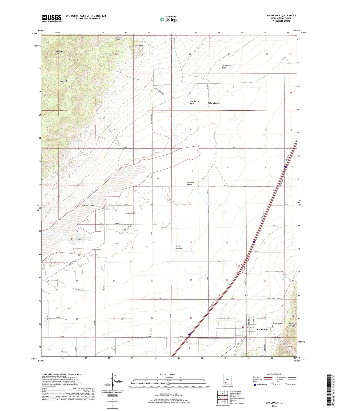
2023 topographic map quadrangle Paragonah in the state of Utah. Scale: 1:24000. Based on the newly updated USGS 7.5' US Topo map series, this map is in the following counties: Iron. The map contains contour data, water features, and other items you are used to seeing on USGS maps, but also has updated roads and other features. This is the next generation of topographic maps. Printed on high-quality waterproof paper with UV fade-resistant inks.
Quads adjacent to this one:
West: Parowan Gap
Northwest: Dry Willow Peak
North: Jack Henry Knoll
Northeast: Buckhorn Flat
East: Cottonwood Mountain
Southeast: Red Creek Reservoir
South: Parowan
Southwest: Summit
This map covers the same area as the classic USGS quad with code o37112h7.
Contains the following named places: Black Knoll, Chimney Meadow, Cottonwood Wash, Flying Cal Ute Rancheros Airport, Fremont Wash, Jackrabbit Mountain, Kane Spring Wash, Little Creek, Paragonah, Paragonah Cemetery, Paragonah Post Office, Paragonah Volunteer Fire Department, Parowan Division, Parowan Valley, Red Creek, Slough Bench, Slough Wash, Stringies Canyon, Stubbs Well, The Church of Jesus Christ of Latter Day Saints, Town of Paragonah, Wheatgrass, ZIP Code: 84761