
MyTopo
Jessen Butte Utah US Topo Map
Couldn't load pickup availability
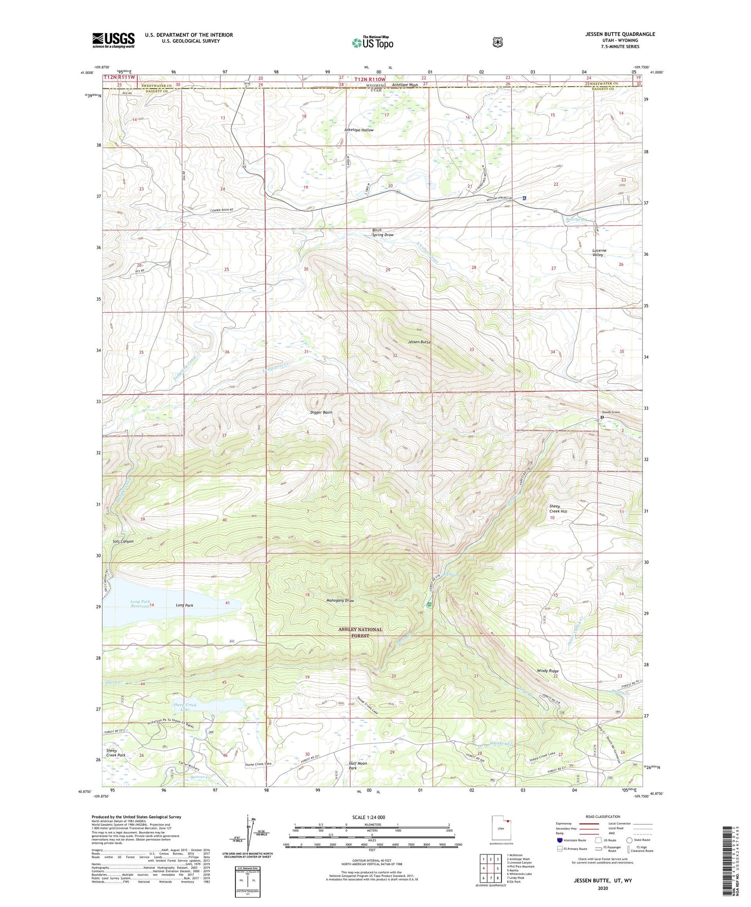
2020 topographic map quadrangle Jessen Butte in the states of Utah, Wyoming. Scale: 1:24000. Based on the newly updated USGS 7.5' US Topo map series, this map is in the following counties: Daggett, Sweetwater. The map contains contour data, water features, and other items you are used to seeing on USGS maps, but also has updated roads and other features. This is the next generation of topographic maps. Printed on high-quality waterproof paper with UV fade-resistant inks.
Quads adjacent to this one:
West: Phil Pico Mountain
Northwest: McKinnon
North: Antelope Wash
Northeast: Linwood Canyon
East: Manila
Southeast: Elk Park
South: Leidy Peak
Southwest: Whiterocks Lake
Contains the following named places: Antelope Hollow, Big Spring, Birch Spring, Daggett County Jail, Daggett County Sheriff's Office, Digger Basin, Dowds Grave, Half Moon Park, Hope Creek, Jessen Butte, Lodgepole Canal, Lodgepole Creek, Long Park, Long Park Dam, Long Park Reservoir, Mahogany Draw, Palisade Campground, Palisades Memorial Park, Sheep Creek Canal, Sheep Creek Canyon Geological Area, Sheep Creek Dam, Sheep Creek Hill, Sheep Creek Lake, Sheep Creek Park, Sols Canyon, South Valley Canal, Whiskey Creek, Windy Ridge, ZIP Code: 84046


