MyTopo
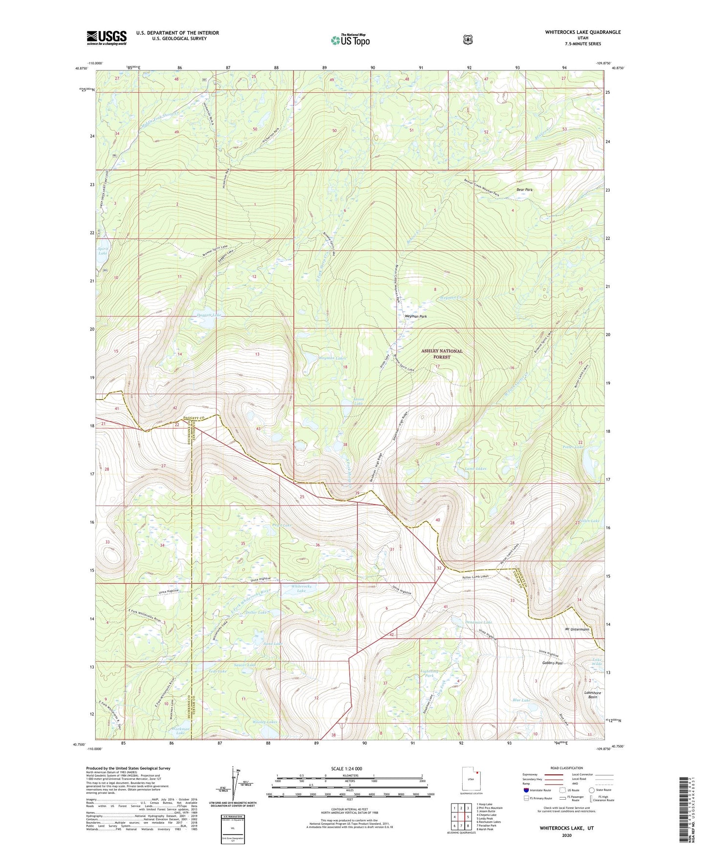
Whiterocks Lake Utah US Topo Map
Couldn't load pickup availability
Also explore the Whiterocks Lake Forest Service Topo of this same quad for updated USFS data
2023 topographic map quadrangle Whiterocks Lake in the state of Utah. Scale: 1:24000. Based on the newly updated USGS 7.5' US Topo map series, this map is in the following counties: Daggett, Uintah, Duchesne. The map contains contour data, water features, and other items you are used to seeing on USGS maps, but also has updated roads and other features. This is the next generation of topographic maps. Printed on high-quality waterproof paper with UV fade-resistant inks.
Quads adjacent to this one:
West: Chepeta Lake
Northwest: Hoop Lake
North: Phil Pico Mountain
Northeast: Jessen Butte
East: Leidy Peak
Southeast: Marsh Peak
South: Paradise Park
Southwest: Rasmussen Lakes
This map covers the same area as the classic USGS quad with code o40109g8.
Contains the following named places: Anson Lake, Bear Park, Blue Lake, Daggett Lake, Daggett Lake Dam, Deadman Lake, Dollar Lake, Gabbro Pass, Lake Wilde, Lamb Lakes, Lightning Park, Mount Untermann, Pearl Lake, Potter Lake, Sand Lake, Saucer Lake, Spirit Lake, Spirit Lake Dam, Teds Lake, Weyman Lakes, Weyman Park, Whiterocks Lake, Whiterocks Lake Dam, Wooley Lakes, Workman Lake