MyTopo
Jim Canyon Utah US Topo Map
Couldn't load pickup availability
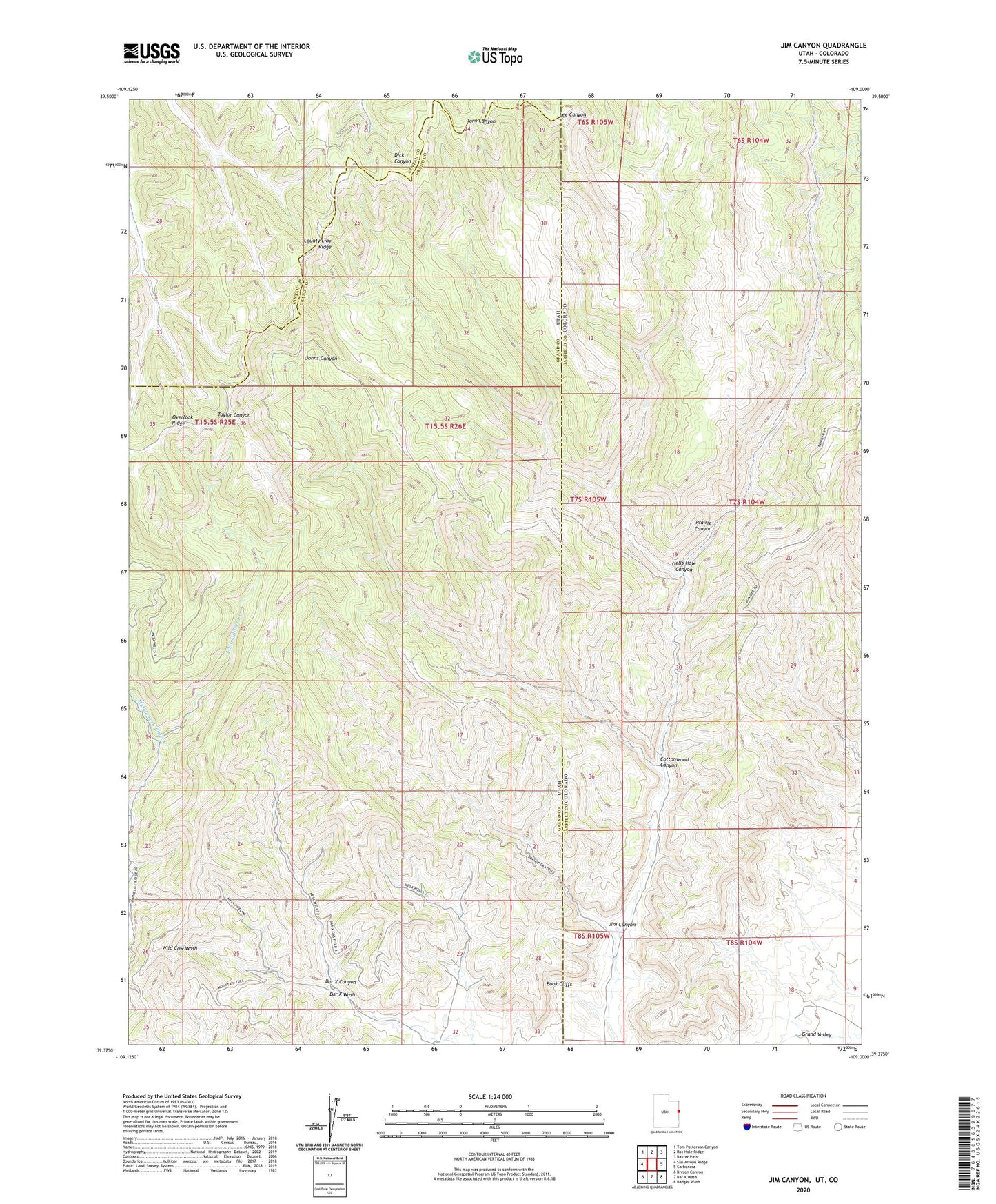
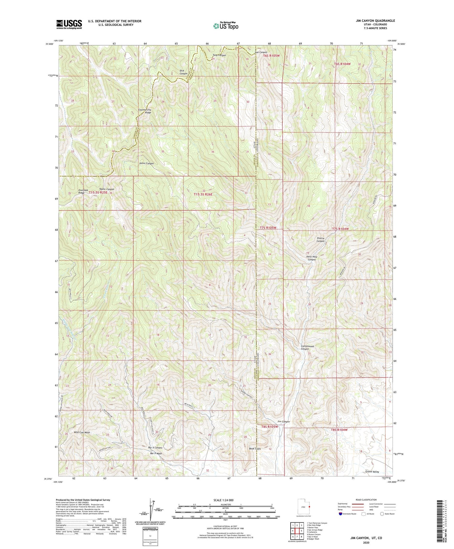
2020 topographic map quadrangle Jim Canyon in the states of Utah, Colorado. Scale: 1:24000. Based on the newly updated USGS 7.5' US Topo map series, this map is in the following counties: Grand, Garfield, Uintah. The map contains contour data, water features, and other items you are used to seeing on USGS maps, but also has updated roads and other features. This is the next generation of topographic maps. Printed on high-quality waterproof paper with UV fade-resistant inks.
Quads adjacent to this one:
West: San Arroyo Ridge
Northwest: Tom Patterson Canyon
North: Rat Hole Ridge
Northeast: Baxter Pass
East: Carbonera
Southeast: Badger Wash
South: Bar X Wash
Southwest: Bryson Canyon
Contains the following named places: Bar X Canyon, Cottonwood Canyon, County Line Ridge, East Fork Bitter Creek, Hells Hole Canyon, Jim Canyon, Middle Fork Bitter Creek, Prairie Canyon Gas Field, San Arroyo Gas Field, West Fork Bitter Creek