MyTopo
Kamas Utah US Topo Map
Couldn't load pickup availability
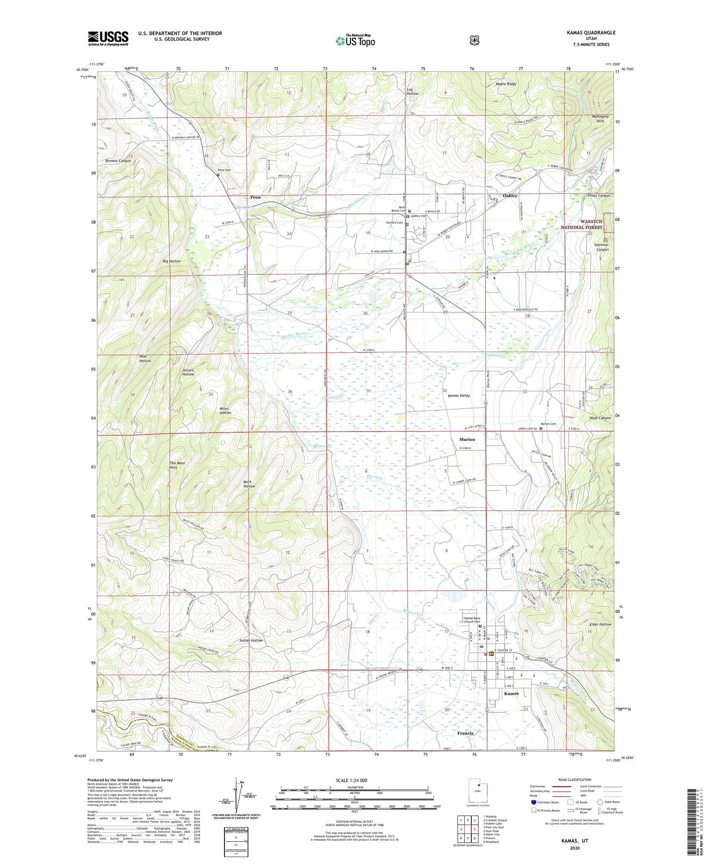
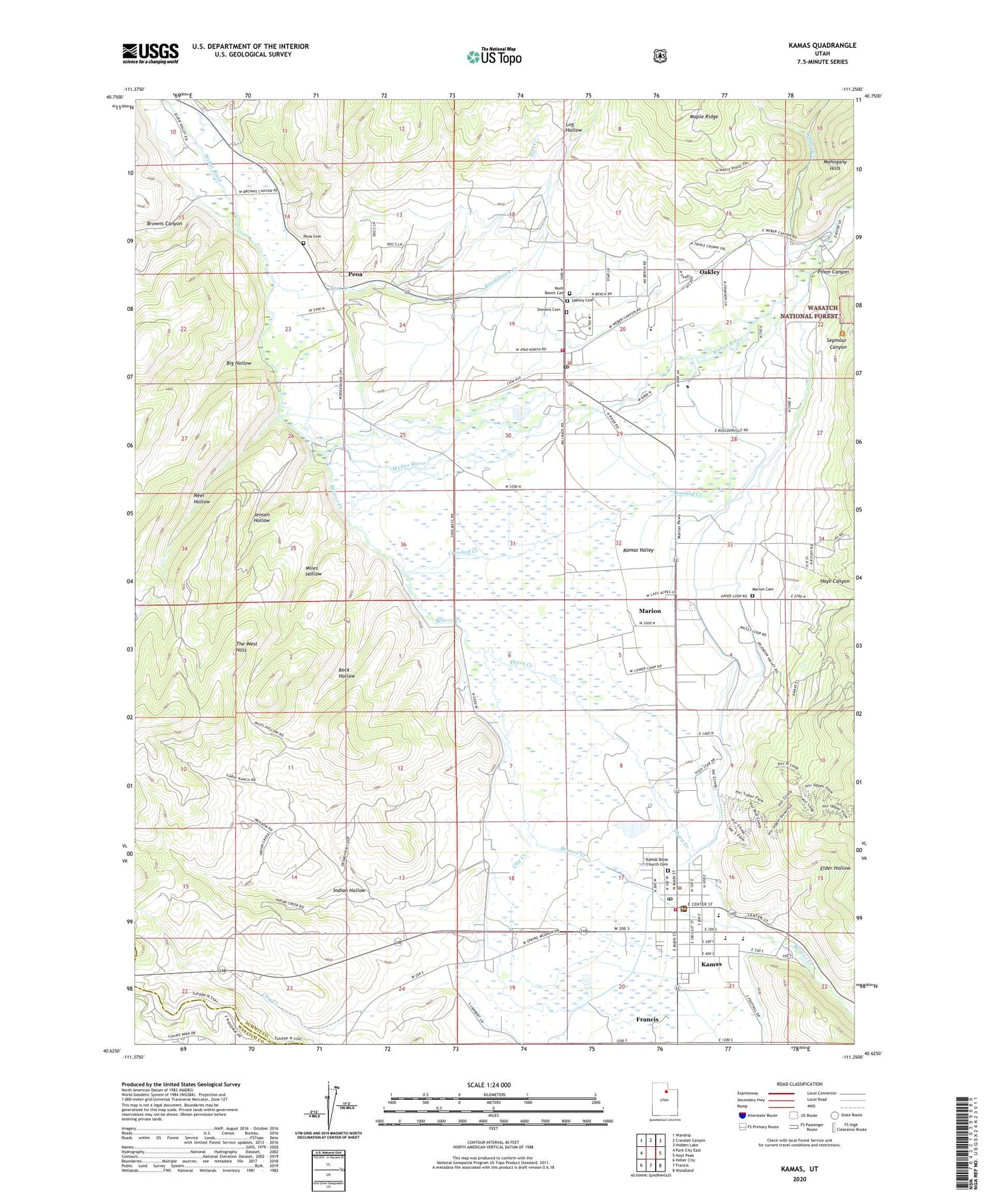
2020 topographic map quadrangle Kamas in the state of Utah. Scale: 1:24000. Based on the newly updated USGS 7.5' US Topo map series, this map is in the following counties: Summit, Wasatch. The map contains contour data, water features, and other items you are used to seeing on USGS maps, but also has updated roads and other features. This is the next generation of topographic maps. Printed on high-quality waterproof paper with UV fade-resistant inks.
Quads adjacent to this one:
West: Park City East
Northwest: Wanship
North: Crandall Canyon
Northeast: Hidden Lake
East: Hoyt Peak
Southeast: Woodland
South: Francis
Southwest: Heber City
Contains the following named places: Baptist Community Bible Church, Beaver Creek, Big Hollow, Boulderville Ditch, Browns Canyon, City Creek, City of Kamas, City of Oakley, Crooked Creek, Elder Hollow, Fort Creek, Hoyt Canyon, Indian Hollow, Jensen Hollow, Kamas, Kamas Bible Church Cemetery, Kamas Police Department, Kamas Post Office, Kamas Ranger District, Kamas Valley, Log Hollow, Marion, Marion Cemetery, Marion Census Designated Place, Miles Hollow, Neel Hollow, North Bench Cemetery, Oakley, Oakley Cemetery, Oakley Post Office, Peoa, Peoa Cemetery, Peoa Census Designated Place, Pinon Canyon, Rasmussen Creek, Rock Hollow, Seymour Canyon, South Summit Emergency Medical Service Ambulance, South Summit Fire District, South Summit Fire District - Kamas, South Summit High School, Spring Creek, Stevens Cemetery, The Church of Jesus Christ of Latter Day Saints, The West Hills, Thorn Creek, Weber Provo Diversion Canal, Whites Creek