MyTopo
Davis Gulch Utah US Topo Map
Couldn't load pickup availability
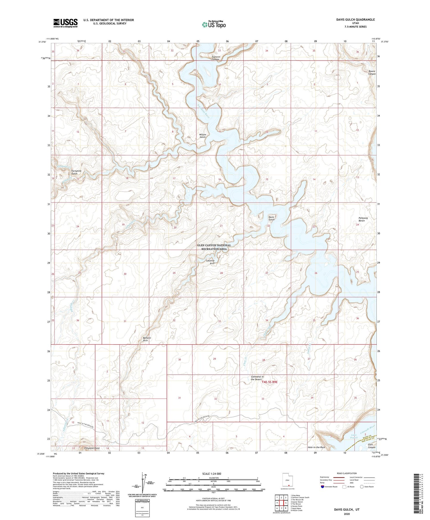
2023 topographic map quadrangle Davis Gulch in the state of Utah. Scale: 1:24000. Based on the newly updated USGS 7.5' US Topo map series, this map is in the following counties: Kane, San Juan. The map contains contour data, water features, and other items you are used to seeing on USGS maps, but also has updated roads and other features. This is the next generation of topographic maps. Printed on high-quality waterproof paper with UV fade-resistant inks.
Quads adjacent to this one:
West: Sooner Bench
Northwest: King Mesa
North: Stevens Canyon South
Northeast: The Rincon NE
East: The Rincon
Southeast: Wilson Creek
South: Nasja Mesa
Southwest: Navajo Point
This map covers the same area as the classic USGS quad with code o37110c8.
Contains the following named places: Bement Arch, Cathedral in the Desert, Clear Creek, Davis Gulch, Explorer Canyon, Fiftymile Creek, Fortymile Creek, Fortymile Gulch, Gregory Natural Bridge, Hole-in-the-Rock, Hole-in-the-Rock Crossing, Hole-in-the-Rock Historical Marker, Indian Creek, La Gorce Arch, Willow Creek, Willow Gulch