
MyTopo
Lower Bowns Reservoir Utah US Topo Map
Couldn't load pickup availability
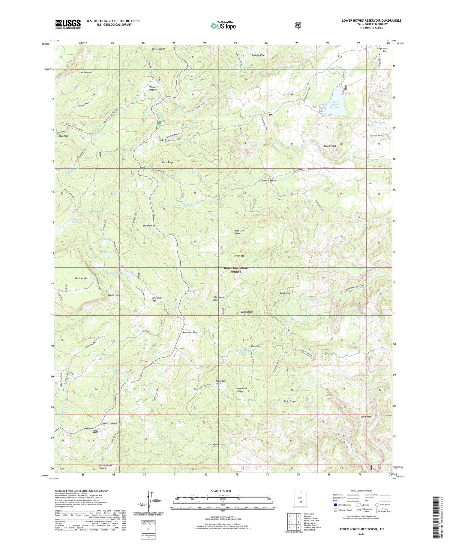
2020 topographic map quadrangle Lower Bowns Reservoir in the state of Utah. Scale: 1:24000. Based on the newly updated USGS 7.5' US Topo map series, this map is in the following counties: Garfield. The map contains contour data, water features, and other items you are used to seeing on USGS maps, but also has updated roads and other features. This is the next generation of topographic maps. Printed on high-quality waterproof paper with UV fade-resistant inks.
Quads adjacent to this one:
West: Deer Creek Lake
Northwest: Blind Lake
North: Grover
Northeast: Golden Throne
East: Bear Canyon
Southeast: Lamp Stand
South: Steep Creek Bench
Southwest: Boulder Town
Contains the following named places: Aspen Point, Aspen Spring, Bear Flat, Behanin Creek, Big Ridge, Blue Grass, Blue Grass Lake, Bowery Flat, Bowns Lake, Bowns Point, Cons Hole, Cons Knoll, Dry Bench, Dunfey Creek, Edmunds Hole, Jorgenson Flat, Keller Knoll, Long Lake, Lower Bown Campground, Lower Bowns Dam, Lower Bowns Reservoir, Oak Creek Campground, Oak Creek Dam, Oak Creek Forest Camp, Oak Creek Reservoir, Park Ridge, Parks Pasture, Pine Creek Campground, Pleasant Creek Campground, Point Lookout, Pole Corral Draw, Round Lake, Roundup Flat, Salt Lick Draw, Sawmill Bench, Scout Lake, Spruce Spring, Steep Creek Lake, Sunflower Flat, The Terrace, Wildcat Creek, Wildcat Pasture, Wildcat Ranger Station, Windmill Ridge


