MyTopo
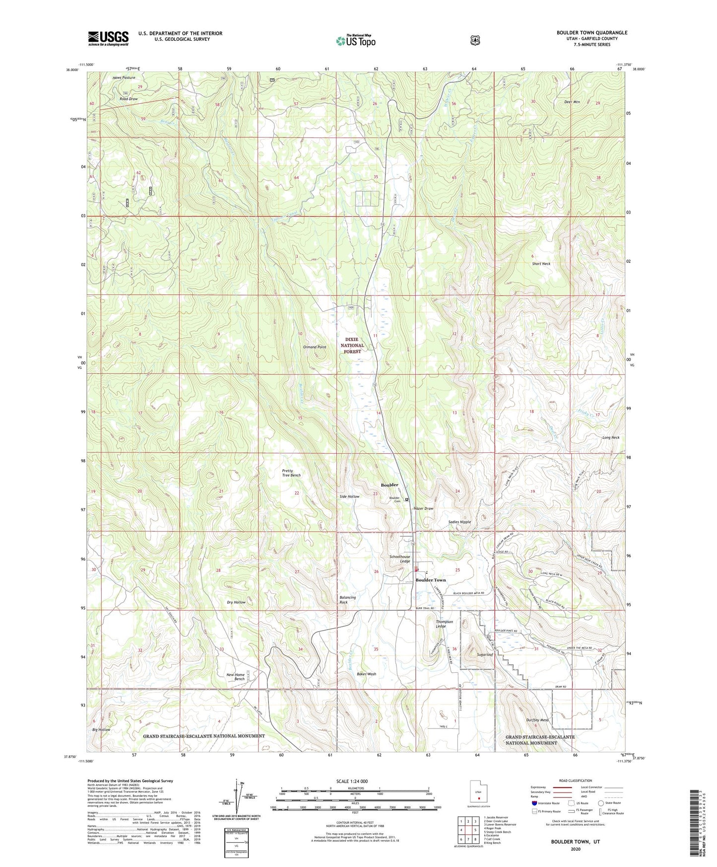
Boulder Town Utah US Topo Map
Couldn't load pickup availability
Also explore the Boulder Town Forest Service Topo of this same quad for updated USFS data
2023 topographic map quadrangle Boulder Town in the state of Utah. Scale: 1:24000. Based on the newly updated USGS 7.5' US Topo map series, this map is in the following counties: Garfield. The map contains contour data, water features, and other items you are used to seeing on USGS maps, but also has updated roads and other features. This is the next generation of topographic maps. Printed on high-quality waterproof paper with UV fade-resistant inks.
Quads adjacent to this one:
West: Roger Peak
Northwest: Jacobs Reservoir
North: Deer Creek Lake
Northeast: Lower Bowns Reservoir
East: Steep Creek Bench
Southeast: King Bench
South: Calf Creek
Southwest: Escalante
This map covers the same area as the classic USGS quad with code o37111h4.
Contains the following named places: Anasazi State Park, Baker Wash, Balancing Rock, Bear Creek, Big Hollow, Boulder Cemetery, Boulder Elementary School, Boulder Post Office, Boulder Town, Boulder Volunteer Fire Department, Deer Mountain, East Deer Creek, Frisky Creek, Garfield County Ambulance, Garkane Hydroelectric Plant, Haws Pasture, Lizzie Creek, Middle Deer Creek, Nazer Draw, Ormand Point, Pretty Tree Bench, Road Draw, Road Draw Creek, Sadies Nipple, Schoolhouse Ledge, Short Neck, Side Hollow, Sugarloaf, Tailrace Canal, The Church of Jesus Christ of Latter Day Saints, Thompson Ledge, Town of Boulder, West Deer Creek, ZIP Code: 84716