MyTopo
Mahogany Point Utah US Topo Map
Couldn't load pickup availability
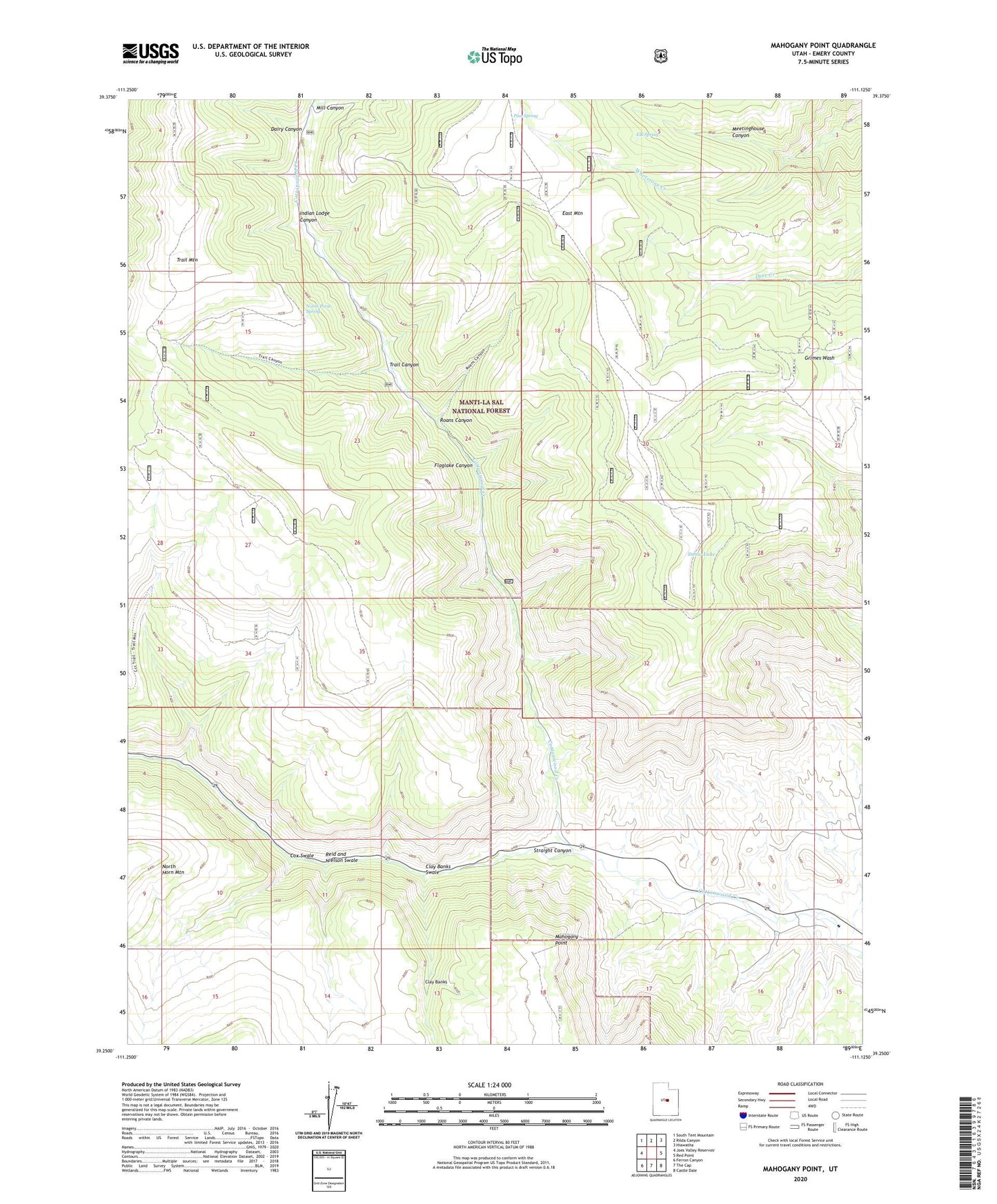
2020 topographic map quadrangle Mahogany Point in the state of Utah. Scale: 1:24000. Based on the newly updated USGS 7.5' US Topo map series, this map is in the following counties: Emery. The map contains contour data, water features, and other items you are used to seeing on USGS maps, but also has updated roads and other features. This is the next generation of topographic maps. Printed on high-quality waterproof paper with UV fade-resistant inks.
Quads adjacent to this one:
West: Joes Valley Reservoir
Northwest: South Tent Mountain
North: Rilda Canyon
Northeast: Hiawatha
East: Red Point
Southeast: Castle Dale
South: The Cap
Southwest: Ferron Canyon
Contains the following named places: Black Diamond Mine, CCC Trail, Clay Banks Swale, Coal Mining Monument Point of Ineterst, Cox Swale, Dairy Canyon, Elk Spring, Flaglake Canyon, Indian Lodge Canyon, Mahogany Point, Mill Canyon, North Point Spring, Oliphant Mine, Pine Spring, Reid and Nielson Swale, Roans Canyon, Snow Lake, Straight Canyon, Trail Canyon, Trail Mountain Mine, Whetstone Creek, ZIP Code: 84537