MyTopo
Picacho Peak Utah US Topo Map
Couldn't load pickup availability
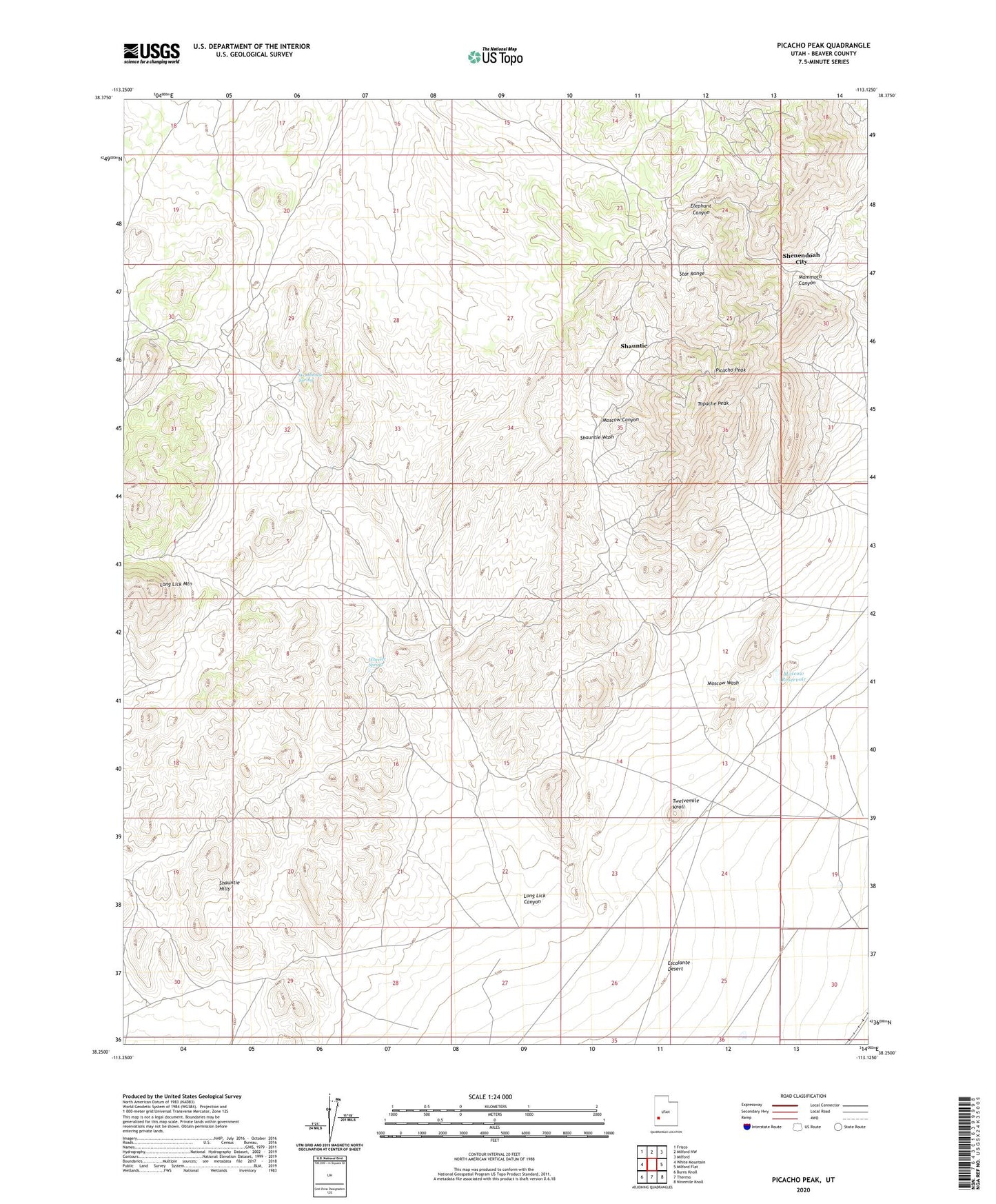
2023 topographic map quadrangle Picacho Peak in the state of Utah. Scale: 1:24000. Based on the newly updated USGS 7.5' US Topo map series, this map is in the following counties: Beaver. The map contains contour data, water features, and other items you are used to seeing on USGS maps, but also has updated roads and other features. This is the next generation of topographic maps. Printed on high-quality waterproof paper with UV fade-resistant inks.
Quads adjacent to this one:
West: White Mountain
Northwest: Frisco
North: Milford NW
Northeast: Milford
East: Milford Flat
Southeast: Ninemile Knoll
South: Thermo
Southwest: Burns Knoll
This map covers the same area as the classic USGS quad with code o38113c2.
Contains the following named places: Atlas Mine, Beaver County, Cedar Talisman Mine, Commonwealth Mine, Hoosier Boy Mine, Hub Mine, Lady Bryan Mine, Leonora Mine, Long Lick Canyon, Long Lick Mountain, Lucky Find Mine, Magnolia Mine, Mammoth Canyon, Mammoth Lode Mine, Mammoth Mine, Moscow Canyon, Moscow Mine, Moscow Reservoir, Moscow Wash, Mowitza Mine, Picacho Peak, Progressive Mine, Red Warrior Mine, Saint Marys Mine, Shauntie, Shauntie Hills, Shauntie Wash, Shauntie Well, Shenendoah City, Sonny Boy Mine, South Camp, Topache Peak, Twelvemile Knoll, Velvet Silver Mine, Wheeler Spring, Woodhouse Spring