MyTopo
Klondike Bluffs Utah US Topo Map
Couldn't load pickup availability
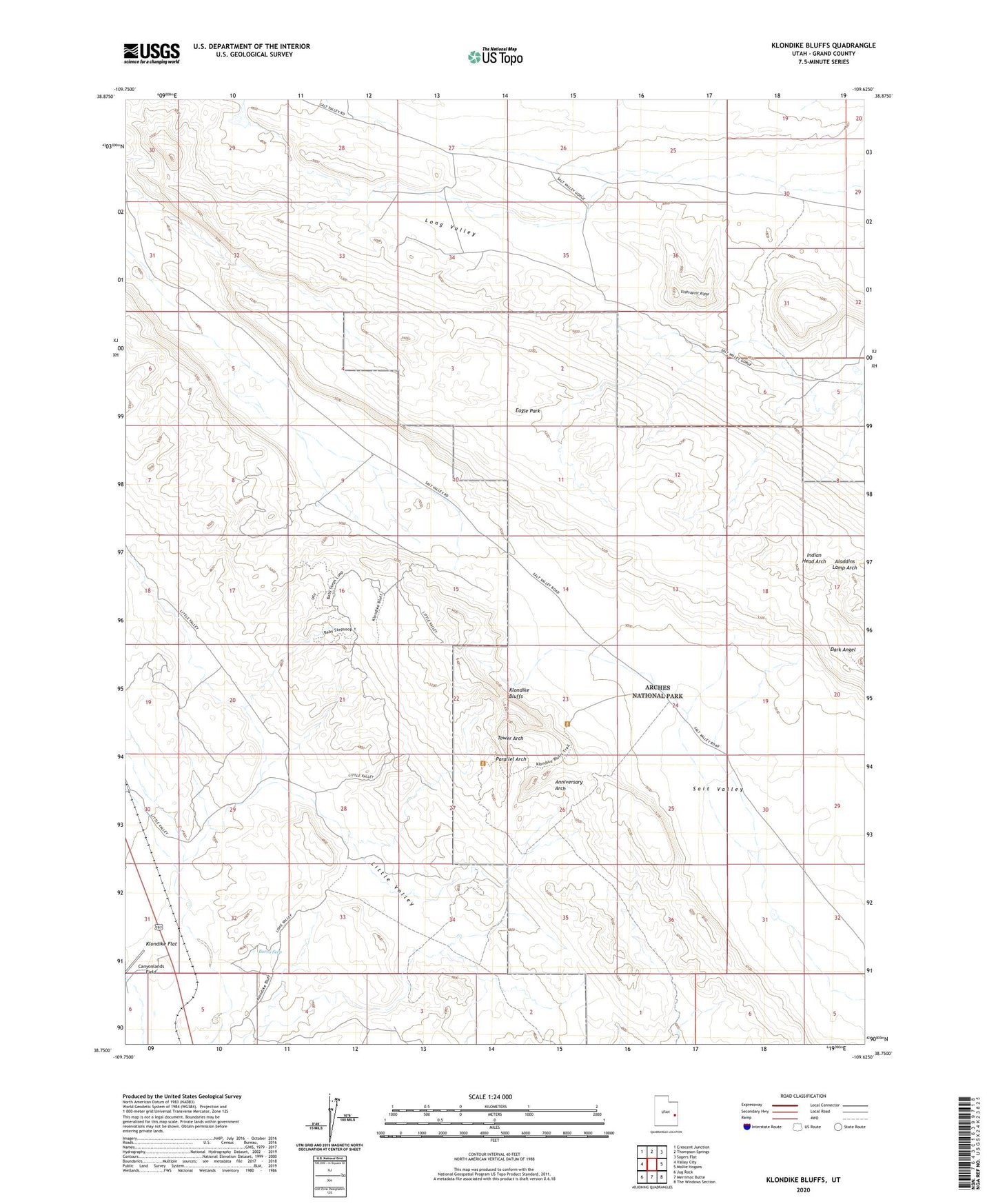
2023 topographic map quadrangle Klondike Bluffs in the state of Utah. Scale: 1:24000. Based on the newly updated USGS 7.5' US Topo map series, this map is in the following counties: Grand. The map contains contour data, water features, and other items you are used to seeing on USGS maps, but also has updated roads and other features. This is the next generation of topographic maps. Printed on high-quality waterproof paper with UV fade-resistant inks.
Quads adjacent to this one:
West: Valley City
Northwest: Crescent Junction
North: Thompson Springs
Northeast: Sagers Flat
East: Mollie Hogans
Southeast: The Windows Section
South: Merrimac Butte
Southwest: Jug Rock
This map covers the same area as the classic USGS quad with code o38109g6.
Contains the following named places: Aladdins Lamp Arch, Anniversary Arch, Burro Seep, Dark Angel, Eagle Park, Indian Head Arch, Klondike Bluffs, Klondike Flat, Long Valley, Marching Men, Parallel Arch, Tower Arch, Utahraptor Ridge