MyTopo
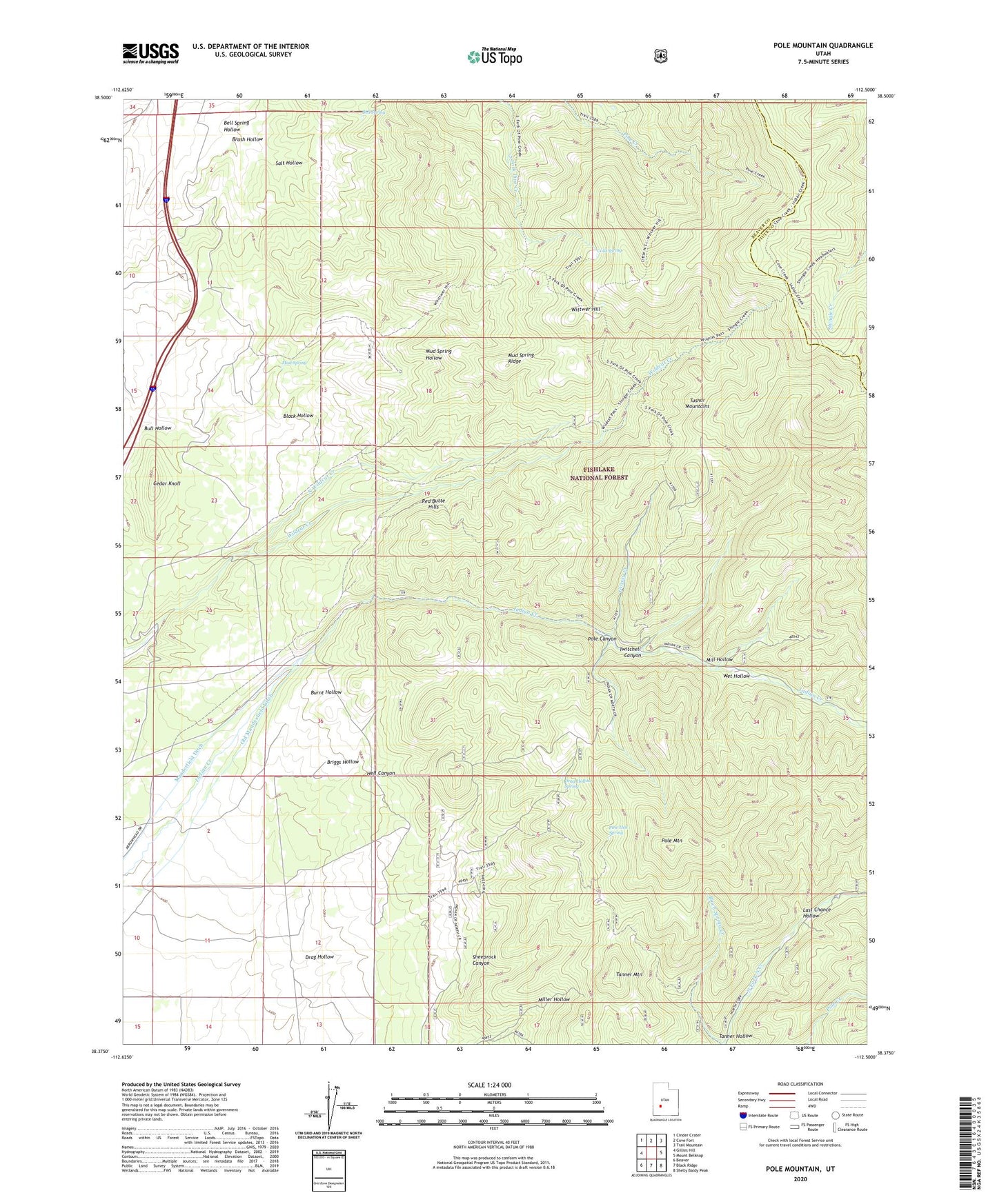
Pole Mountain Utah US Topo Map
Couldn't load pickup availability
Also explore the Pole Mountain Forest Service Topo of this same quad for updated USFS data
2023 topographic map quadrangle Pole Mountain in the state of Utah. Scale: 1:24000. Based on the newly updated USGS 7.5' US Topo map series, this map is in the following counties: Beaver, Piute. The map contains contour data, water features, and other items you are used to seeing on USGS maps, but also has updated roads and other features. This is the next generation of topographic maps. Printed on high-quality waterproof paper with UV fade-resistant inks.
Quads adjacent to this one:
West: Gillies Hill
Northwest: Cinder Crater
North: Cove Fort
Northeast: Trail Mountain
East: Mount Belknap
Southeast: Shelly Baldy Peak
South: Black Ridge
Southwest: Beaver
This map covers the same area as the classic USGS quad with code o38112d5.
Contains the following named places: Bell Spring, Bell Spring Hollow, Birch Spring Creek, Black Hollow, Briggs Hollow, Brush Hollow, Bull Hollow, Cedar Knoll, Cold Spring, Drag Hollow, Drag Hollow Spring, Glider Mine, Grassy Creek, Hell Canyon, Indian Creek Grand Station, Last Chance Hollow, Manderfield Ditch, Mill Hollow, Mud Spring, Mud Spring Ridge, North Wildcat Creek, Old Manderfield Ditch, Pine Hen Spring, Pole Canyon, Pole Mountain, Red Butte Hills, Rob Roy Mine, Salt Hollow, Sheeprock Canyon, Sheeprock Mine, Sunday Mine, Tanner Hollow, Tanner Mountain, Twitchell Canyon, Wet Hollow, White Cliff Mine, Wittwer Hill