MyTopo
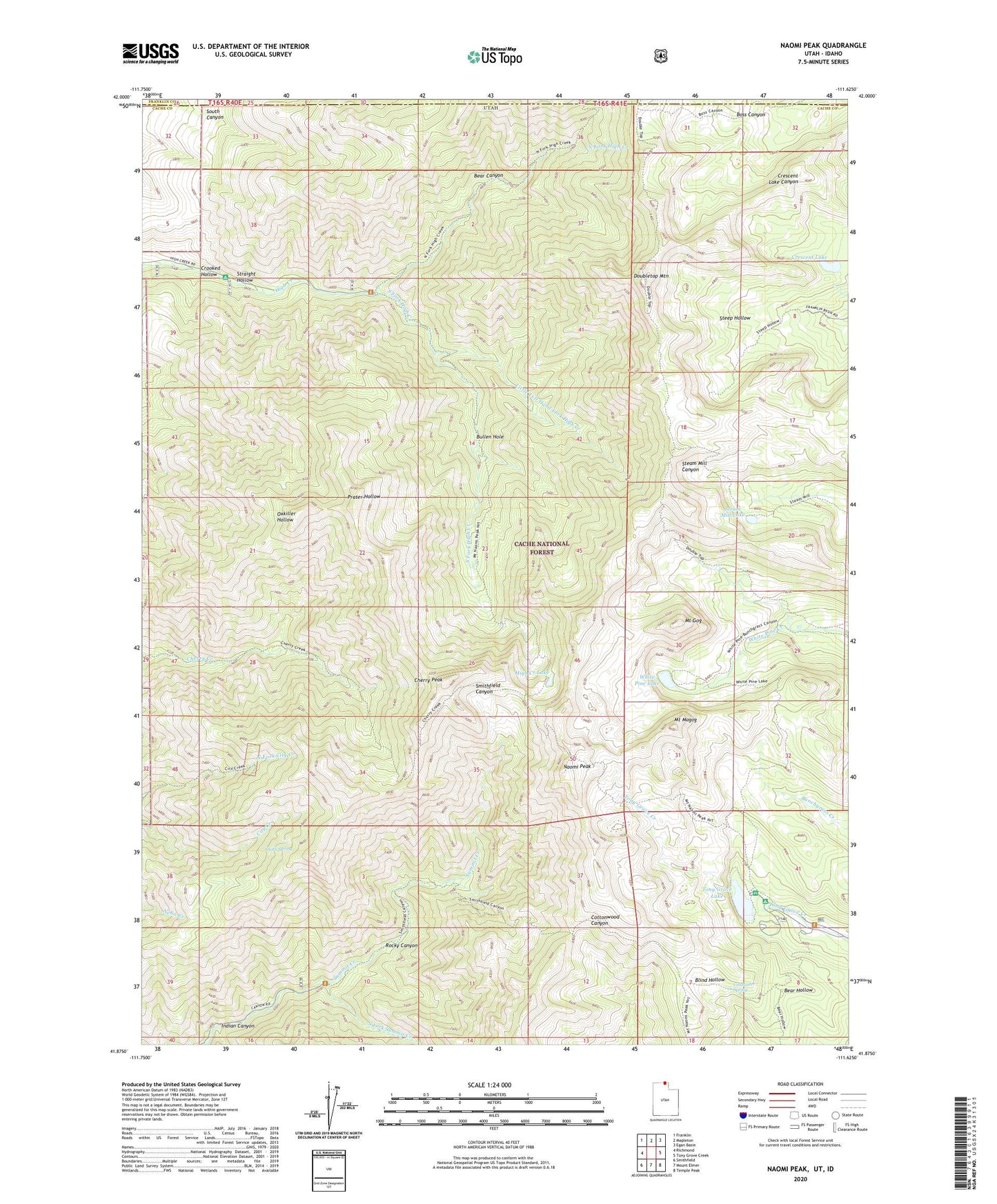
Naomi Peak Utah US Topo Map
Couldn't load pickup availability
Also explore the Naomi Peak Forest Service Topo of this same quad for updated USFS data
2023 topographic map quadrangle Naomi Peak in the state of Utah. Scale: 1:24000. Based on the newly updated USGS 7.5' US Topo map series, this map is in the following counties: Cache, Franklin. The map contains contour data, water features, and other items you are used to seeing on USGS maps, but also has updated roads and other features. This is the next generation of topographic maps. Printed on high-quality waterproof paper with UV fade-resistant inks.
Quads adjacent to this one:
West: Richmond
Northwest: Franklin
North: Mapleton
Northeast: Egan Basin
East: Tony Grove Creek
Southeast: Temple Peak
South: Mount Elmer
Southwest: Smithfield
This map covers the same area as the classic USGS quad with code o41111h6.
Contains the following named places: Bear Canyon, Bear River Range, Bullen Hole, Cherry Peak, Coldwater Spring, Crescent Lake, Crooked Hollow, Doubletop Mountain, High Creek Campground, High Creek Lake, Indian Canyon, Little Left Hand Fork High Creek, Mount Gog, Mount Magog, Mount Naomi Wilderness, Naomi Peak, North Fork High Creek, Rocky Canyon, Smith Spring, South Canyon, South Fork High Creek, South Fork Summit Creek, Steam Mill Lake, Straight Hollow, Tony Grove Lake, Tony Grove Lake Campground, Tony Grove Lake Trailhead, White Pine Lake