MyTopo
Newcastle Utah US Topo Map
Couldn't load pickup availability
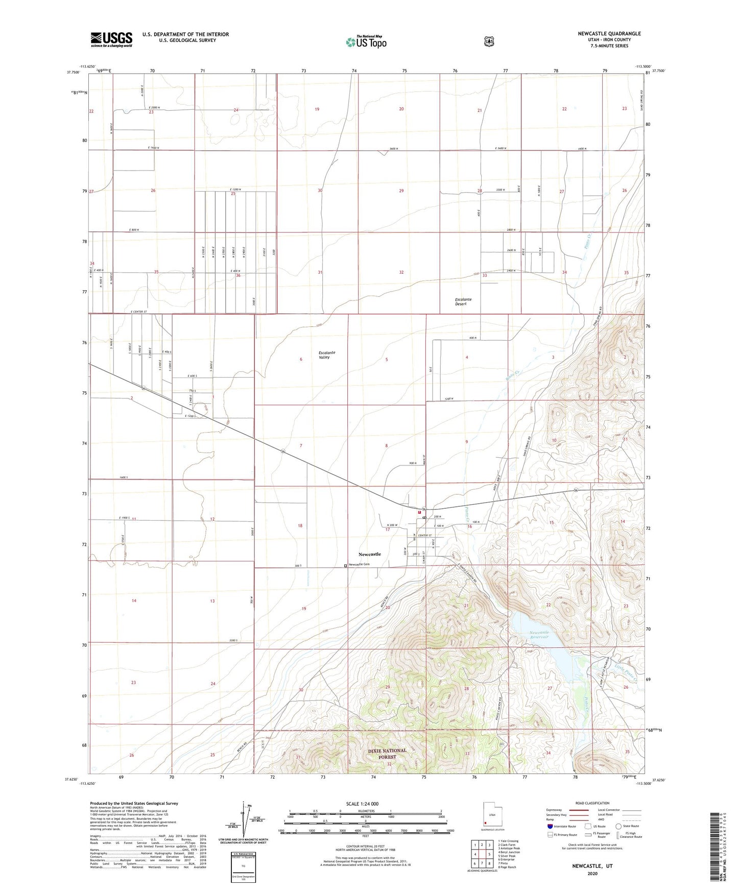
2020 topographic map quadrangle Newcastle in the state of Utah. Scale: 1:24000. Based on the newly updated USGS 7.5' US Topo map series, this map is in the following counties: Iron. The map contains contour data, water features, and other items you are used to seeing on USGS maps, but also has updated roads and other features. This is the next generation of topographic maps. Printed on high-quality waterproof paper with UV fade-resistant inks.
Quads adjacent to this one:
West: Beryl Junction
Northwest: Yale Crossing
North: Clark Farm
Northeast: Antelope Peak
East: Silver Peak
Southeast: Page Ranch
South: Pinto
Southwest: Enterprise
Contains the following named places: Hamblin Valley Fire and Rescue, Jefferson Hunt Monument, Little Pinto Creek, Newcastle, Newcastle Cemetery, Newcastle Census Designated Place, Newcastle Dam, Newcastle Fire Department, Newcastle Post Office, Newcastle Reservoir, Pinto Creek, The Church of Jesus Christ of Latter Day Saints