MyTopo
Silver Peak Utah US Topo Map
Couldn't load pickup availability
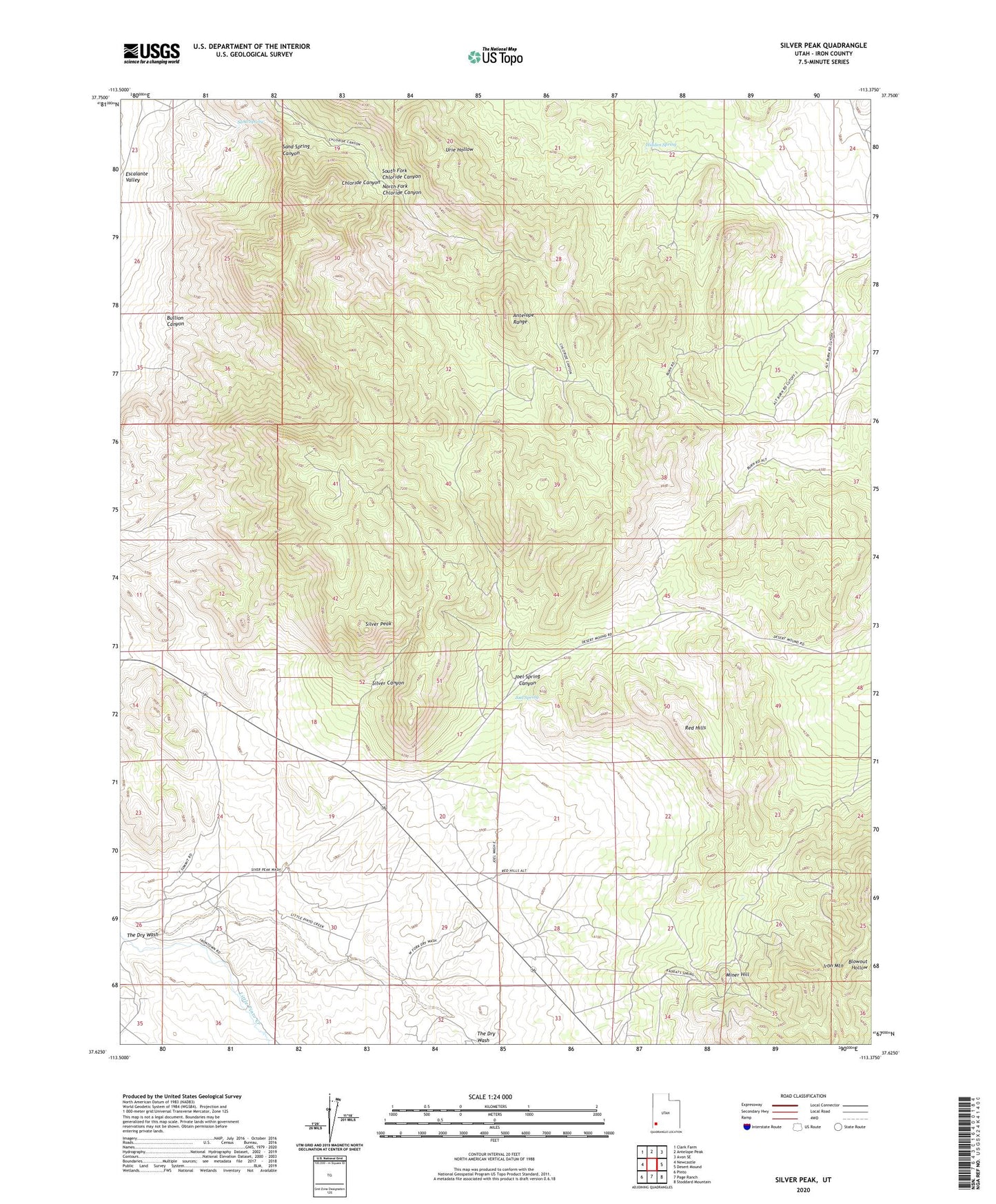
2023 topographic map quadrangle Silver Peak in the state of Utah. Scale: 1:24000. Based on the newly updated USGS 7.5' US Topo map series, this map is in the following counties: Iron. The map contains contour data, water features, and other items you are used to seeing on USGS maps, but also has updated roads and other features. This is the next generation of topographic maps. Printed on high-quality waterproof paper with UV fade-resistant inks.
Quads adjacent to this one:
West: Newcastle
Northwest: Clark Farm
North: Antelope Peak
Northeast: Avon SE
East: Desert Mound
Southeast: Stoddard Mountain
South: Page Ranch
Southwest: Pinto
This map covers the same area as the classic USGS quad with code o37113f4.
Contains the following named places: Antelope Range, Bullion Canyon, Hidden Spring, Joel Spring, Joel Spring Canyon, KBRE-FM (Cedar City), KSUB-FM (Cedar City), Miner Hill, North Fork Chloride Canyon, Red Hills, Sand Spring, Silver Canyon, Silver Peak, South Fork Chloride Canyon, The Dry Wash