MyTopo
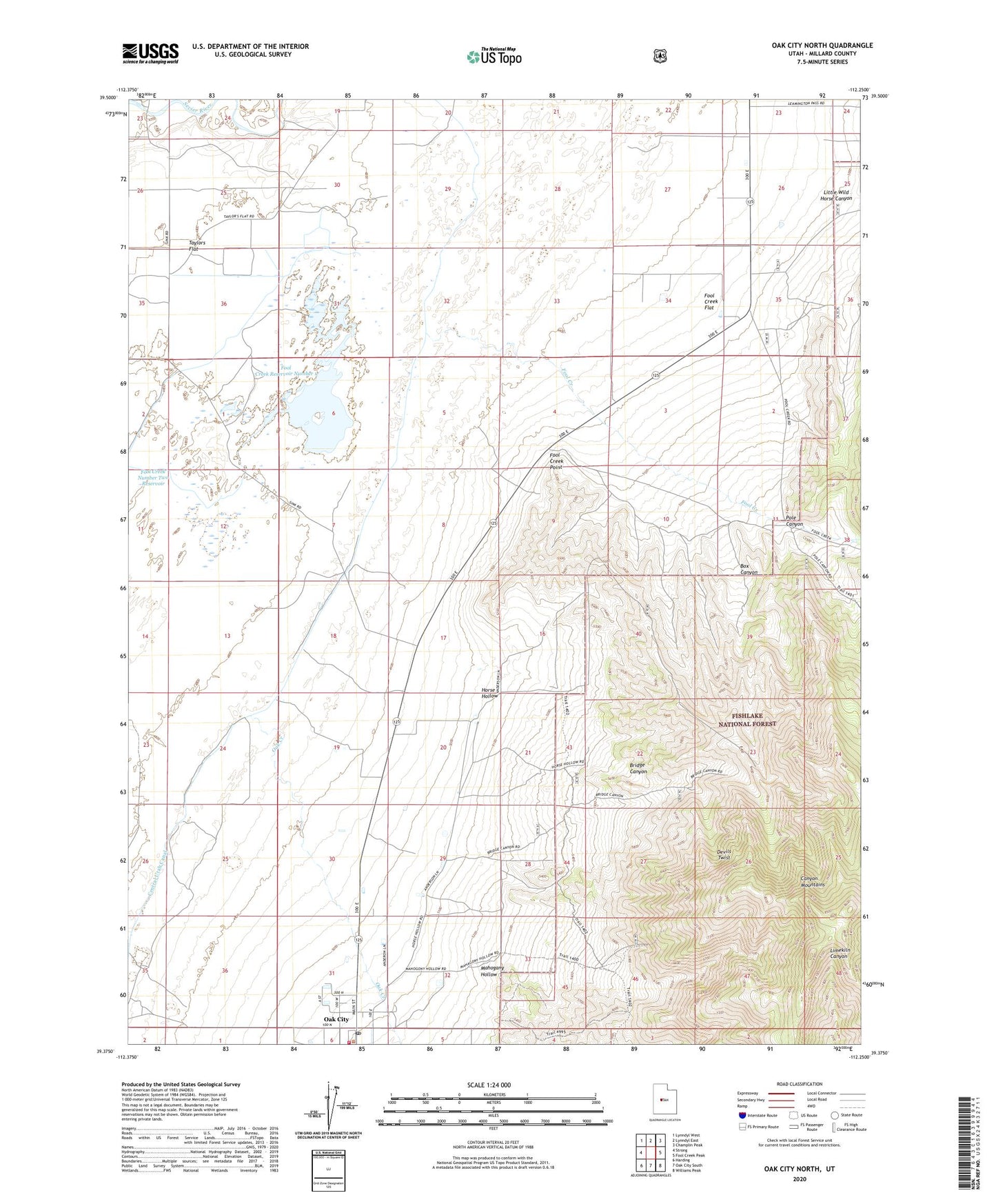
Oak City North Utah US Topo Map
Couldn't load pickup availability
Also explore the Oak City North Forest Service Topo of this same quad for updated USFS data
2023 topographic map quadrangle Oak City North in the state of Utah. Scale: 1:24000. Based on the newly updated USGS 7.5' US Topo map series, this map is in the following counties: Millard. The map contains contour data, water features, and other items you are used to seeing on USGS maps, but also has updated roads and other features. This is the next generation of topographic maps. Printed on high-quality waterproof paper with UV fade-resistant inks.
Quads adjacent to this one:
West: Strong
Northwest: Lynndyl West
North: Lynndyl East
Northeast: Champlin Peak
East: Fool Creek Peak
Southeast: Williams Peak
South: Oak City South
Southwest: Harding
This map covers the same area as the classic USGS quad with code o39112d3.
Contains the following named places: Box Canyon, Bridge Canyon, Devils Twist, Fool Creek, Fool Creek Flat, Fool Creek Number One Dam, Fool Creek Number Two Dam, Fool Creek Number Two Reservoir, Fool Creek Point, Fool Creek Reservoir Number 1, Horse Hollow, Mahogany Hollow, Oak City Fire Department, Oak City Post Office, Oak Creek, Pauls Meadow, Pole Canyon, Taylors Flat, The Church of Jesus Christ of Latter Day Saints, Town of Oak City