MyTopo
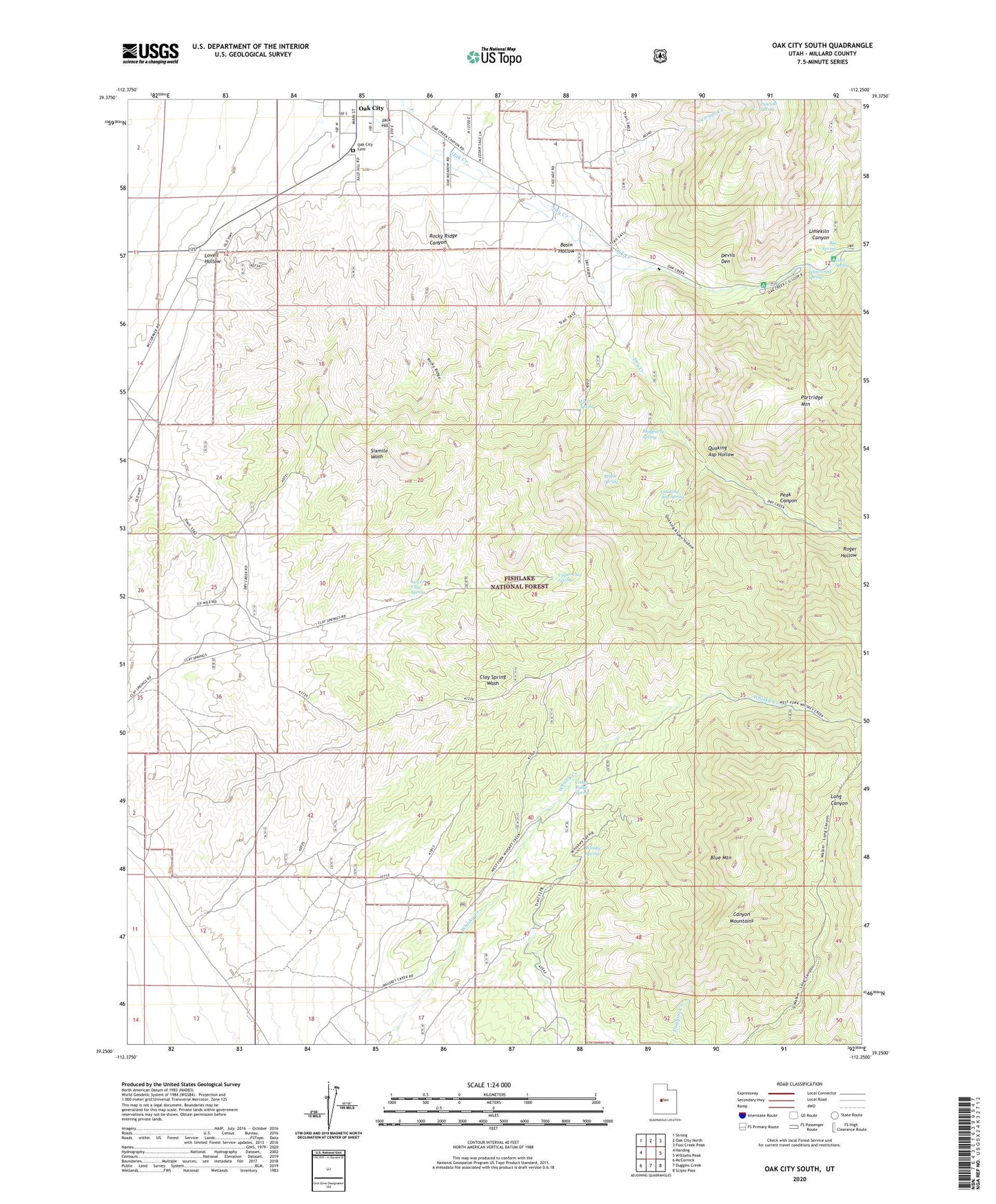
Oak City South Utah US Topo Map
Couldn't load pickup availability
Also explore the Oak City South Forest Service Topo of this same quad for updated USFS data
2023 topographic map quadrangle Oak City South in the state of Utah. Scale: 1:24000. Based on the newly updated USGS 7.5' US Topo map series, this map is in the following counties: Millard. The map contains contour data, water features, and other items you are used to seeing on USGS maps, but also has updated roads and other features. This is the next generation of topographic maps. Printed on high-quality waterproof paper with UV fade-resistant inks.
Quads adjacent to this one:
West: Harding
Northwest: Strong
North: Oak City North
Northeast: Fool Creek Peak
East: Williams Peak
Southeast: Scipio Pass
South: Duggins Creek
Southwest: McCornick
This map covers the same area as the classic USGS quad with code o39112c3.
Contains the following named places: Basin Hollow, Big Spring, Blue Mountain, Cascade Creek, Cascade Spring, Cedar Ridge Spring, Cold Spring, Devils Den, Dry Creek, First Spring, Jack Hill, Limekiln Canyon, Lovell Hollow, Lower Clay Spring, Maple Spring, Mayparty Spring, Oak City, Oak City Cemetery, Oak Creek Campground, Oak Creek Ranger Station, Partridge Mountain Research Natural Area, Peak Canyon, Quaking Asp Hollow, Quaking Asp Spring, Rocky Ridge Canyon, Upper Clay Spring, Watercrest Spring, Whisky Spring, ZIP Code: 84649