MyTopo
Old Canyon Utah US Topo Map
Couldn't load pickup availability
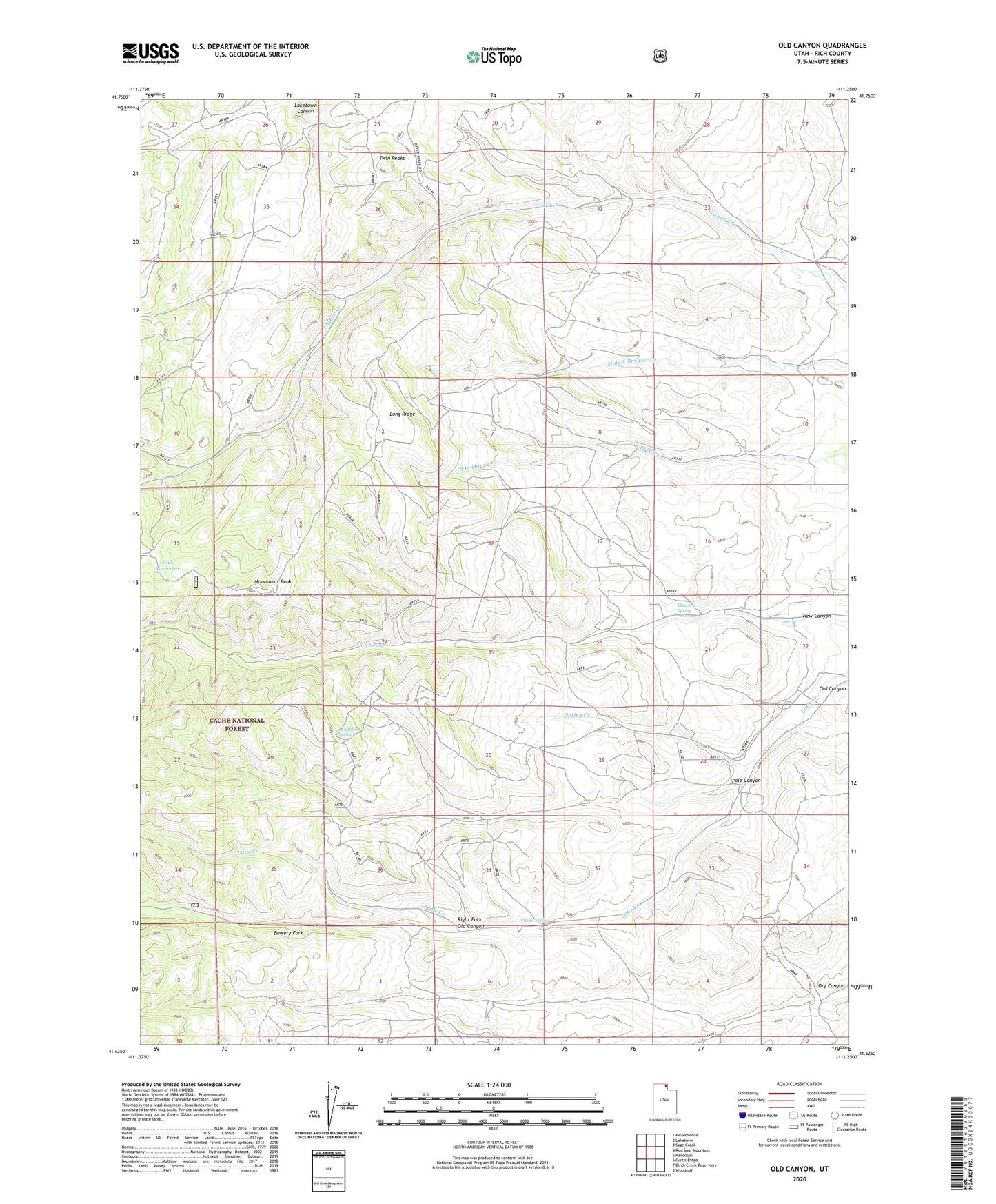
2020 topographic map quadrangle Old Canyon in the state of Utah. Scale: 1:24000. Based on the newly updated USGS 7.5' US Topo map series, this map is in the following counties: Rich. The map contains contour data, water features, and other items you are used to seeing on USGS maps, but also has updated roads and other features. This is the next generation of topographic maps. Printed on high-quality waterproof paper with UV fade-resistant inks.
Quads adjacent to this one:
West: Red Spur Mountain
Northwest: Meadowville
North: Laketown
Northeast: Sage Creek
East: Randolph
Southeast: Woodruff
South: Birch Creek Reservoirs
Southwest: Curtis Ridge
Contains the following named places: Bowery Fork, Clawson Spring, Keg Spring, Long Ridge, Longhurst Spring, Monument Peak, New Canyon, Nick Reservoir, Old Canyon, Pole Canyon, Right Fork Old Canyon, Spring Creek, Twin Peaks, Willow Spring