MyTopo
Pine Park Utah US Topo Map
Couldn't load pickup availability
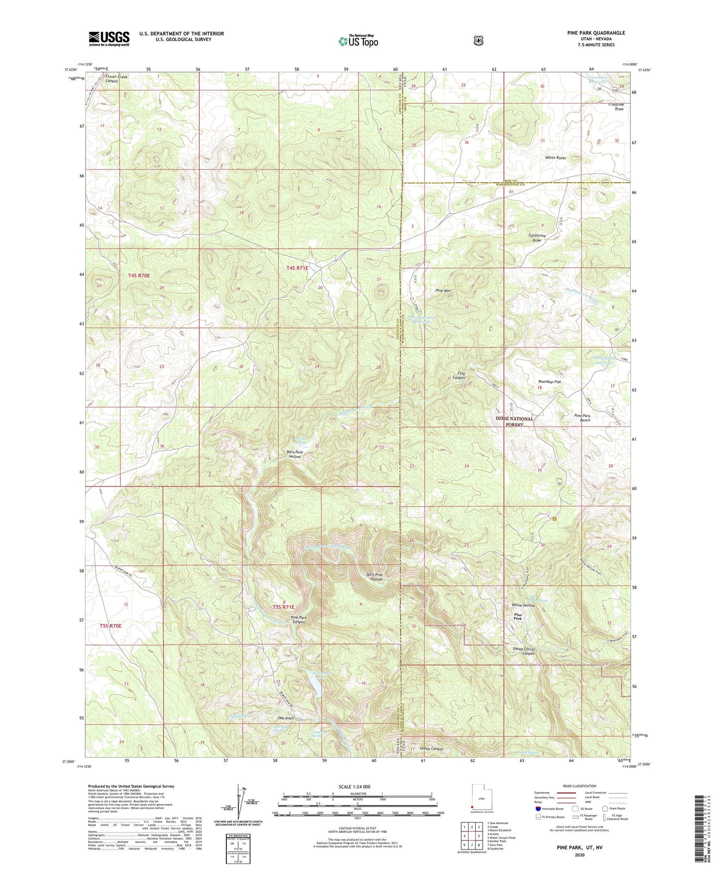
2020 topographic map quadrangle Pine Park in the states of Nevada, Utah. Scale: 1:24000. Based on the newly updated USGS 7.5' US Topo map series, this map is in the following counties: Washington, Lincoln, Iron. The map contains contour data, water features, and other items you are used to seeing on USGS maps, but also has updated roads and other features. This is the next generation of topographic maps. Printed on high-quality waterproof paper with UV fade-resistant inks.
Quads adjacent to this one:
West: Acoma
Northwest: Dow Mountain
North: Uvada
Northeast: Mount Escalante
East: Water Canyon Peak
Southeast: Goldstrike
South: Docs Pass
Southwest: Bunker Peak
Contains the following named places: Barn Pole Hollow, Beaver Dam State Park, California Draw, Clay Canyon, Cliff Spring, Crestline Draw, Crestline Reservoir, East Fork Beaver Dam Wash, Grapevine Spring, Hamblin Ranch, Headwaters Wash, Jessie Tie Exclosure, Mile High Spring, Oak Knoll, Pine Mountain, Pine Mountain Reservoir, Pine Park, Pine Park Campground, Pine Park Canyon, Pine Park Spring, Roundup Flat, Schroeder Dam, Schroeder Lake, Sheep Corral Canyon, Sheep Spring, Split Pine Hollow, Tunnel Spring Wilderness, Tunnel Springs, Wheatgrass Reservoir, White Hollow, White Rocks