MyTopo
Uvada Utah US Topo Map
Couldn't load pickup availability
Also explore the Uvada Forest Service Topo of this same quad for updated USFS data
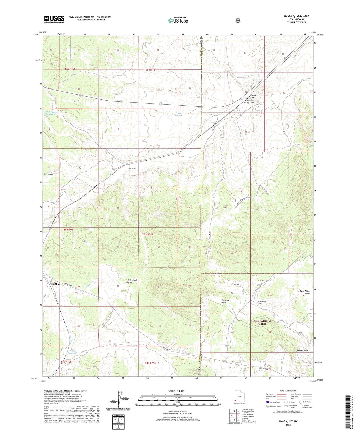
2023 topographic map quadrangle Uvada in the states of Nevada, Utah. Scale: 1:24000. Based on the newly updated USGS 7.5' US Topo map series, this map is in the following counties: Iron, Lincoln. The map contains contour data, water features, and other items you are used to seeing on USGS maps, but also has updated roads and other features. This is the next generation of topographic maps. Printed on high-quality waterproof paper with UV fade-resistant inks.
Quads adjacent to this one:
West: Dow Mountain
Northwest: Panaca Summit
North: Prohibition Flat
Northeast: Modena
East: Mount Escalante
Southeast: Water Canyon Peak
South: Pine Park
Southwest: Acoma
This map covers the same area as the classic USGS quad with code o37114f1.
Contains the following named places: C C C Well, Devils Gap, Lafes Reservoir, Lien, Lien Draw, Old Highway Reservoir, Panaca Ridge, Salt Licks, Sheep Spring Draw, Uvada, Uvada Reservoir