MyTopo
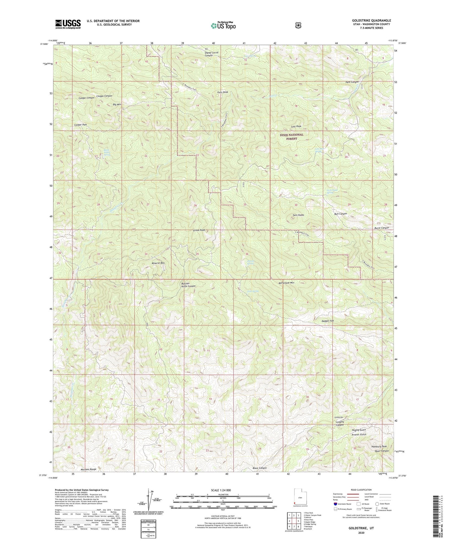
Goldstrike Utah US Topo Map
Couldn't load pickup availability
Also explore the Goldstrike Forest Service Topo of this same quad for updated USFS data
2023 topographic map quadrangle Goldstrike in the state of Utah. Scale: 1:24000. Based on the newly updated USGS 7.5' US Topo map series, this map is in the following counties: Washington. The map contains contour data, water features, and other items you are used to seeing on USGS maps, but also has updated roads and other features. This is the next generation of topographic maps. Printed on high-quality waterproof paper with UV fade-resistant inks.
Quads adjacent to this one:
West: Docs Pass
Northwest: Pine Park
North: Water Canyon Peak
Northeast: Hebron
East: Maple Ridge
Southeast: Gunlock
South: Motoqua
Southwest: Dodge Spring
This map covers the same area as the classic USGS quad with code o37113d8.
Contains the following named places: Arsenic Gulch, Aspen Spring, Big Mountain, Black Canyon, Black Willow Spring, Bull Run Mine, Cougar Pass, Dagget Flat, Emma Mine, Goldstrike, Greek Peak, Gutz Peak, Hamburg Peak, Longley Canyon, Lost Peak, Lost Peak Spring, McFarlane Mountain, Mineral Mountain, Park Canyon, Pegleg Gulch, Polecat Spring, Quail Canyon, Slaughter Creek Wilderness, Trail Spring, Twin Peaks, Twin Peaks Spring