MyTopo
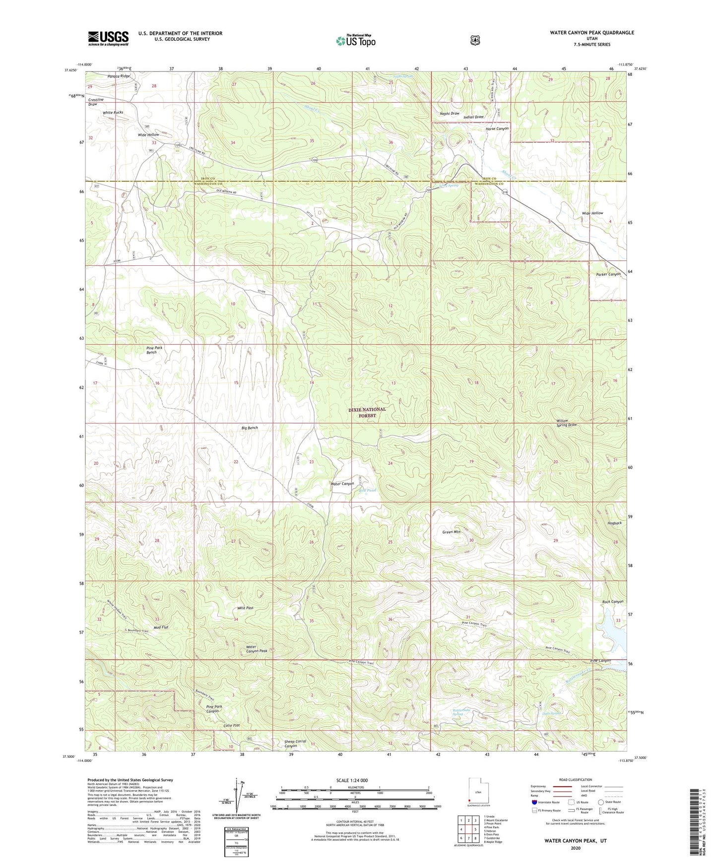
Water Canyon Peak Utah US Topo Map
Couldn't load pickup availability
Also explore the Water Canyon Peak Forest Service Topo of this same quad for updated USFS data
2023 topographic map quadrangle Water Canyon Peak in the state of Utah. Scale: 1:24000. Based on the newly updated USGS 7.5' US Topo map series, this map is in the following counties: Washington, Iron. The map contains contour data, water features, and other items you are used to seeing on USGS maps, but also has updated roads and other features. This is the next generation of topographic maps. Printed on high-quality waterproof paper with UV fade-resistant inks.
Quads adjacent to this one:
West: Pine Park
Northwest: Uvada
North: Mount Escalante
Northeast: Pinon Point
East: Hebron
Southeast: Maple Ridge
South: Goldstrike
Southwest: Docs Pass
This map covers the same area as the classic USGS quad with code o37113e8.
Contains the following named places: Big Bench, Colie Flat, Dads Spring, Green Mountain, Horse Canyon, Indian Draw, Jessie Tie Wash, Mud Flat, Nephi Draw, Nephi Spring, Parker Canyon, Parker Canyon Trail, Pine Canyon, Pine Park Bench, Rattlesnake Creek, Rattlesnake Spring, Red Pond, Rock Canyon, Rock Hole Corral, Rock Hole Wash, Terry Spring, Water Canyon, Water Canyon Peak, West Pass, White Hollow Pack Trail, Wide Hollow