MyTopo
Pine Spring Canyon Utah US Topo Map
Couldn't load pickup availability
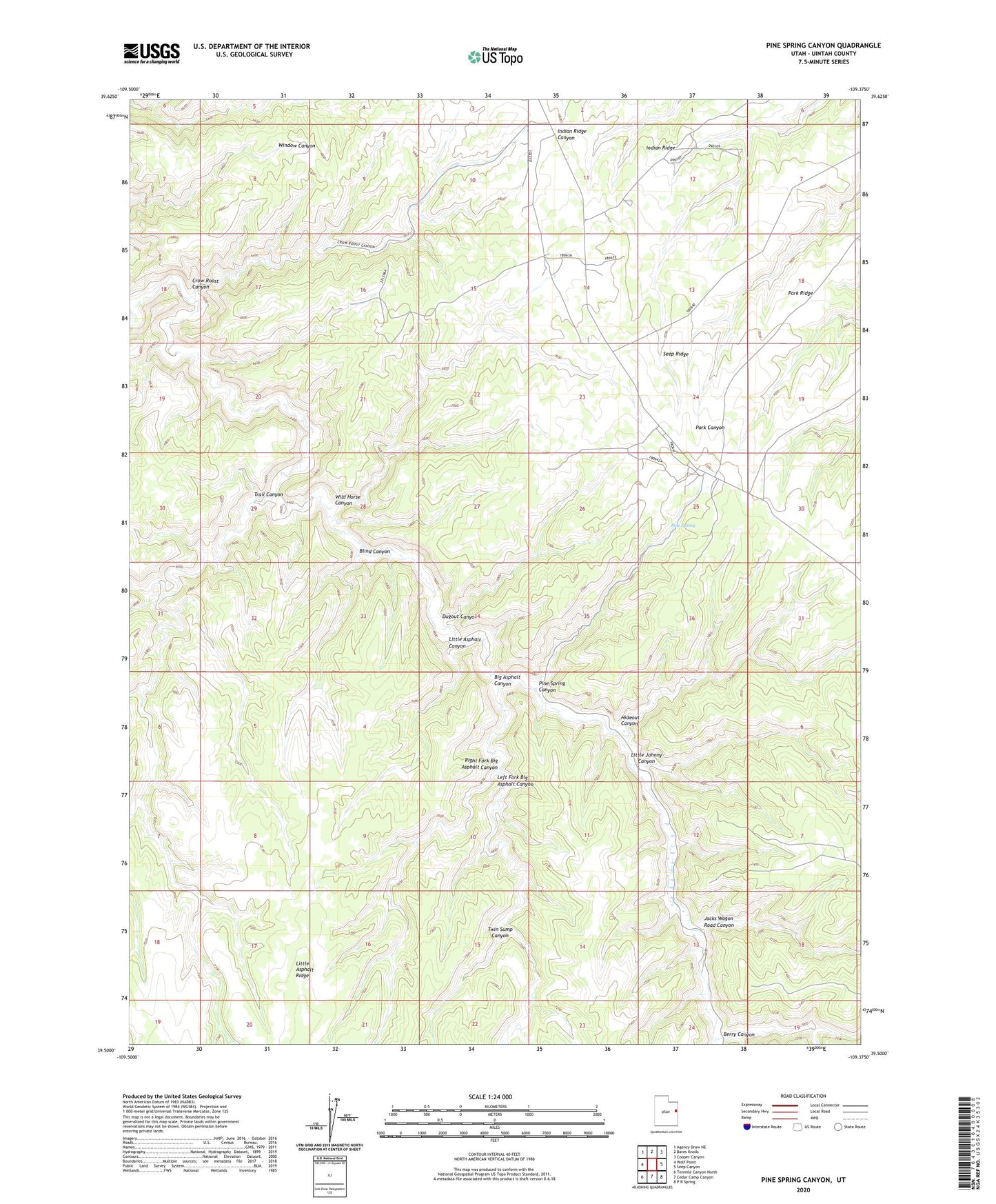
2023 topographic map quadrangle Pine Spring Canyon in the state of Utah. Scale: 1:24000. Based on the newly updated USGS 7.5' US Topo map series, this map is in the following counties: Uintah. The map contains contour data, water features, and other items you are used to seeing on USGS maps, but also has updated roads and other features. This is the next generation of topographic maps. Printed on high-quality waterproof paper with UV fade-resistant inks.
Quads adjacent to this one:
West: Wolf Point
Northwest: Agency Draw NE
North: Bates Knolls
Northeast: Cooper Canyon
East: Seep Canyon
Southeast: P R Spring
South: Cedar Camp Canyon
Southwest: Tenmile Canyon North
This map covers the same area as the classic USGS quad with code o39109e4.
Contains the following named places: Berry Canyon, Big Asphalt Canyon, Blind Canyon, Crow Roost Canyon, Dugout Canyon, Hideout Canyon, Jacks Wagon Road Canyon, Left Fork Big Asphalt Canyon, Little Asphalt Canyon, Little Johnny Canyon, Mayos Cabin, Pine Spring, Pine Spring Canyon, Right Fork Big Asphalt Canyon, Seep Ridge, Trail Canyon, Twin Sump Canyon, Wild Horse Canyon