MyTopo
Seep Canyon Utah US Topo Map
Couldn't load pickup availability
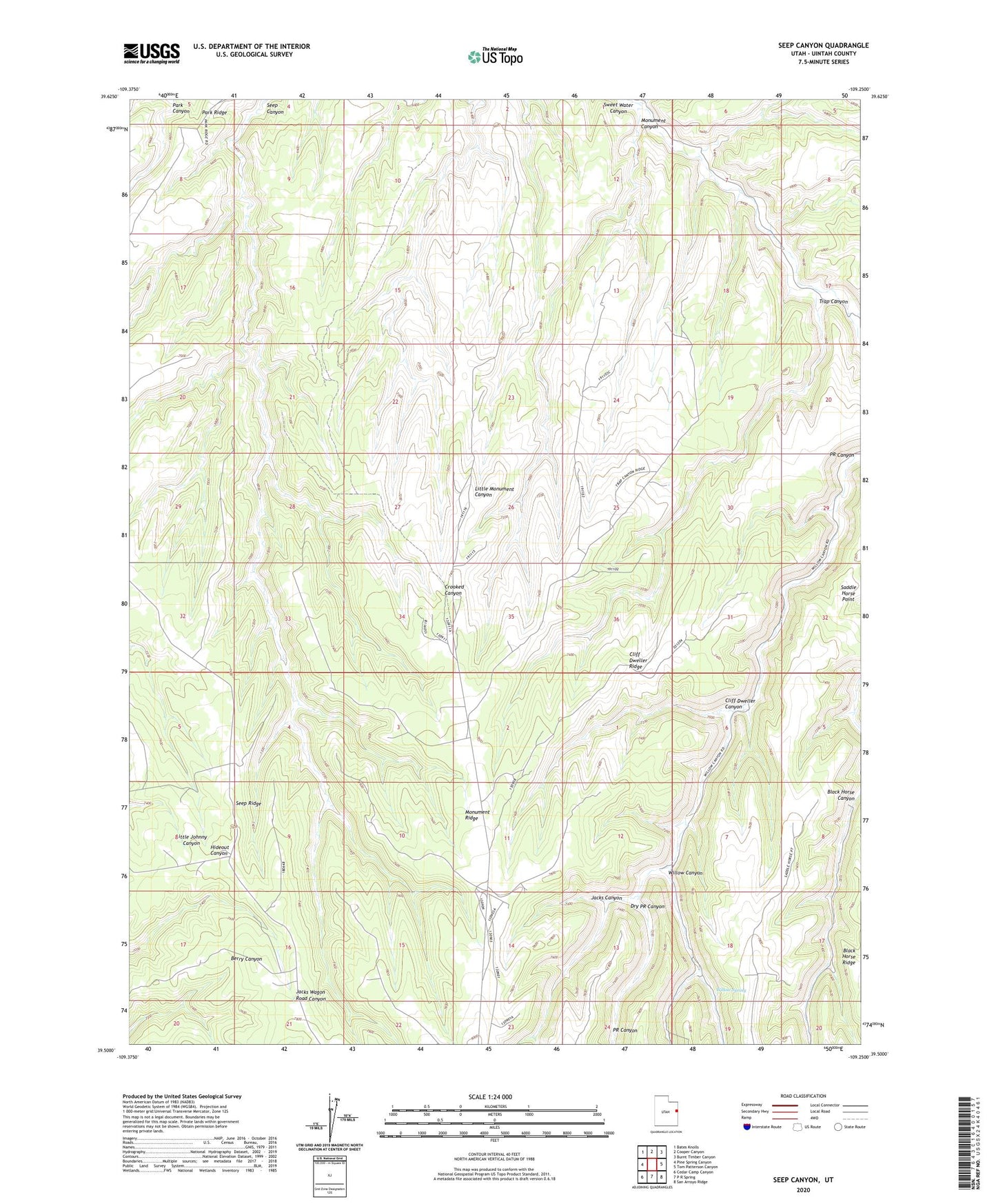
2023 topographic map quadrangle Seep Canyon in the state of Utah. Scale: 1:24000. Based on the newly updated USGS 7.5' US Topo map series, this map is in the following counties: Uintah. The map contains contour data, water features, and other items you are used to seeing on USGS maps, but also has updated roads and other features. This is the next generation of topographic maps. Printed on high-quality waterproof paper with UV fade-resistant inks.
Quads adjacent to this one:
West: Pine Spring Canyon
Northwest: Bates Knolls
North: Cooper Canyon
Northeast: Burnt Timber Canyon
East: Tom Patterson Canyon
Southeast: San Arroyo Ridge
South: P R Spring
Southwest: Cedar Camp Canyon
This map covers the same area as the classic USGS quad with code o39109e3.
Contains the following named places: Cliff Dweller Canyon, Cliff Dweller Ridge, Dry PR Canyon, Jacks Canyon, Monument Canyon, Monument Ridge, Park Ridge, Saddle Horse Point, Trap Canyon, Willow Canyon, Willow Spring