MyTopo
Piute Knoll Utah US Topo Map
Couldn't load pickup availability
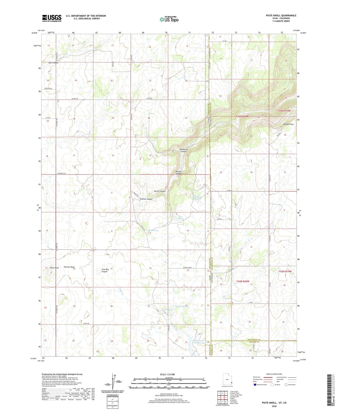
2023 topographic map quadrangle Piute Knoll in the states of Utah, Colorado. Scale: 1:24000. Based on the newly updated USGS 7.5' US Topo map series, this map is in the following counties: San Juan, San Miguel, Dolores. The map contains contour data, water features, and other items you are used to seeing on USGS maps, but also has updated roads and other features. This is the next generation of topographic maps. Printed on high-quality waterproof paper with UV fade-resistant inks.
Quads adjacent to this one:
West: Eastland NW
Northwest: Sop Canyon
North: Summit Point
Northeast: Horse Range Mesa
East: Egnar
Southeast: Dove Creek
South: Northdale
Southwest: Eastland
This map covers the same area as the classic USGS quad with code o37109h1.
Contains the following named places: Bishop Point, Black Spider Mine, Bluebird Mine, Burn School, Calliham Mine, Deremo Mine Number 1, Dermo Mine Number 2, East Summit School, Eloise Mine, Geisinger Mine, Hazel Group Mine, Ingram Spring, Last Hope Mine, Lucky Strike Mine, Marie Mine, Mercantile Mine, Piute Knoll, Piute Spring, Red Ant Mine, Rustler Canyon, Rustler Spring, Sage Mine, Secret Canyon, Secret Springs, Silver Bell Mine, Snyder Mine, Snyder Reservoir Number Two, Summit Spring, Wildhorse Canyon, Wilson Mine