MyTopo
Dove Creek Colorado US Topo Map
Couldn't load pickup availability
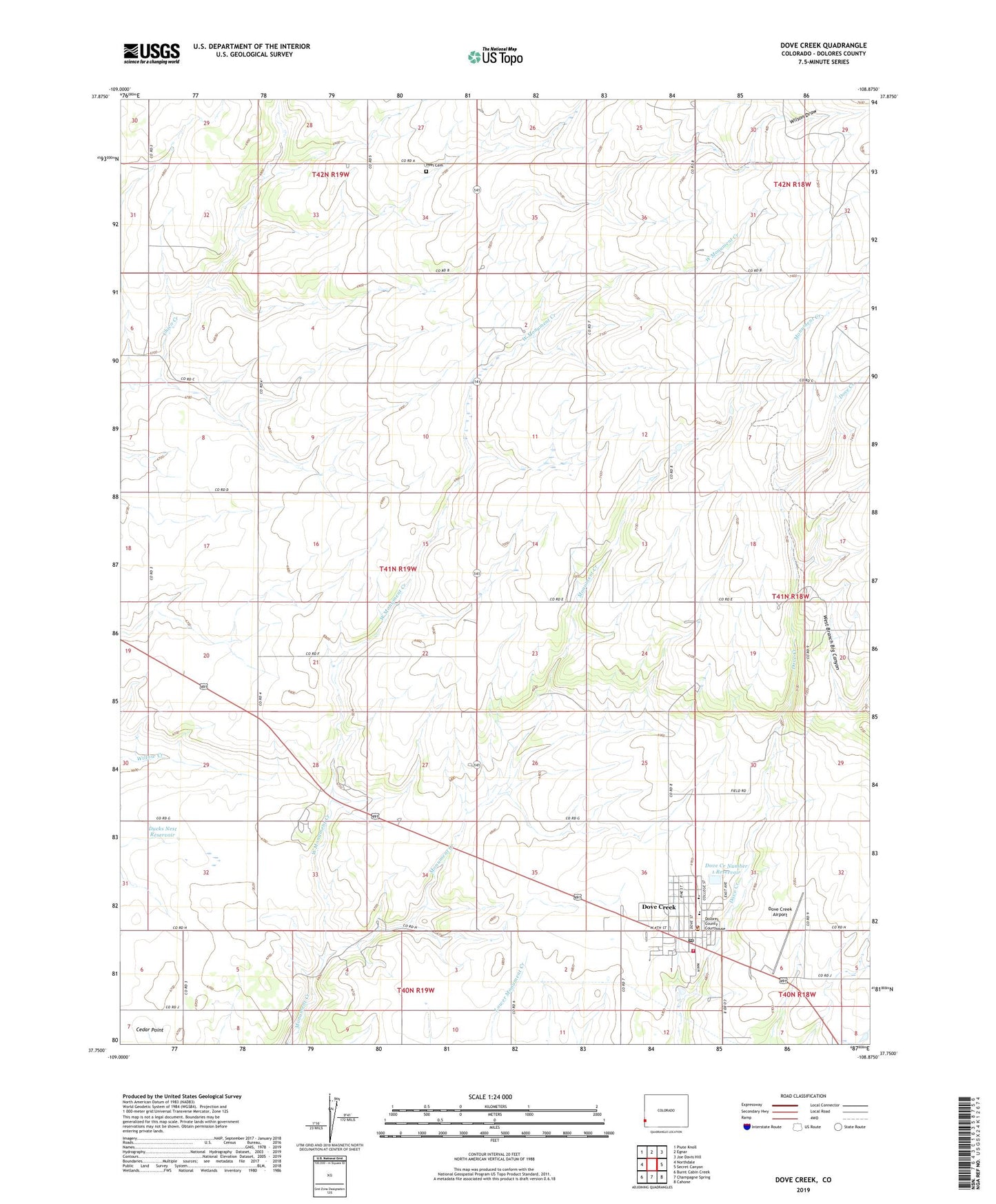
2022 topographic map quadrangle Dove Creek in the state of Colorado. Scale: 1:24000. Based on the newly updated USGS 7.5' US Topo map series, this map is in the following counties: Dolores. The map contains contour data, water features, and other items you are used to seeing on USGS maps, but also has updated roads and other features. This is the next generation of topographic maps. Printed on high-quality waterproof paper with UV fade-resistant inks.
Quads adjacent to this one:
West: Northdale
Northwest: Piute Knoll
North: Egnar
Northeast: Joe Davis Hill
East: Secret Canyon
Southeast: Cahone
South: Champagne Spring
Southwest: Burnt Cabin Creek
This map covers the same area as the classic USGS quad with code o37108g8.
Contains the following named places: Dolores County Sheriff's Office, Dove Creek, Dove Creek Airport, Dove Creek and 1 Dam, Dove Creek Fire Department, Dove Creek Number 1 Reservoir, Dove Creek Post Office, Dove Creek Volunteer Ambulance Service, Ducks Nest Dam, Ducks Nest Reservoir, Fritz and Erickson Mine, Peel Cemetery, Town of Dove Creek, West Monument Creek, Wilson Draw