MyTopo
Red Wash NW Utah US Topo Map
Couldn't load pickup availability
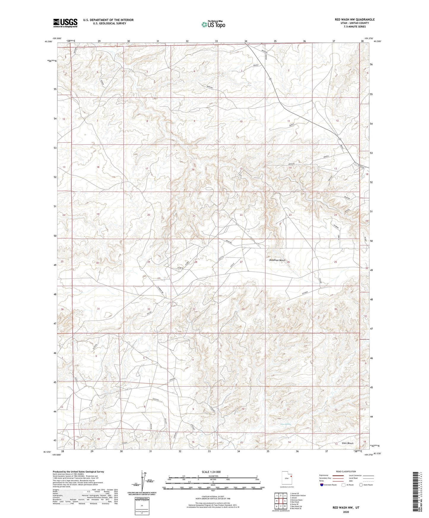
2023 topographic map quadrangle Red Wash NW in the state of Utah. Scale: 1:24000. Based on the newly updated USGS 7.5' US Topo map series, this map is in the following counties: Uintah. The map contains contour data, water features, and other items you are used to seeing on USGS maps, but also has updated roads and other features. This is the next generation of topographic maps. Printed on high-quality waterproof paper with UV fade-resistant inks.
Quads adjacent to this one:
West: Brennan Basin
Northwest: Vernal SE
North: Rasmussen Hollow
Northeast: Jensen
East: Red Wash
Southeast: Red Wash SE
South: Red Wash SW
Southwest: Ouray SE
This map covers the same area as the classic USGS quad with code o40109b4.
Contains the following named places: Glen Spring, Horseshoe Bend Oil and Gas Field, White River Oil and Gas Field, Wonsits-Wonsits Valley Oil Field, Wooley Reservoir