MyTopo
Redmond Utah US Topo Map
Couldn't load pickup availability
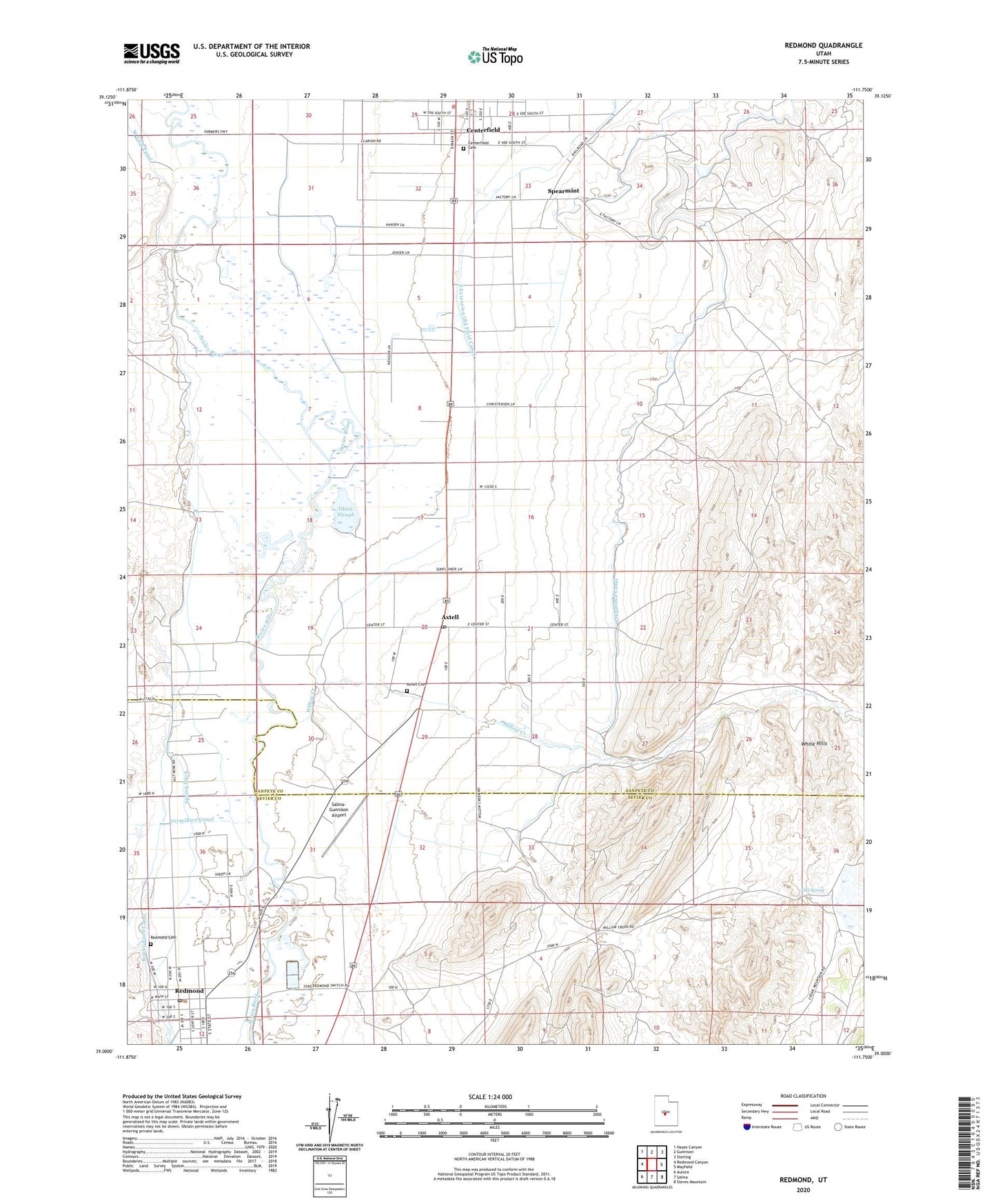
2023 topographic map quadrangle Redmond in the state of Utah. Scale: 1:24000. Based on the newly updated USGS 7.5' US Topo map series, this map is in the following counties: Sanpete, Sevier. The map contains contour data, water features, and other items you are used to seeing on USGS maps, but also has updated roads and other features. This is the next generation of topographic maps. Printed on high-quality waterproof paper with UV fade-resistant inks.
Quads adjacent to this one:
West: Redmond Canyon
Northwest: Hayes Canyon
North: Gunnison
Northeast: Sterling
East: Mayfield
Southeast: Steves Mountain
South: Salina
Southwest: Aurora
This map covers the same area as the classic USGS quad with code o39111a7.
Contains the following named places: Axtell, Axtell Cemetery, Axtell Post Office, Centerfield Cemetery, Centerfield Police Department, Highland Canal, Niel Spring, Old Field Canal, Olsen Slough, Redmond, Redmond Cemetery, Redmond Post Office, Salina-Gunnison Airport, South Extension Old Field Canal, Spearmint, Spring Ditch, The Church of Jesus Christ of Latter Day Saints, Town of Redmond, West View Canal, Willow Creek, Willow Creek Dam, Willow Creek Reservoir, ZIP Codes: 84621, 84622, 84652