MyTopo
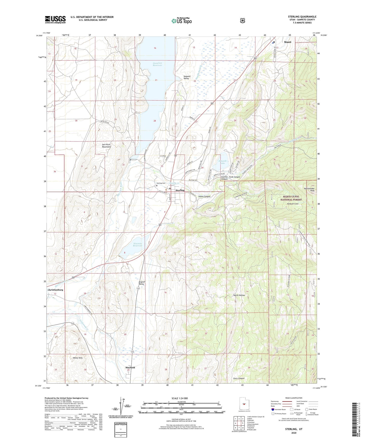
Sterling Utah US Topo Map
Couldn't load pickup availability
Also explore the Sterling Forest Service Topo of this same quad for updated USFS data
2023 topographic map quadrangle Sterling in the state of Utah. Scale: 1:24000. Based on the newly updated USGS 7.5' US Topo map series, this map is in the following counties: Sanpete. The map contains contour data, water features, and other items you are used to seeing on USGS maps, but also has updated roads and other features. This is the next generation of topographic maps. Printed on high-quality waterproof paper with UV fade-resistant inks.
Quads adjacent to this one:
West: Gunnison
Northwest: Hells Kitchen Canyon SE
North: Manti
Northeast: Ephraim
East: Black Mountain
Southeast: Woods Lake
South: Mayfield
Southwest: Redmond
This map covers the same area as the classic USGS quad with code o39111b6.
Contains the following named places: Antelope Valley Ranch, Arapien Valley, Chris Canyon, Danish Field Creek, Forbush Cove, Funk Canyon, Gunnison Dam, Gunnison Reservoir, KMXU-FM (Manti), Lake Canal, Larson Ditch, Manti Dump Wildlife Management Area, Manti Meadows Waterfowl Management Area, Morrison Mine, Ninemile Dam, Ninemile Reservoir, Ninemile State Wildlife Management Area, North Hollow Wildlife Management Area, Palisade Campground, Palisade Lake, Palisade Lake Dam, Palisade State Boating Park, Rattlesnake Peak, Sanpete County Jail, Sanpete County Sheriffs Office, Sanpete Valley, Sixmile Canyon, Sixmile Creek, Six-Mile Wildlife Management Area, Snows Canyon, Sterling, Sterling Cemetery, Sterling Post Office, The Church of Jesus Christ of Latter Day Saints, Town of Sterling, Twelvemile Creek, ZIP Code: 84665