MyTopo
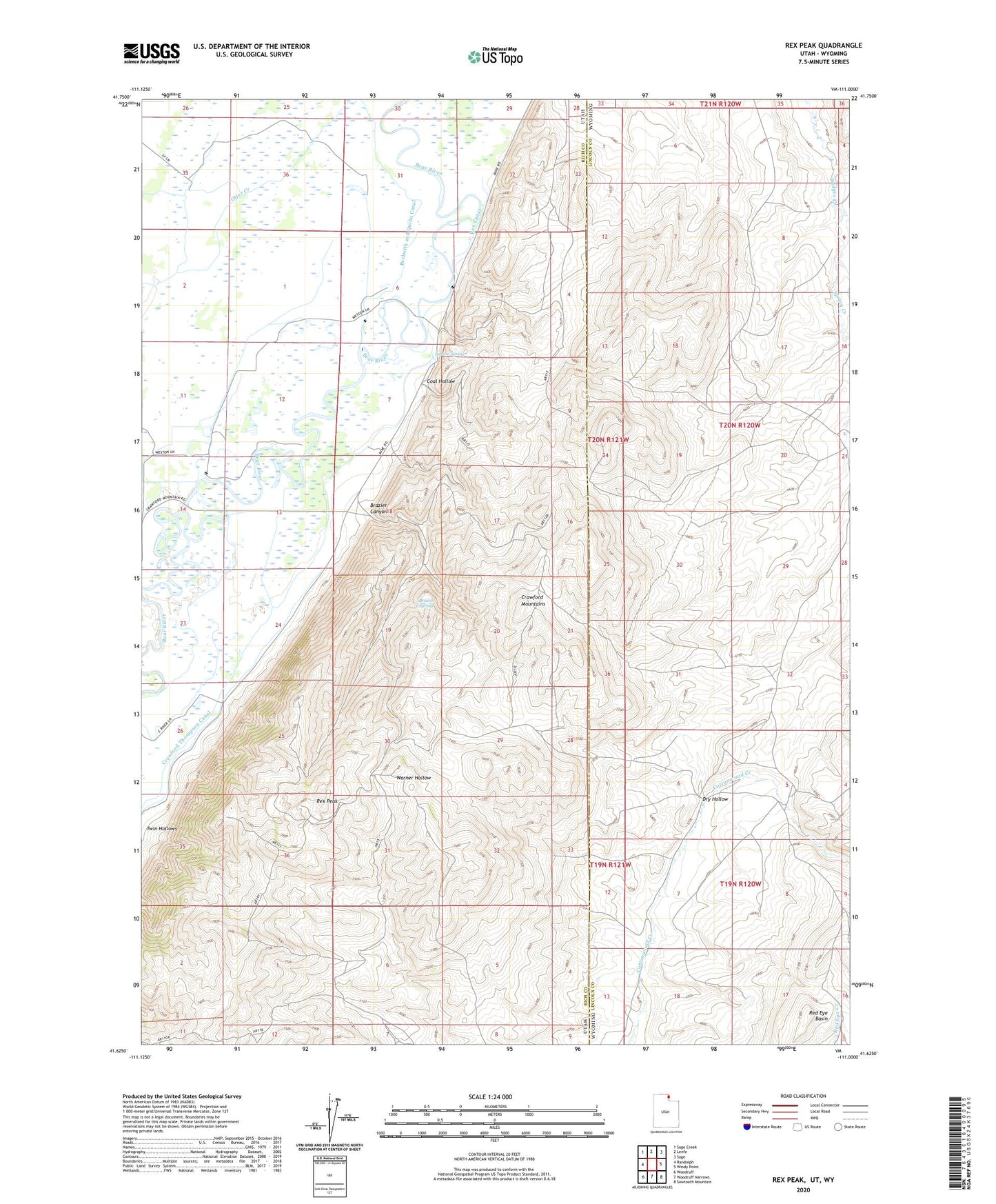
Rex Peak Utah US Topo Map
Couldn't load pickup availability
2020 topographic map quadrangle Rex Peak in the states of Utah, Wyoming. Scale: 1:24000. Based on the newly updated USGS 7.5' US Topo map series, this map is in the following counties: Rich, Lincoln. The map contains contour data, water features, and other items you are used to seeing on USGS maps, but also has updated roads and other features. This is the next generation of topographic maps. Printed on high-quality waterproof paper with UV fade-resistant inks.
Quads adjacent to this one:
West: Randolph
Northwest: Sage Creek
North: Leefe
Northeast: Sage
East: Windy Point
Southeast: Sawtooth Mountain
South: Woodruff Narrows
Southwest: Woodruff
Contains the following named places: Benjamin Mine, Brazier Canyon, Brazier Spring, Cherokee Mine, Coal Hollow, Crawford Mountains, Frank Mine, Kearl Ranch, Larson Dam, Larson Spring, McMinn Canal, Rex Canal, Rex Peak, Rex Ranch, Spring Creek, Twin Hollows