MyTopo
Sandy Creek Benches Utah US Topo Map
Couldn't load pickup availability
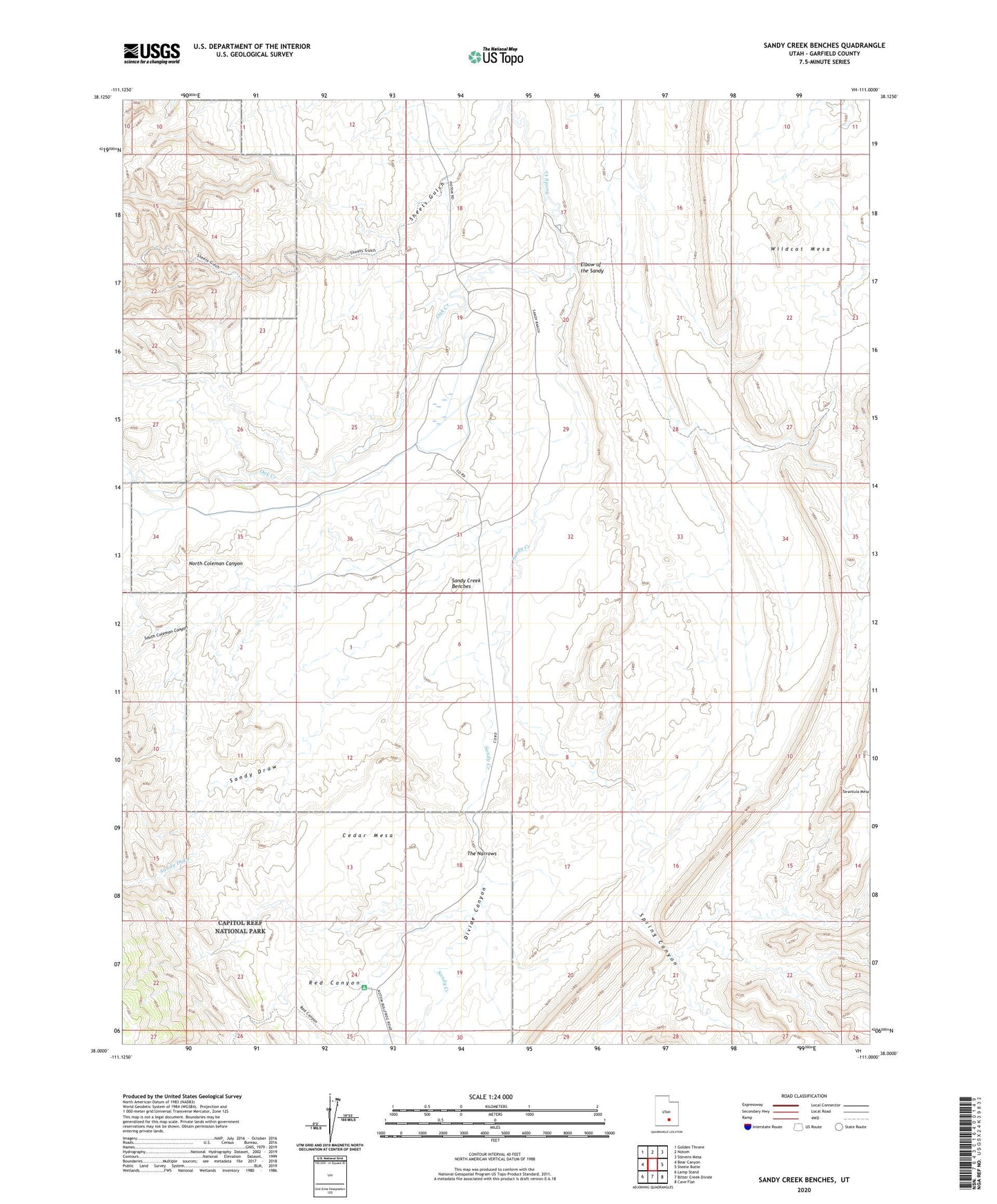
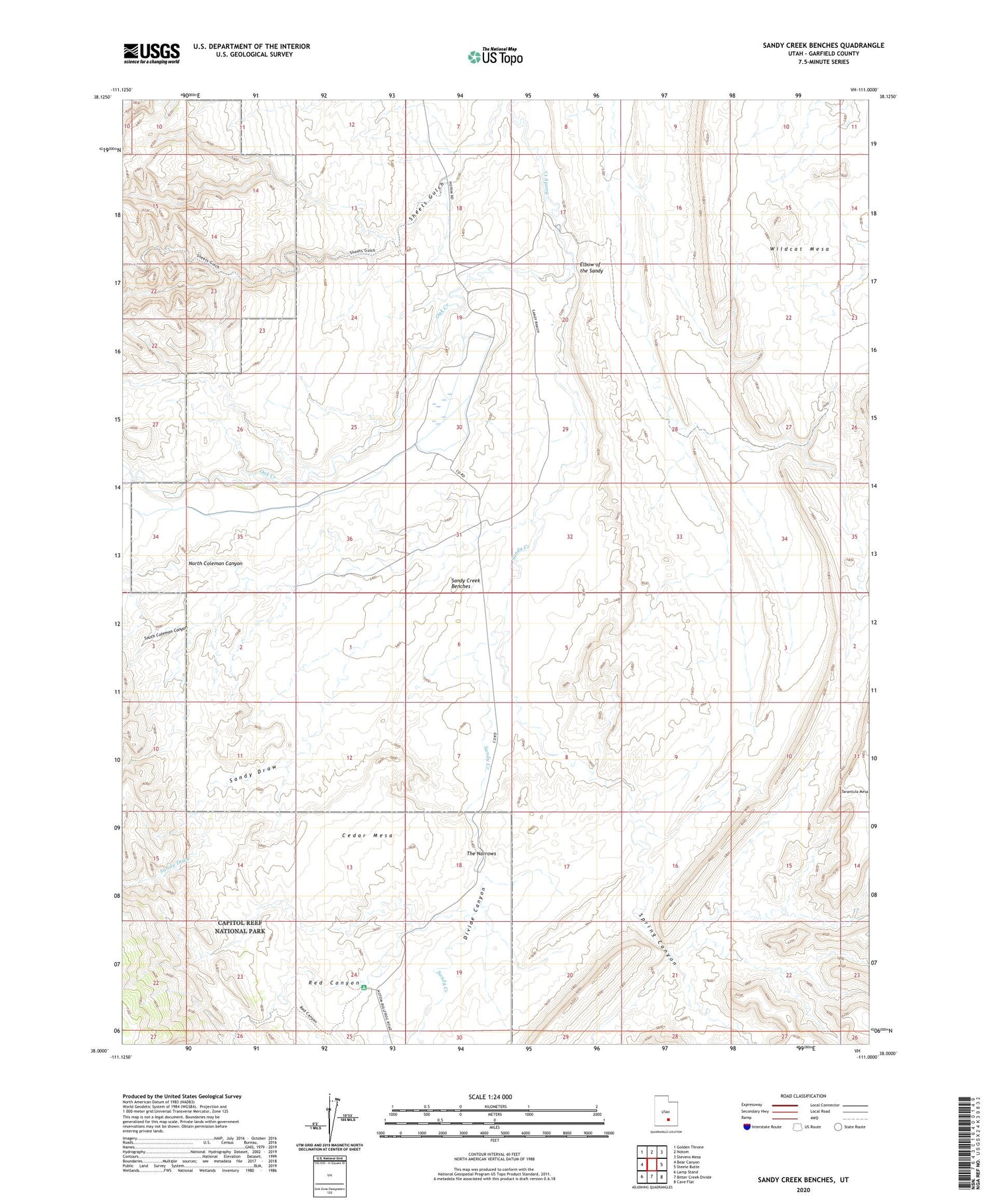
2020 topographic map quadrangle Sandy Creek Benches in the state of Utah. Scale: 1:24000. Based on the newly updated USGS 7.5' US Topo map series, this map is in the following counties: Garfield. The map contains contour data, water features, and other items you are used to seeing on USGS maps, but also has updated roads and other features. This is the next generation of topographic maps. Printed on high-quality waterproof paper with UV fade-resistant inks.
Quads adjacent to this one:
West: Bear Canyon
Northwest: Golden Throne
North: Notom
Northeast: Stevens Mesa
East: Steele Butte
Southeast: Cave Flat
South: Bitter Creek Divide
Southwest: Lamp Stand
Contains the following named places: Blind Trail, Cedar Mesa, Cedar Mesa Campground, Divide Canyon, Elbow of the Sandy, North Coleman Canyon, Oak Creek, Red Canyon, Sandy Creek Benches, Sandy Draw, Sandy Ranch, South Coleman Canyon, Spring Canyon, The Narrows, Water Pocket Fold, Wildcat Mesa