MyTopo
Scarecrow Peak Utah US Topo Map
Couldn't load pickup availability
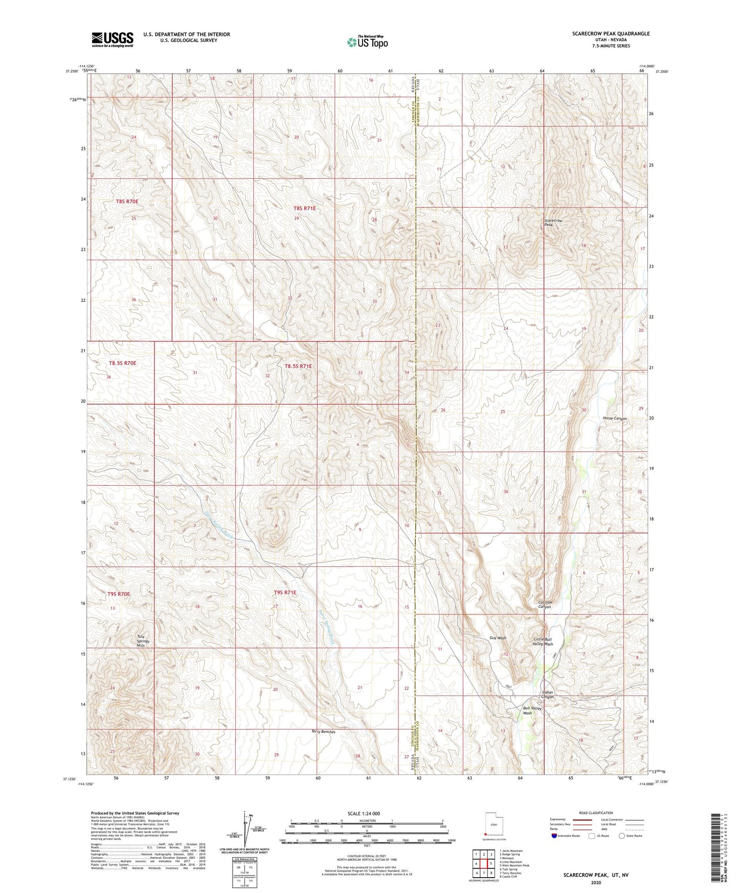
2023 topographic map quadrangle Scarecrow Peak in the states of Nevada, Utah. Scale: 1:24000. Based on the newly updated USGS 7.5' US Topo map series, this map is in the following counties: Washington, Lincoln. The map contains contour data, water features, and other items you are used to seeing on USGS maps, but also has updated roads and other features. This is the next generation of topographic maps. Printed on high-quality waterproof paper with UV fade-resistant inks.
Quads adjacent to this one:
West: Lime Mountain
Northwest: Jacks Mountain
North: Dodge Spring
Northeast: Motoqua
East: West Mountain Peak
Southeast: Castle Cliff
South: Terry Benches
Southwest: Tule Spring
This map covers the same area as the classic USGS quad with code o37114b1.
Contains the following named places: Bull Valley Wash, Catclaw Canyon, Guy Wash, Horse Canyon, Indian Canyon, Little Bull Valley Wash, Lower Lime Mountain Well, Scarecrow Peak