
MyTopo
Stevens Canyon South Utah US Topo Map
Couldn't load pickup availability
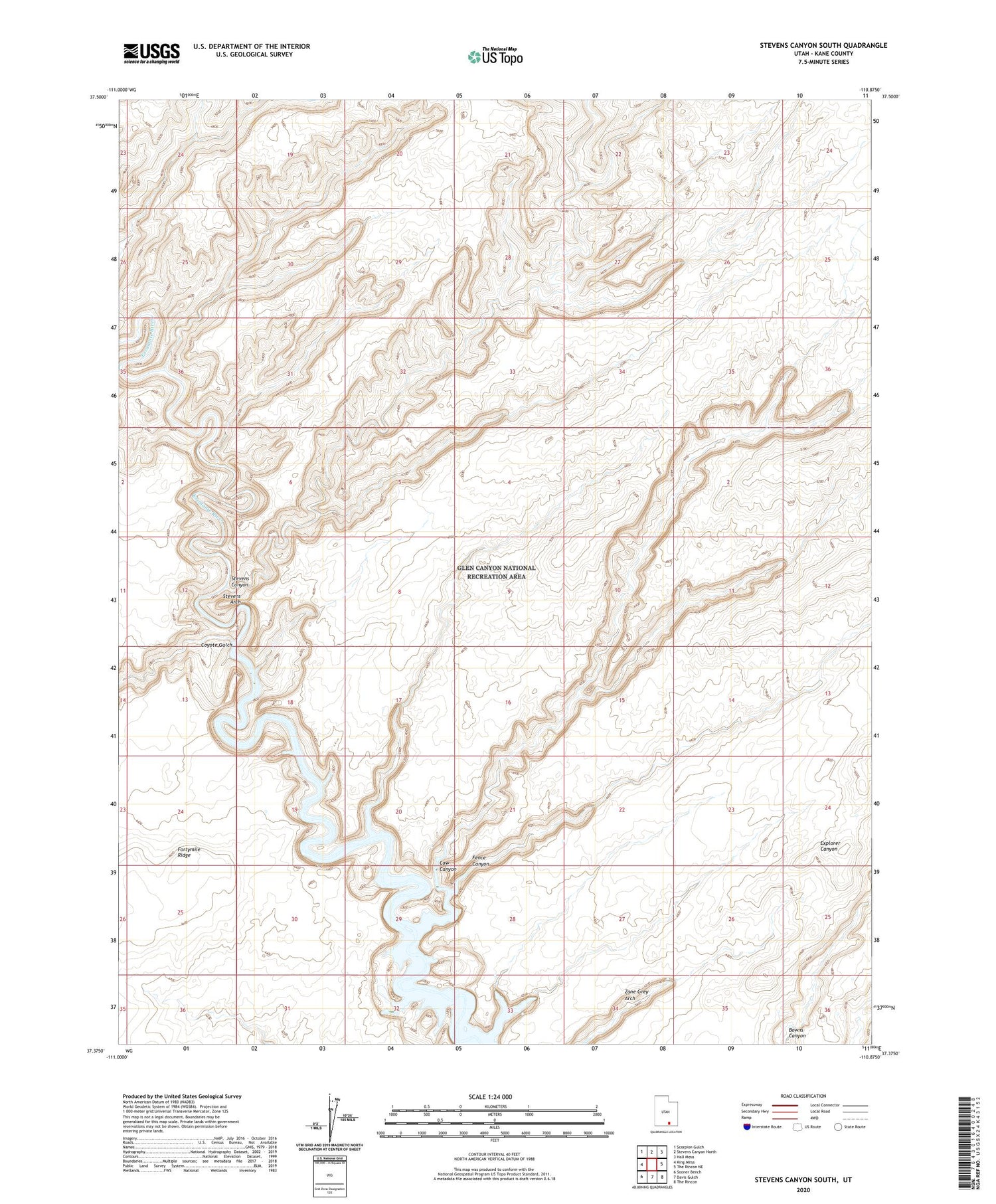
2020 topographic map quadrangle Stevens Canyon South in the state of Utah. Scale: 1:24000. Based on the newly updated USGS 7.5' US Topo map series, this map is in the following counties: Kane. The map contains contour data, water features, and other items you are used to seeing on USGS maps, but also has updated roads and other features. This is the next generation of topographic maps. Printed on high-quality waterproof paper with UV fade-resistant inks.
Quads adjacent to this one:
West: King Mesa
Northwest: Scorpion Gulch
North: Stevens Canyon North
Northeast: Hall Mesa
East: The Rincon NE
Southeast: The Rincon
South: Davis Gulch
Southwest: Sooner Bench
Contains the following named places: Cow Canyon, Coyote Gulch, Fence Canyon, Stevens Arch, Stevens Canyon, Zane Grey Arch


