MyTopo
Hall Mesa Utah US Topo Map
Couldn't load pickup availability
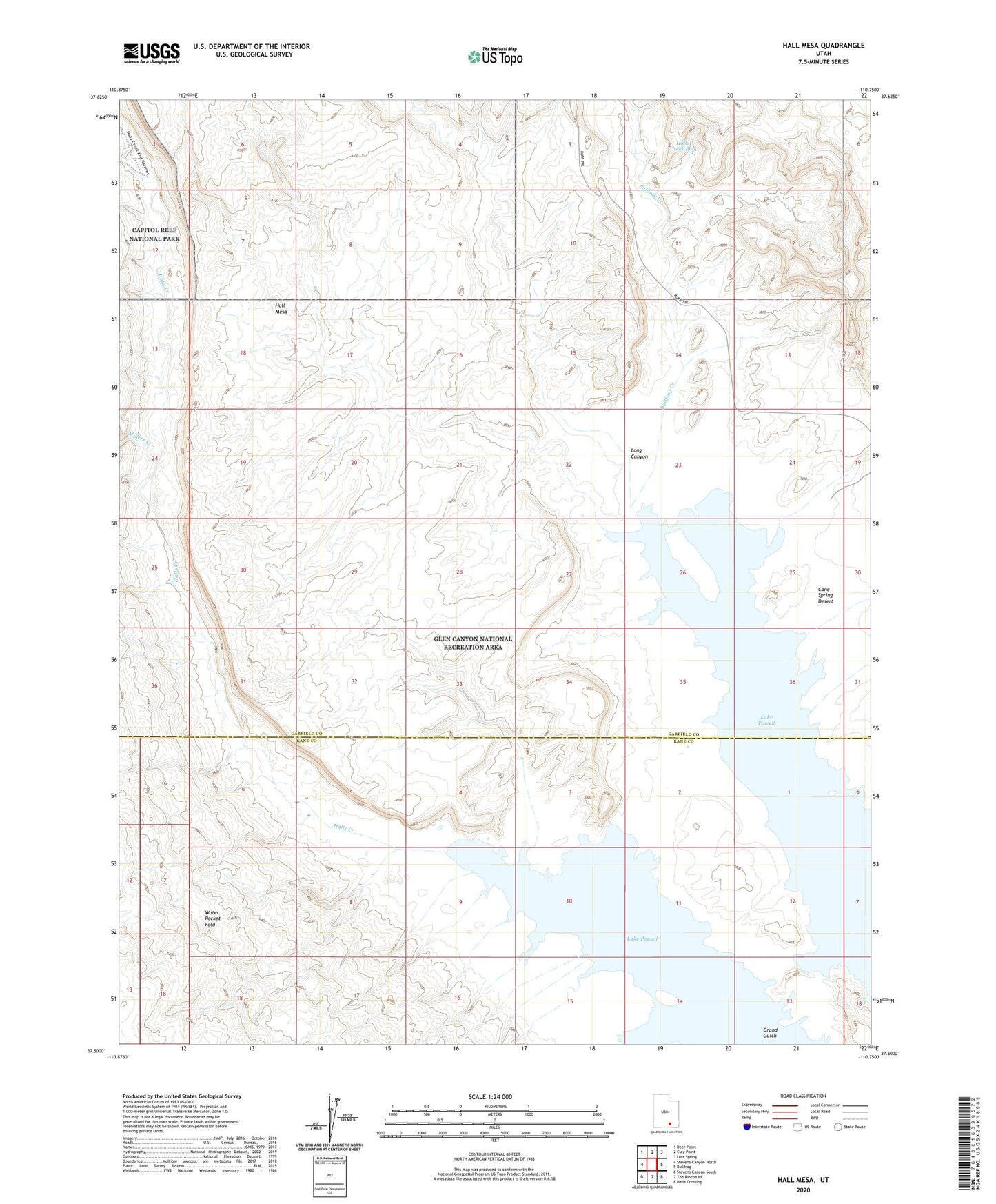
2023 topographic map quadrangle Hall Mesa in the state of Utah. Scale: 1:24000. Based on the newly updated USGS 7.5' US Topo map series, this map is in the following counties: Garfield, Kane. The map contains contour data, water features, and other items you are used to seeing on USGS maps, but also has updated roads and other features. This is the next generation of topographic maps. Printed on high-quality waterproof paper with UV fade-resistant inks.
Quads adjacent to this one:
West: Stevens Canyon North
Northwest: Deer Point
North: Clay Point
Northeast: Lost Spring
East: Bullfrog
Southeast: Halls Crossing
South: The Rincon NE
Southwest: Stevens Canyon South
This map covers the same area as the classic USGS quad with code o37110e7.
Contains the following named places: Baker Ranch, Bullfrog Creek, Glen Canyon National Recreation Area, Grand Gulch, Halls Creek, Halls Creek Bay, Long Canyon, Millers Creek