MyTopo
Strawberry Peak Utah US Topo Map
Couldn't load pickup availability
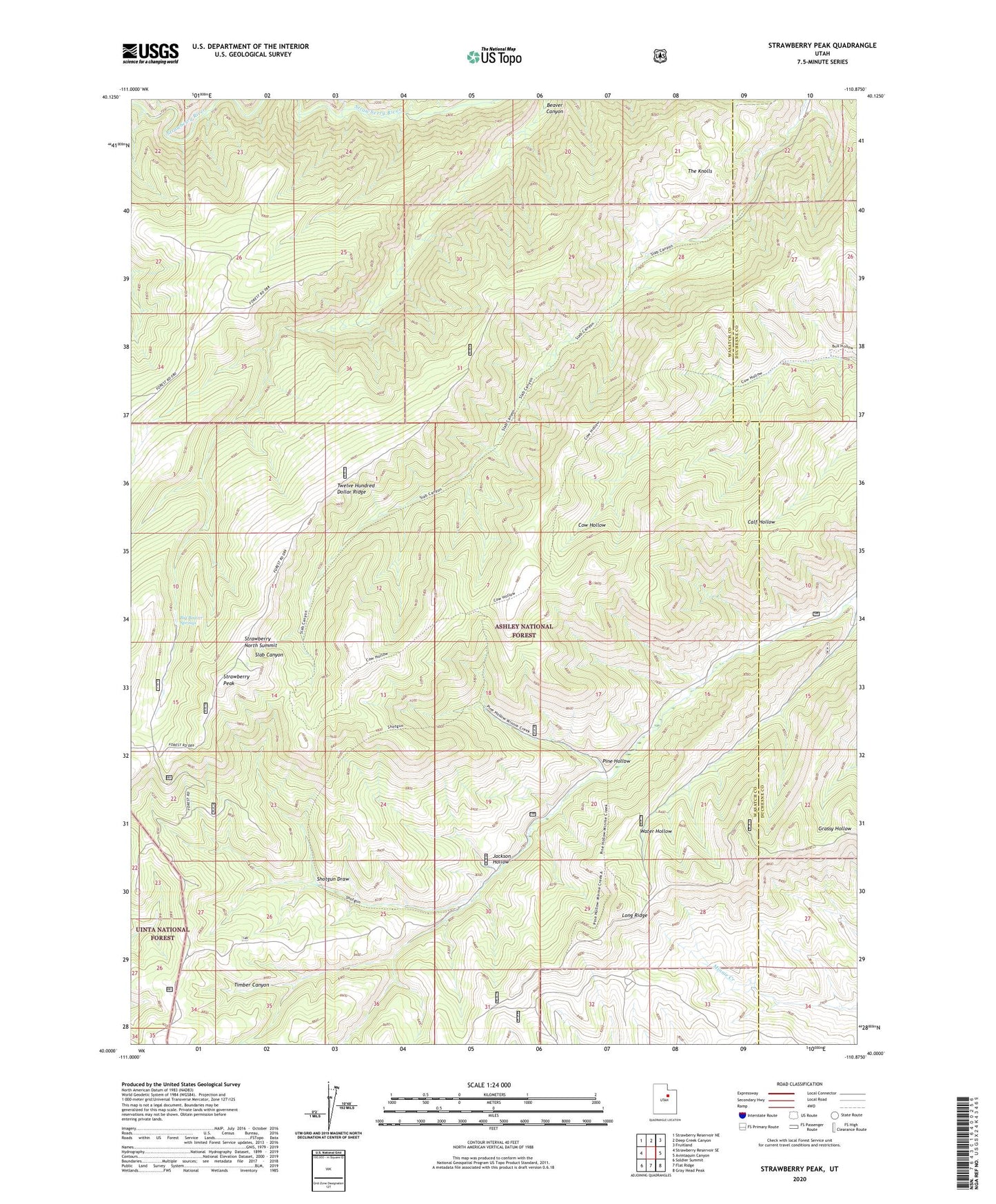
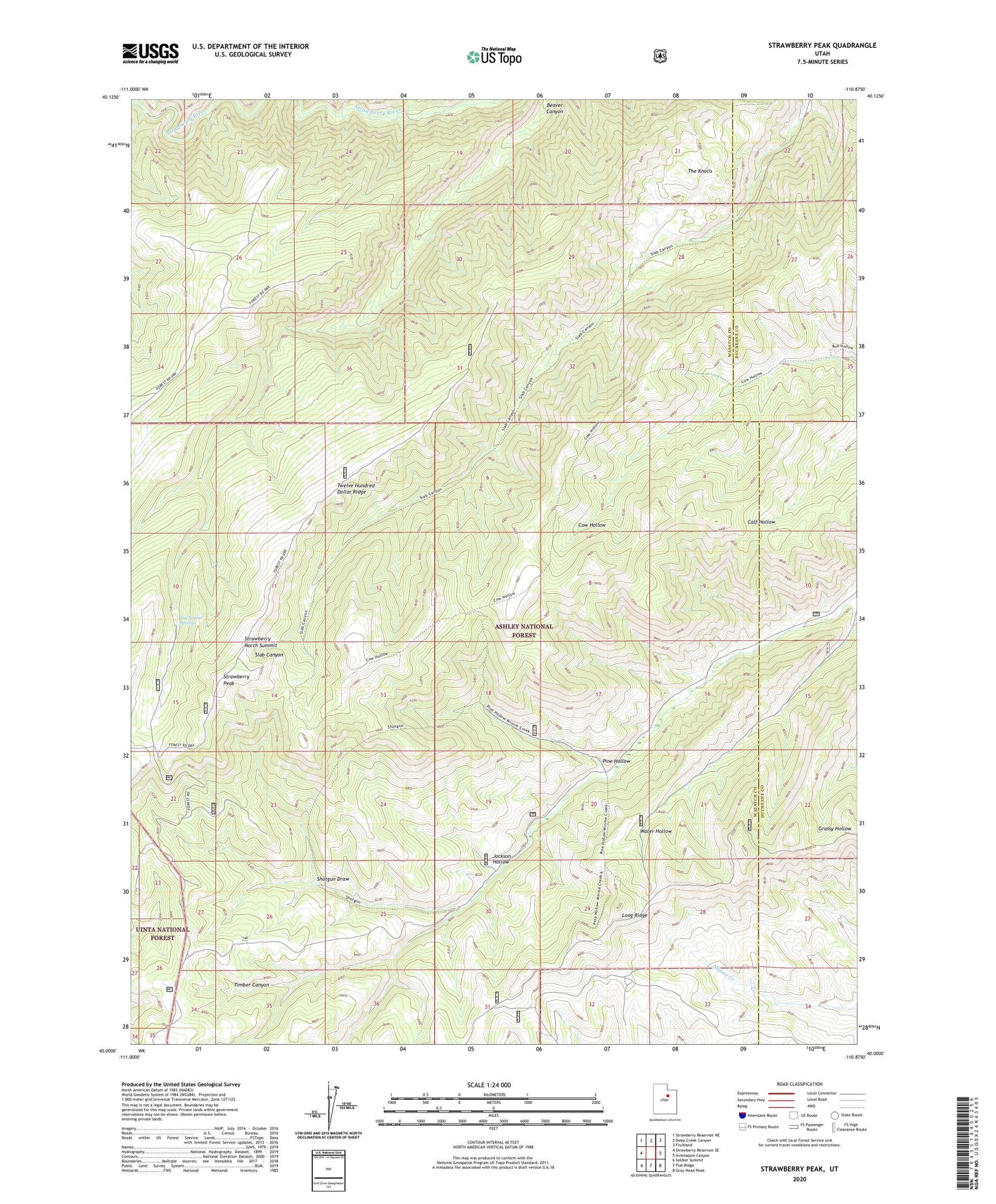
2020 topographic map quadrangle Strawberry Peak in the state of Utah. Scale: 1:24000. Based on the newly updated USGS 7.5' US Topo map series, this map is in the following counties: Wasatch, Duchesne. The map contains contour data, water features, and other items you are used to seeing on USGS maps, but also has updated roads and other features. This is the next generation of topographic maps. Printed on high-quality waterproof paper with UV fade-resistant inks.
Quads adjacent to this one:
West: Strawberry Reservoir SE
Northwest: Strawberry Reservoir NE
North: Deep Creek Canyon
Northeast: Fruitland
East: Avintaquin Canyon
Southeast: Gray Head Peak
South: Flat Ridge
Southwest: Soldier Summit
Contains the following named places: Big Beaver Springs, Jackson Hollow, Pine Hollow, Shotgun Draw, Strawberry North Summit, Strawberry Peak, The Knolls, Twelve Hundred Dollar Ridge