MyTopo
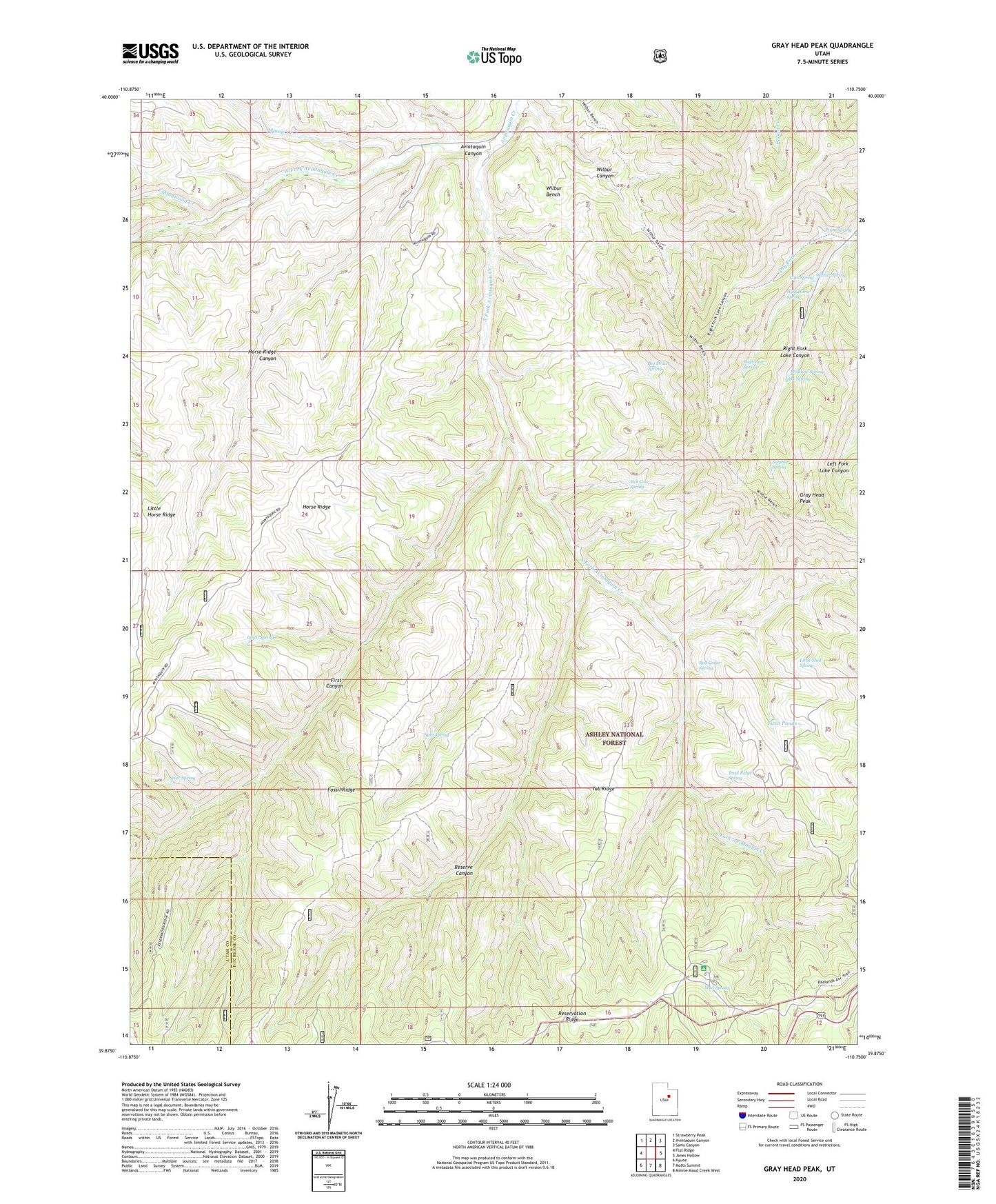
Gray Head Peak Utah US Topo Map
Couldn't load pickup availability
Also explore the Gray Head Peak Forest Service Topo of this same quad for updated USFS data
2023 topographic map quadrangle Gray Head Peak in the state of Utah. Scale: 1:24000. Based on the newly updated USGS 7.5' US Topo map series, this map is in the following counties: Duchesne, Utah. The map contains contour data, water features, and other items you are used to seeing on USGS maps, but also has updated roads and other features. This is the next generation of topographic maps. Printed on high-quality waterproof paper with UV fade-resistant inks.
Quads adjacent to this one:
West: Flat Ridge
Northwest: Strawberry Peak
North: Avintaquin Canyon
Northeast: Sams Canyon
East: Jones Hollow
Southeast: Minnie Maud Creek West
South: Matts Summit
Southwest: Kyune
This map covers the same area as the classic USGS quad with code o39110h7.
Contains the following named places: Avintaquin Campground, Avintaquin Wildlife Management Area, Big Draw Spring, Cottonwood Creek, Cow Spring, Dry Fork, First Canyon, Fossil Ridge, Gray Head Peak, High Line Spring, Horse Ridge Canyon, Lake Spring, Little Horse Ridge, Little Mud Spring, Meadow Spring, Minnie Creek, Mud Spring, Olsen Spring, Pinto Spring, Red Cedar Spring, Reserve Canyon, Sick Cow Spring, South Fork Avintaquin Creek, Split Spring, Steer Spring, Sulphur Spring, Trail Ridge Spring, Tub Ridge, Twin Ponds, West Fork Avintaquin Creek, Wilbur Bench, Wilbur Canyon, Wilbur Spring, Wild Horse Spring