MyTopo
Strawberry Reservoir NE Utah US Topo Map
Couldn't load pickup availability
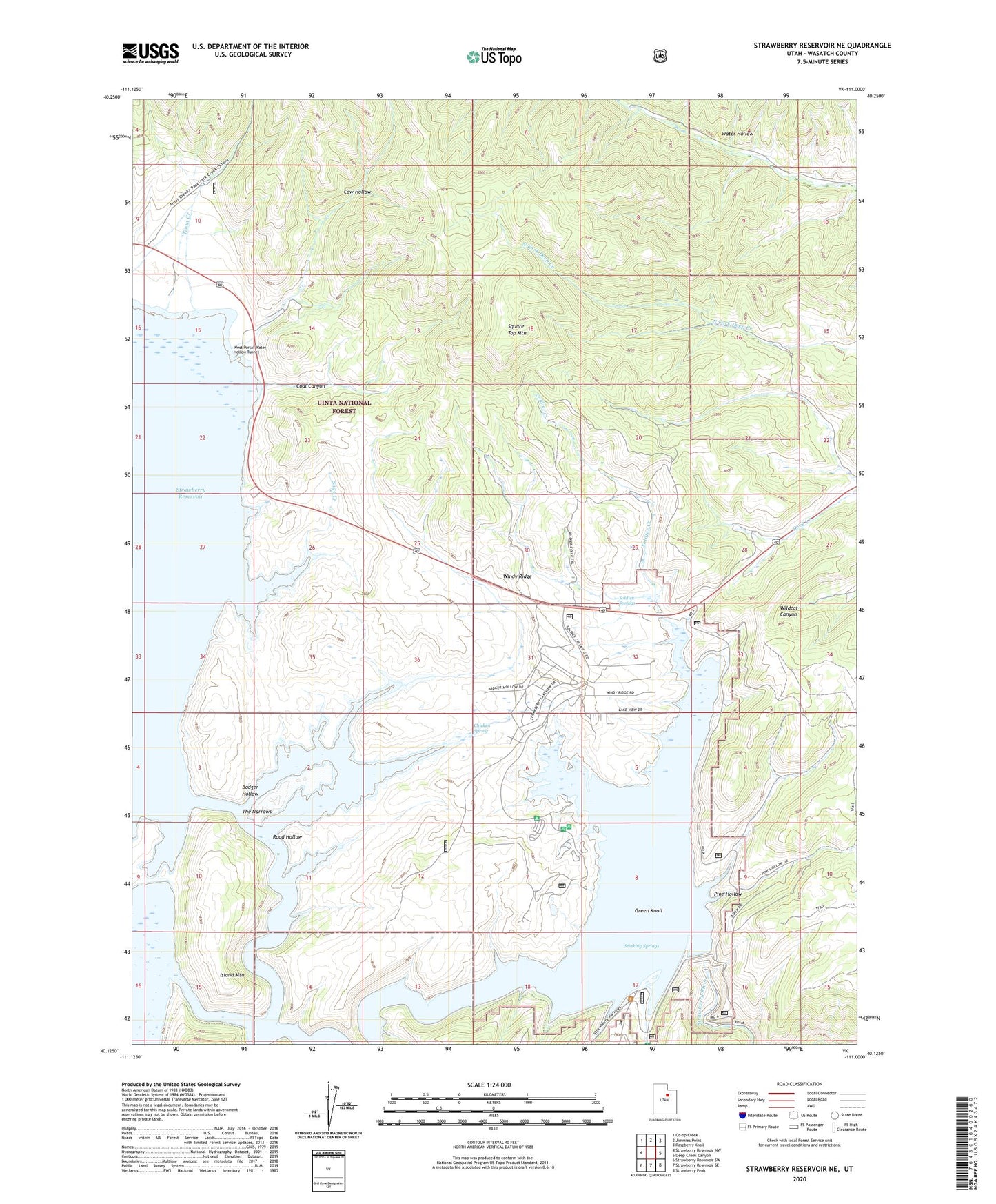
2020 topographic map quadrangle Strawberry Reservoir NE in the state of Utah. Scale: 1:24000. Based on the newly updated USGS 7.5' US Topo map series, this map is in the following counties: Wasatch. The map contains contour data, water features, and other items you are used to seeing on USGS maps, but also has updated roads and other features. This is the next generation of topographic maps. Printed on high-quality waterproof paper with UV fade-resistant inks.
Quads adjacent to this one:
West: Strawberry Reservoir NW
Northwest: Co-op Creek
North: Jimmies Point
Northeast: Raspberry Knoll
East: Deep Creek Canyon
Southeast: Strawberry Peak
South: Strawberry Reservoir SE
Southwest: Strawberry Reservoir SW
Contains the following named places: Badger Hollow, Badger Point Campground, Chicken Spring, Chipman Creek, Coal Canyon, Cow Hollow, Diving Rock Fisherman Access, Green Knoll, Island Mountain, Pine Hollow, Road Hollow, Sage Creek, Sage Creek Fisherman Access, Soldier Creek, Soldier Creek Bay Fisherman Access, Soldier Creek Campground, Soldier Creek Campground Loop Trail, Soldier Creek Dam, Soldier Creek Dam Day Use Area, Soldier Creek Overlook, Soldier Creek Recreation Complex, Soldier Springs, Square Top Mountain, Stinking Springs, Strawberry Dam, Strawberry River Day Use Area, The Narrows, Trout Creek, Uintah and Ouray Division, Water Hollow Tunnel, West Portal Fisherman Access, West Portal Water Hollow Tunnel, Windy Ridge