MyTopo
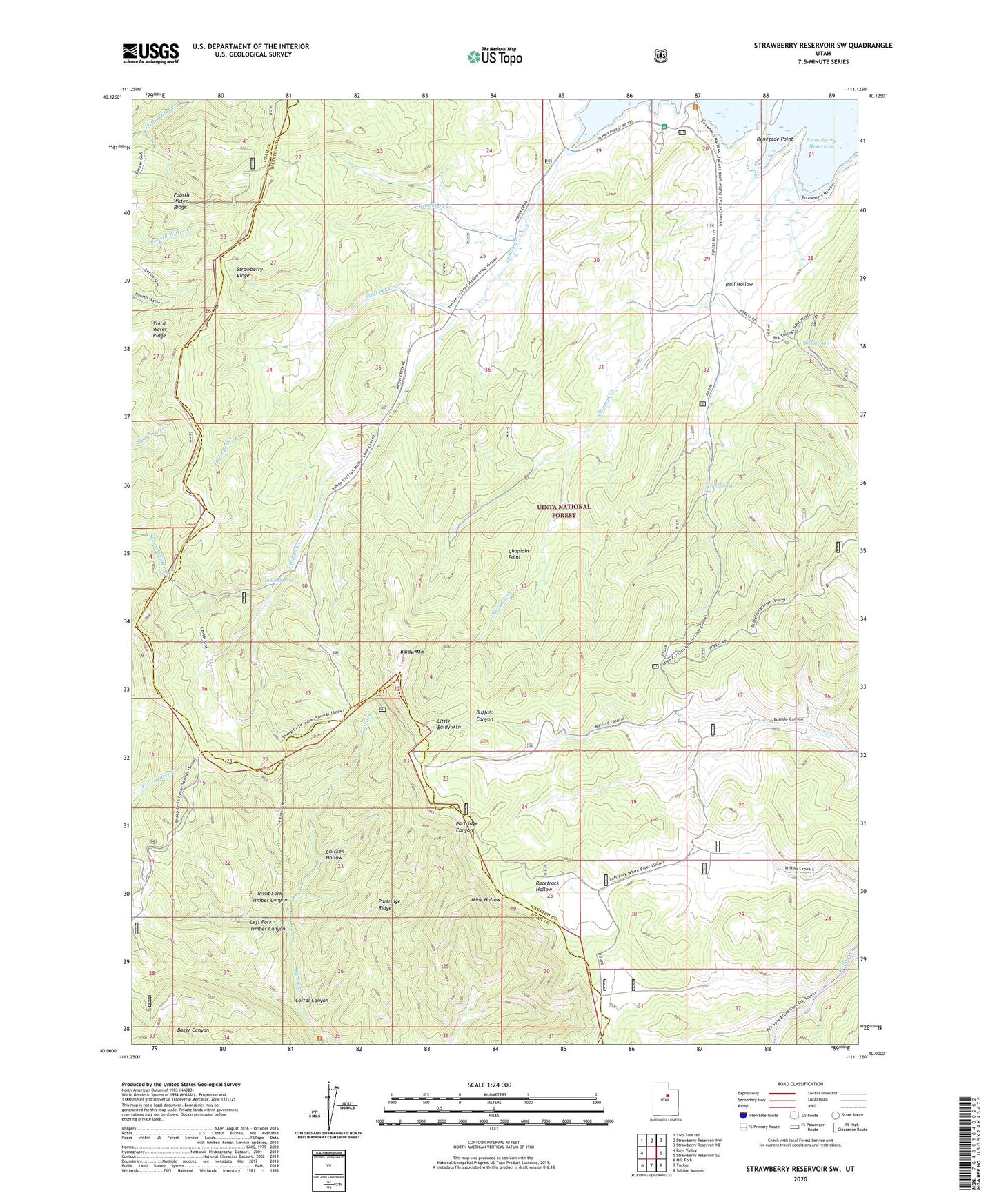
Strawberry Reservoir SW Utah US Topo Map
Couldn't load pickup availability
Also explore the Strawberry Reservoir SW Forest Service Topo of this same quad for updated USFS data
2023 topographic map quadrangle Strawberry Reservoir SW in the state of Utah. Scale: 1:24000. Based on the newly updated USGS 7.5' US Topo map series, this map is in the following counties: Wasatch, Utah. The map contains contour data, water features, and other items you are used to seeing on USGS maps, but also has updated roads and other features. This is the next generation of topographic maps. Printed on high-quality waterproof paper with UV fade-resistant inks.
Quads adjacent to this one:
West: Rays Valley
Northwest: Two Tom Hill
North: Strawberry Reservoir NW
Northeast: Strawberry Reservoir NE
East: Strawberry Reservoir SE
Southeast: Soldier Summit
South: Tucker
Southwest: Mill Fork
This map covers the same area as the classic USGS quad with code o40111a2.
Contains the following named places: Baldy Mountain, Big Spring, Chaplain Point, Chicken Hollow, Corral Canyon, Crooked Creek, Fourth Water Ridge, Indian Spring, Left Fork Timber Canyon, Little Baldy Mountain, Partridge Ridge, Renegade Point, Renegade Point Campground, Right Fork Timber Canyon, Squaw Creek, Streeper Creek, Third Water Ridge, Trail Hollow, Trail Spring, Willow Creek Guard Station