MyTopo
Sugarloaf Butte Utah US Topo Map
Couldn't load pickup availability
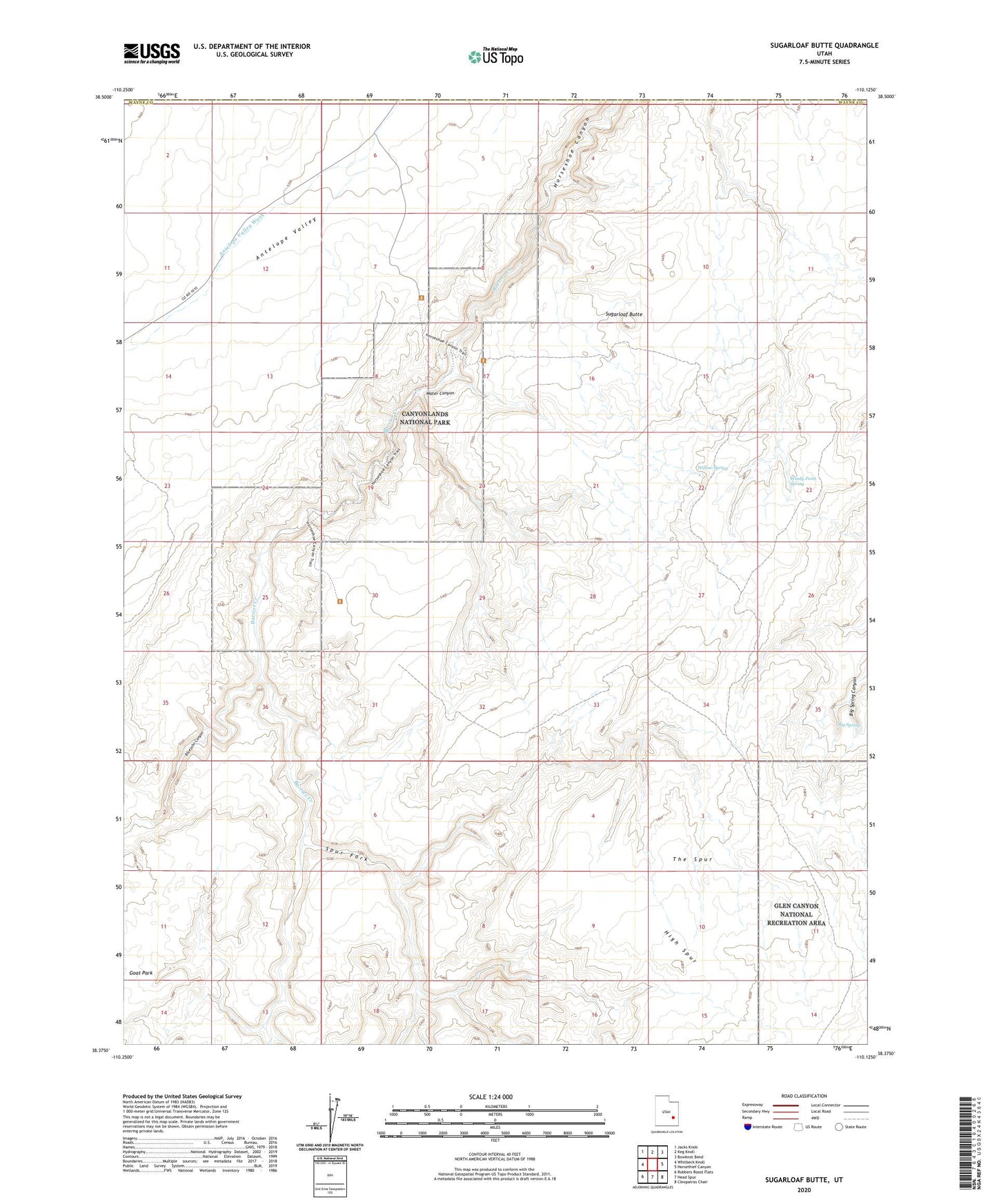
2023 topographic map quadrangle Sugarloaf Butte in the state of Utah. Scale: 1:24000. Based on the newly updated USGS 7.5' US Topo map series, this map is in the following counties: Wayne, Emery. The map contains contour data, water features, and other items you are used to seeing on USGS maps, but also has updated roads and other features. This is the next generation of topographic maps. Printed on high-quality waterproof paper with UV fade-resistant inks.
Quads adjacent to this one:
West: Whitbeck Knoll
Northwest: Jacks Knob
North: Keg Knoll
Northeast: Bowknot Bend
East: Horsethief Canyon
Southeast: Cleopatras Chair
South: Head Spur
Southwest: Robbers Roost Flats
This map covers the same area as the classic USGS quad with code o38110d2.
Contains the following named places: Big Spring, Bluejohn Canyon, Great Gallery Pictographs, Horseshoe Canyon Unit- Canyonlands National Park, Red Nubs, Spur Fork, Sugarloaf Butte, The Mailbox, Tidwell Ranch, Water Canyon, Willow Spring, Windy Point Spring