MyTopo
Tabby Mountain Utah US Topo Map
Couldn't load pickup availability
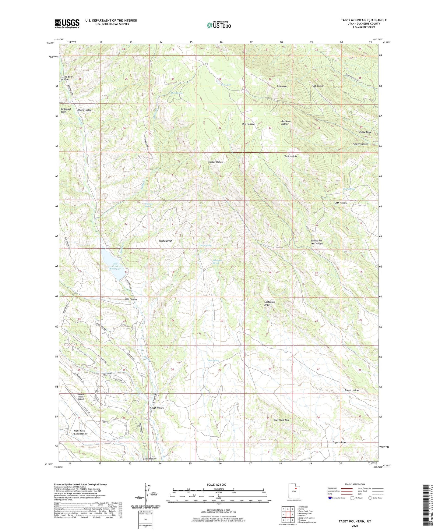
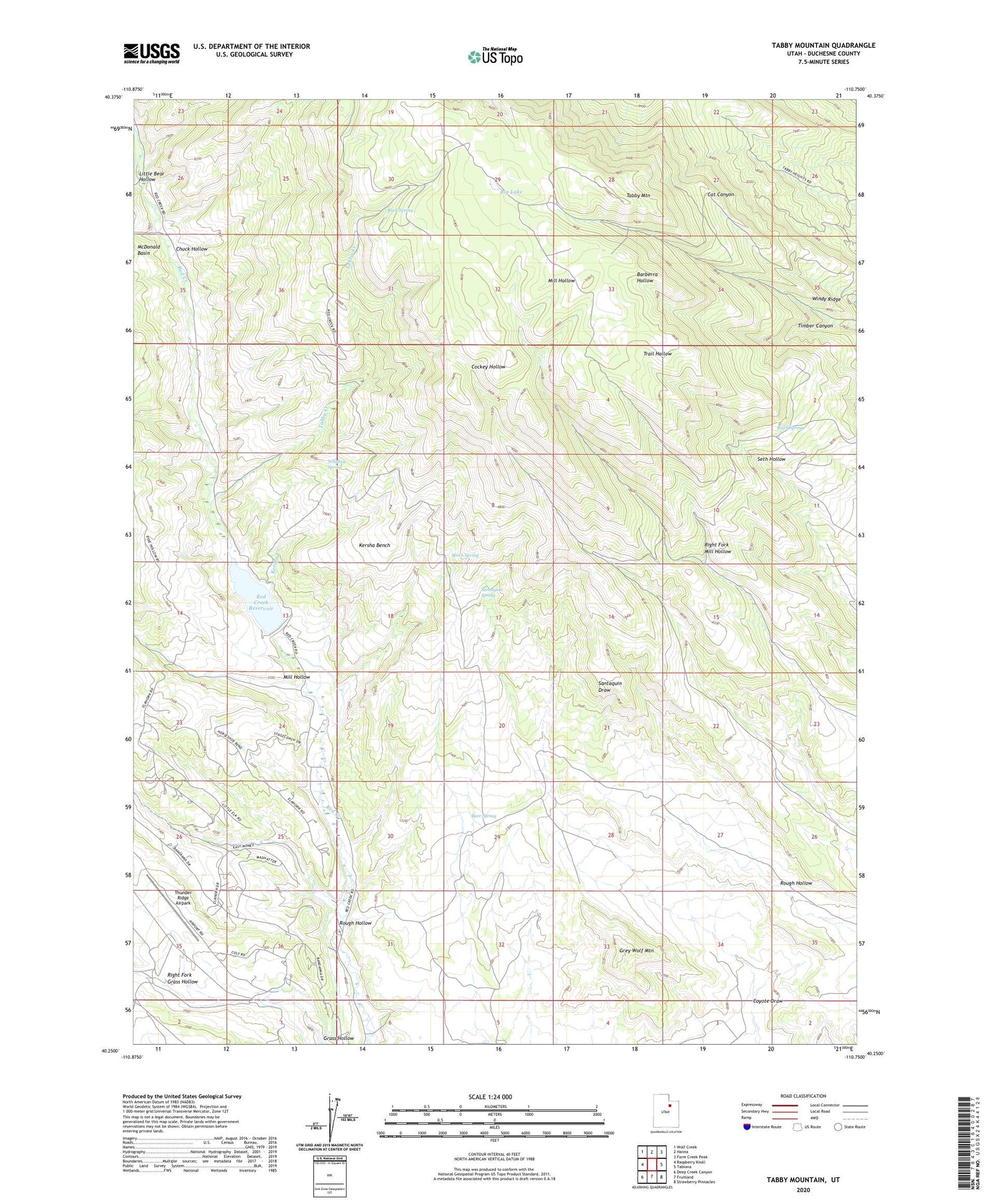
2020 topographic map quadrangle Tabby Mountain in the state of Utah. Scale: 1:24000. Based on the newly updated USGS 7.5' US Topo map series, this map is in the following counties: Duchesne. The map contains contour data, water features, and other items you are used to seeing on USGS maps, but also has updated roads and other features. This is the next generation of topographic maps. Printed on high-quality waterproof paper with UV fade-resistant inks.
Quads adjacent to this one:
West: Raspberry Knoll
Northwest: Wolf Creek
North: Hanna
Northeast: Farm Creek Peak
East: Tabiona
Southeast: Strawberry Pinnacles
South: Fruitland
Southwest: Deep Creek Canyon
Contains the following named places: Beer Spring, Big Lake, Birch Spring, Chuck Hollow, Coyote Draw, Grey Wolf Mountain, Kersha Bench, Kersha Creek, Little Bear Hollow, Little Lake, Mill Hollow, Red Creek Dam, Red Creek Reservoir, Right Fork Grass Hollow, Right Fork Mill Hollow, Rock Spring, Rough Hollow, Santaquin Spring, Seth Hollow, Tabby Creek, Tabby Mountain, Thunder Ridge Airpark, Timber Canyon, Whiskey Spring