MyTopo
Cross Canyon Utah US Topo Map
Couldn't load pickup availability
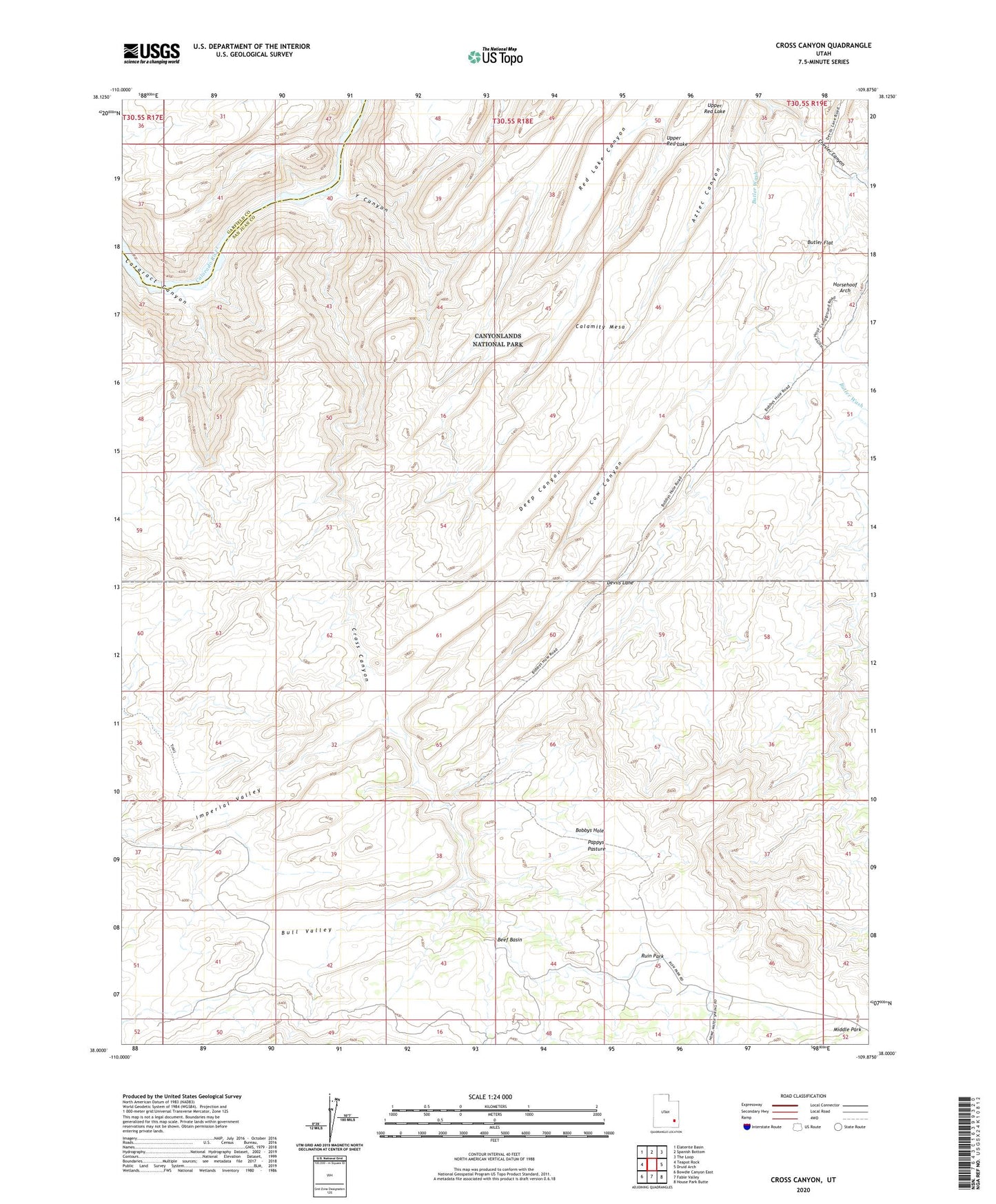
2023 topographic map quadrangle Cross Canyon in the state of Utah. Scale: 1:24000. Based on the newly updated USGS 7.5' US Topo map series, this map is in the following counties: San Juan, Garfield. The map contains contour data, water features, and other items you are used to seeing on USGS maps, but also has updated roads and other features. This is the next generation of topographic maps. Printed on high-quality waterproof paper with UV fade-resistant inks.
Quads adjacent to this one:
West: Teapot Rock
Northwest: Elaterite Basin
North: Spanish Bottom
Northeast: The Loop
East: Druid Arch
Southeast: House Park Butte
South: Fable Valley
Southwest: Bowdie Canyon East
This map covers the same area as the classic USGS quad with code o38109a8.
Contains the following named places: Bobbys Hole, Butler Flat, Calamity Mesa, Chesler Canyon, Chocolate Drops, Cow Canyon, Cross Canyon, Deep Canyon, Horsehoof Arch, Pappys Pasture, Ruin Park, The Grabens, The Needles Canyon, The Needles Country, Upper Red Lake, Y Canyon